Sea of Sardinia
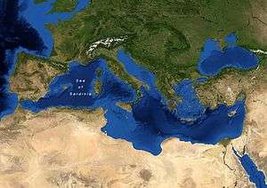
Map of the Sea of Sardinia.
The Sea of Sardinia is a body of water in the Mediterranean Sea between the Spanish archipelago of Balearic Islands and the Italian island of Sardinia.
The deepest point is at some 3,000 m,some 150 km north-west to the island of Minorca.
Recognition
The International Hydrographic Organization defines the area as generic Mediterranean Sea, in the Western Basin. It does not recognize the label Sea of Sardinia.[1]
Notes
- ↑ "Limits of Oceans and Seas, 3rd edition" (PDF). International Hydrographic Organization. 1953. Retrieved 25 April 2012.
Coordinates: 40°00′N 6°00′E / 40.000°N 6.000°E
This article is issued from Wikipedia - version of the 10/27/2016. The text is available under the Creative Commons Attribution/Share Alike but additional terms may apply for the media files.