Segreganset River
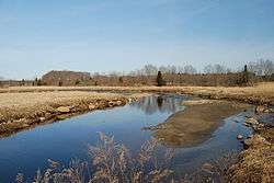
View of Segreganset River at low tide, Dighton, Massachusetts
The Segreganset River is a small river in Bristol County, Massachusetts that flows 9.6 miles (15.4 km)[1] in a southeasterly direction through Taunton and Dighton into the Taunton River.[2] Named tributaries include the Maple Swamp, Poppasquash Swamp, Sunken Brook and Cedar Swamp.
The USGS maintains a gaging station on the Segreganset River near Center Street in Dighton.[3]
See also
References
- ↑ U.S. Geological Survey. National Hydrography Dataset high-resolution flowline data. The National Map, accessed April 1, 2011
- ↑ USGS Quadrangle Map
- ↑ USGS Real-time Water Information System
Coordinates: 41°49′30″N 71°07′08″W / 41.825°N 71.119°W
This article is issued from Wikipedia - version of the 10/22/2016. The text is available under the Creative Commons Attribution/Share Alike but additional terms may apply for the media files.