Sela pri Šumberku
| Sela pri Šumberku | |
|---|---|
|
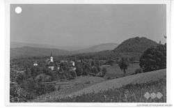
Pre-World War II postcard of Sela pri Šumberku | |
 Sela pri Šumberku Location in Slovenia | |
| Coordinates: 45°53′45.02″N 14°53′18.68″E / 45.8958389°N 14.8885222°ECoordinates: 45°53′45.02″N 14°53′18.68″E / 45.8958389°N 14.8885222°E | |
| Country |
|
| Traditional region | Lower Carniola |
| Statistical region | Southeast Slovenia |
| Municipality | Trebnje |
| Area | |
| • Total | 4.54 km2 (1.75 sq mi) |
| Elevation | 456.8 m (1,498.7 ft) |
| Population (2002) | |
| • Total | 100 |
| [1] | |
Sela pri Šumberku (pronounced [ˈseːla pɾi ˈʃuːmbɛɾku]) is a village in the Municipality of Trebnje in eastern Slovenia. The area is part of the historical Lower Carniola region. The municipality is now included in the Southeast Slovenia Statistical Region.[2]
The parish church in the settlement is dedicated to John the Baptist and belongs to the Roman Catholic Diocese of Novo Mesto. It was first mentioned in written documents dating to 1526, but the current building dates to the mid-19th century.[3]
The ruins of Šumberk Castle (German: Schönberg),[4] a 12th-century castle that was abandoned in the early 18th century, lie on a hill southeast of the settlement. The castle chapel survives as a church dedicated to Saint Catherine.[5]
References
- ↑ Statistical Office of the Republic of Slovenia
- ↑ Trebnje municipal site
- ↑ Slovenian Ministry of Culture register of national heritage reference number ešd 2240
- ↑ Kos, Dušan. 1994. Med gradom in mestom: odnos kranjskega, slovenještajerskega in koroškega plemstva do gradov in meščanskih naselij do začetka 15. stoletja. Ljubljana: Znanstvenoraziskovalni center SAZU, p. 41.
- ↑ Slovenian Ministry of Culture register of national heritage reference numbers ešd 8754 & 2241
