Semey
Coordinates: 50°26′N 80°16′E / 50.433°N 80.267°E
| Semey Семей | ||
|---|---|---|
 | ||
| ||
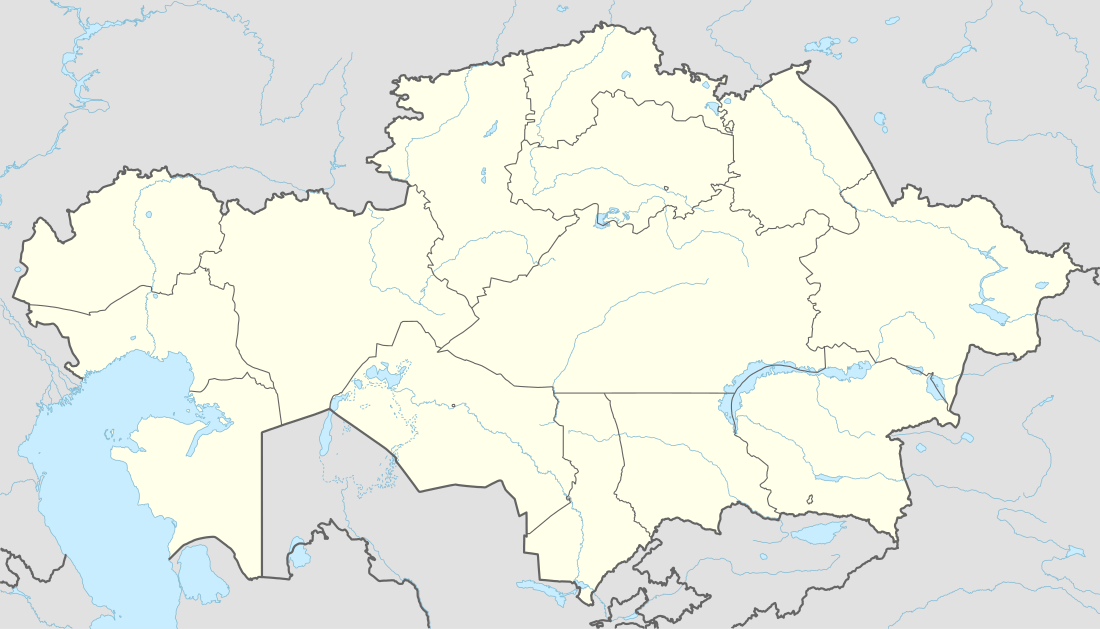 Semey Location in Kazakhstan | ||
| Coordinates: 50°26′0″N 80°16′0″E / 50.43333°N 80.26667°E | ||
| Country | Kazakhstan | |
| Region | East Kazakhstan Region | |
| Founded | 1718 | |
| Incorporated (city) | 1782 | |
| Government | ||
| • Akim (mayor) | Ermak Salimov | |
| Area | ||
| • Total | 210 km2 (80 sq mi) | |
| Population (2009) | ||
| • Total | 299,264 | |
| Time zone | ALMT (UTC+6) | |
| Postal code | 071400 | |
| Area code(s) | +7 7222 | |

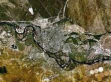
Semey (Kazakh and Russian: Семей), until 2007 known as Semipalatinsk (Kazakh and Russian: Семипалатинск) and in 1917–1920 as Alash-kala (Kazakh: Алаш-қала, Alaş-qala), is a city in Kazakhstan, in East Kazakhstan Region, and in the Kazakhstan part of Siberia, near the border with Russia, around 1,000 kilometers (620 mi) north of Almaty, and 700 kilometers (430 mi) southeast of the Russian city of Omsk, along the Irtysh River. Population: 299,264 (2009 Census results);[2] 269,574 (1999 Census results).[2]
History

The first Russian settlement in the area dates from 1718, when Russia built a fort beside the river Irtysh, near a ruined Buddhist monastery. The monastery's seven buildings lent the fort (and later the city) the name Semipalatinsk (Russian for "Seven-Chambered City"). The fort suffered frequently from flooding caused by the snowmelt swelling the Irtysh, and in 1778 the fort was relocated 18 kilometres (11 mi) upstream to less flood-prone ground. A small city grew around the fort, largely servicing the river trade between the nomadic peoples of Central Asia and the growing Russian Empire. The construction of the Turkestan-Siberia Railway in the early 20th century added to the city's importance, making it a major point of transit between Central Asia and Siberia. On 19 May 1854 Semipalatinsk became the capital of the Semipalatinsk Oblast within the Russian Empire.
Between 1917 and 1920 the city operated as the capital of the largely unrecognized Alash Autonomy, a state (1917-1920) after the outbreak of the October revolution in Russia. The city was called Alash-qala during the Alash Autonomy years. Red Army forces loyal to Petrograd took control of the area in 1920. It was the center of the Semipalatinsk Governorate until 17 January 1928, then of the Eastern Kazakhstan Oblast between 17 January 1928 and 14 October 1939 and finally of the Semipalatinsk Oblast between 1939 and 1997.
In 1949 the Soviet atomic bomb programme selected a site on the steppe 150 km (93 mi) west of the city as the location for its weapons testing. For decades, Kurchatov (the secret city at the heart of the test range named for Igor Kurchatov, father of the Soviet atomic bomb) was home to many of the brightest stars of Soviet weapons science. The Soviet Union operated the Semipalatinsk Test Site (STS) from the first explosion in 1949 until 1989; 456 nuclear tests, including 340 underground and 116 atmospheric tests, took place there.
Semey has suffered serious environmental and health effects from the time of its atomic prosperity: nuclear fallout from the atmospheric tests and uncontrolled exposure of the workers, most of whom lived in the city, have given Semey and neighboring villages high rates of cancer, childhood leukemia, impotence and birth defects.[3]
Modern Semey, a bustling university town, has a population exceeding 300,000. Its proximity to the Kazakh border with the Russian Federation, and the large expatriate scientific community attached to the university and to the STS labs, allegedly gives Semey a more Russian character than other Kazakh cities.
Semipalatinsk Oblast merged with the larger East Kazakhstan Region, whose capital city is Oskemen, on 23 May 1997.
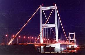
The Semipalatinsk Bridge, a suspension bridge across the Irtish River, connects the two major parts of Semey. It has a main span of 750 metres (2,460 ft) and a total length of 1,086 metres (3,563 ft).[4] Construction began in 1998 and the bridge opened to traffic in November 2000.[5]
In 2007 the Semipalatinsk City Council voted unanimously in favour of changing the name of the city to Semey. The Chairman explained that existing name had negative associations with the atomic test-site.[6]
Climate
Semey has a semi-arid climate (Köppen climate classification BSk) with warm summers and very cold winters. Precipitation is low for the whole year, except for July which has an average of 50 millimetres (2.0 in) compared to less than 30 millimetres (1.2 in) in other months. Snow is common, though light, in winter. The lowest temperature on record is −48.6 °C (−55.5 °F), recorded in November 1938, and the highest temperature is 42.5 °C (108.5 °F), recorded in August 2002.[7]
| Climate data for Semey | |||||||||||||
|---|---|---|---|---|---|---|---|---|---|---|---|---|---|
| Month | Jan | Feb | Mar | Apr | May | Jun | Jul | Aug | Sep | Oct | Nov | Dec | Year |
| Record high °C (°F) | 5.3 (41.5) |
6.8 (44.2) |
24.5 (76.1) |
33.0 (91.4) |
37.6 (99.7) |
39.5 (103.1) |
42.1 (107.8) |
42.5 (108.5) |
38.2 (100.8) |
29.5 (85.1) |
19.5 (67.1) |
7.6 (45.7) |
42.5 (108.5) |
| Average high °C (°F) | −9.4 (15.1) |
−7.6 (18.3) |
−0.3 (31.5) |
13.4 (56.1) |
22.1 (71.8) |
27.1 (80.8) |
28.6 (83.5) |
27.0 (80.6) |
20.6 (69.1) |
12.0 (53.6) |
0.6 (33.1) |
−6.7 (19.9) |
10.6 (51.1) |
| Daily mean °C (°F) | −14.2 (6.4) |
−13.3 (8.1) |
−5.8 (21.6) |
6.6 (43.9) |
14.8 (58.6) |
20.1 (68.2) |
21.7 (71.1) |
19.5 (67.1) |
12.7 (54.9) |
5.2 (41.4) |
−4.3 (24.3) |
−11.1 (12) |
4.3 (39.7) |
| Average low °C (°F) | −19.2 (−2.6) |
−18.8 (−1.8) |
−10.9 (12.4) |
0.3 (32.5) |
7.2 (45) |
12.6 (54.7) |
14.9 (58.8) |
12.0 (53.6) |
5.3 (41.5) |
−0.3 (31.5) |
−8.5 (16.7) |
−15.7 (3.7) |
−1.8 (28.8) |
| Record low °C (°F) | −46.8 (−52.2) |
−45.3 (−49.5) |
−39.1 (−38.4) |
−26.1 (−15) |
−9.9 (14.2) |
−1.0 (30.2) |
4.3 (39.7) |
−0.7 (30.7) |
−8.2 (17.2) |
−20.8 (−5.4) |
−48.6 (−55.5) |
−45.8 (−50.4) |
−48.6 (−55.5) |
| Average precipitation mm (inches) | 15 (0.59) |
15 (0.59) |
16 (0.63) |
16 (0.63) |
28 (1.1) |
29 (1.14) |
50 (1.97) |
22 (0.87) |
15 (0.59) |
21 (0.83) |
26 (1.02) |
22 (0.87) |
275 (10.83) |
| Average rainy days | 1 | 1 | 3 | 9 | 13 | 12 | 15 | 12 | 10 | 11 | 6 | 1 | 94 |
| Average snowy days | 18 | 18 | 14 | 4 | 0.4 | 0 | 0 | 0.03 | 0.1 | 5 | 14 | 19 | 93 |
| Average relative humidity (%) | 75 | 75 | 76 | 59 | 53 | 53 | 60 | 59 | 60 | 67 | 74 | 75 | 66 |
| Mean monthly sunshine hours | 108 | 139 | 199 | 243 | 303 | 335 | 342 | 307 | 242 | 144 | 111 | 94 | 2,567 |
| Source #1: Pogoda.ru.net[7] | |||||||||||||
| Source #2: NOAA (sun, 1961–1990)[8] | |||||||||||||
Famous residents
- Abay Qunanbayuli, father of modern Kazakh poetry, received his Russian schooling at Semey.
- Writer Fyodor Dostoyevsky, whose exile included five years military service as a corporal in the Seventh Line Battalion at the Semipalatinsk garrison, beginning in 1854. Residents claim the details of particular descriptive passages in Dostoyevsky's subsequent books, including his highly acclaimed The Brothers Karamazov, are recognizable as taken from his time in Semey.
- Writer Pavel Bazhov was a member of the Party Committee of the province of Semipalatinsk from 1920 to 1923.
- Stanislav Kurilov (1936-1998) grew up in Semipalatinsk. An oceanographer and a good swimmer, he defected from the USSR in 1974 by means of jumping off a cruise liner in the open ocean and swimming to the Philippines.
- The Ukrainian boxer Wladimir Klitschko, who was born there in 1976.
- The Russian saxophonist Sergey Letov was born there.
The city has a museum to commemorate Abay Qunanbayuli, and has both a museum of and a street named after Dostoyevsky.
Population
| Year | Population |
|---|---|
| 1881 | 17,820 |
| 1897 | 26,353 |
| 1910 | 34,400 |
| 1926 | 56,100 |
| 1939 | 109,700 |
| 1959 | 149,800 |
| 1979 | 270,400 |
| 1989 | 317,100 |
| 1999 | 269,600 |
Higher education
Semey is famous for its intellectual medical community with leading Semey State Medical University which provides region and country with highly professional health specialists.
International relations
Twin towns and sister cities
Semey is twinned with:
See also
References
- ↑ The New bridge in Semey on Wikimapia
- 1 2 "Население Республики Казахстан" (in Russian). Департамент социальной и демографической статистики. Retrieved 8 December 2013.
- ↑ "Inside the nuclear underworld: Deformity and fear", CNN, retrieved 2007-08-31
- ↑ "Semipatalinsk Irtysh River Bridge (2002)". en.structurae.de. Retrieved 16 August 2011.
- ↑ "Irtysh River Bridge Construction Project / Field Survey" (PDF). Japan International Cooperation Agency. September 2006. Retrieved 8 January 2016.
- ↑ "Семипалатинск исчезнет с карты Казахстана [Semipalatinsk disappears from the map of Kazakhstan]". Byvshiy SSSR [The former USSR]. Lenta.ru. Lenta.Ru. 2007-06-19. Retrieved 2015-09-10.
Депутаты городского собрания Семипалатинска единогласно проголосовали за переименование города в Семей. [...] 'Прежнее название немного отпугивало инвесторов, так как ассоциировалось с полигоном. [...]', - пояснил решение депутатов председатель сессии горсовета Куат Мирашев. [The representatives of the city corporation of Semipalatinsk voted unanimously for renaming the city as Cemey. 'The former name rather discouraged investors, since it was associated with the [atomic] test-site. [...]', said the chairman of the session of the city council, Kuat Mirashev, in explaining the decision.]
- 1 2 "Weather and Climate - The Climate of Semipalatinsk (Semey)" (in Russian). Weather and Climate (Погода и климат). Archived from the original on 25 November 2016. Retrieved 25 November 2016.
- ↑ "Semipalatinsk Climate Normals 1961-1990". National Oceanic and Atmospheric Administration. Retrieved 25 November 2016.
External links
| Wikimedia Commons has media related to Semey. |
Capital: Oskemen | ||
| Districts | 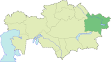 | |
| Major cities | ||