Seppa
| Seppa | |
|---|---|
| City | |
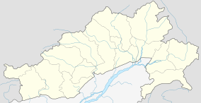 Seppa  Seppa Location in Arunachal Pradesh, India | |
| Coordinates: 27°21′00″N 93°2′44″E / 27.35000°N 93.04556°ECoordinates: 27°21′00″N 93°2′44″E / 27.35000°N 93.04556°E | |
| Country |
|
| State | Arunachal Pradesh |
| District | East Kameng |
| Elevation | 363 m (1,191 ft) |
| Population (2011) | |
| • Total | 18,184 |
| Languages | |
| Time zone | IST (UTC+5:30) |
| Vehicle registration | AR |
| Precipitation | 2,212 millimetres (87.1 in) |
| Avg. summer temperature | 25 °C (77 °F) |
| Avg. winter temperature | 9 °C (48 °F) |
| Climate | Cwa |
Seppa (formerly known as Sepla) is the headquarters of the East Kameng district in the state of Arunachal Pradesh in India. Sapla means 'marshy' land in the local dialect. It lies on the bank of Kameng River and there is a helipad there.[1] It is located 160 kilometres (99 mi) from Itanagar and 213 kilometres (132 mi) from Tezpur (Assam) connected by motorable road.[2] Map p 22 The village of Seppa has 2 out of the 60 Vidhan Sabha Constituencies of Arunachal Pradesh. They are Seppa East and Seppa West.
Demographics
As of 2001 India census,[3] Seppa had a population of 14,965; males constituted 53% of the population and females 47%; 21% of the population was under 6 years of age; the average literacy rate was 53%—lower than the national average of 59.5%, with 64% male literacy and 41% female literacy.
Media
Seppa has an All India Radio Relay station known as Akashvani Seppa. It broadcasts on FM frequencies.
References
- ↑ District Administration, Seppa, East Kameng at a Glance, Retrieved 10 May 2007 Seppa Helipad
- ↑ Nandy S.N. (1998) ENVIS Bulletin - Himalayan Ecology & Development, vol. 6 No. 1, .District Profile: East Kameng
- ↑ "Census of India 2001: Data from the 2001 Census, including cities, villages and towns (Provisional)". Census Commission of India. Archived from the original on 16 June 2004. Retrieved 1 November 2008.