Serdar (city)
| Serdar | |
|---|---|
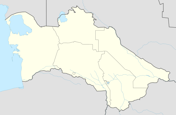 Serdar Location in Turkmenistan | |
| Coordinates: 38°59′N 56°17′E / 38.983°N 56.283°E | |
| Country |
|
| Province | Balkan Province |
| Population (1989 census)[1] | |
| • Total | 33,388 |
Serdar (formerly Kyzyl-Arvat or Gyzylarbat)[2] is a location in Turkmenistan, located north-west of the capital, Ashkhabad on the road to the Caspian Sea. The population of Serdar is 50,000 people, mainly Turkmen. The main language spoken in the region is Turkmen. It is near the northwest end of the line of oases on the north slope of the Kopet Dag that extends southeast to Ashkhabad.
History
Serdar is close to the old Persian city of Farava. In ancient times, the region was inhabited by the Dahae, an Indo-European people.
During the Russian conquest several exploring expeditions reached here, but the main fighting was at Geok Tepe. The modern city was established in 1881 with a station on the Trans-Caspian Railway.[3]
In July 1918, following his declaration of martial law in Ashgabat, Commissar V. Frolov, head of the Tashkent Cheka, came to Kyzyl-Arvat to impose the authority of the Tashkent Soviet. However the railway workers had heard of his execution of strike leaders in Ashgabat and organised an armed response. He was shot with some of his followers and the rest were disarmed. This action opened the way to the formation of the Transcaspian Government.[4]
Climate
Serdar has a cool desert climate (Köppen climate classification BWk), with cool winters and very hot summers. Rainfall is generally light and erratic, and occurs mainly in the winter and autumn months.
| Climate data for Serdar | |||||||||||||
|---|---|---|---|---|---|---|---|---|---|---|---|---|---|
| Month | Jan | Feb | Mar | Apr | May | Jun | Jul | Aug | Sep | Oct | Nov | Dec | Year |
| Record high °C (°F) | 26.4 (79.5) |
28.1 (82.6) |
36.6 (97.9) |
39.7 (103.5) |
45.7 (114.3) |
46.8 (116.2) |
47.3 (117.1) |
46.2 (115.2) |
44.6 (112.3) |
38.5 (101.3) |
31.9 (89.4) |
29.0 (84.2) |
47.3 (117.1) |
| Average high °C (°F) | 5.6 (42.1) |
8.5 (47.3) |
14.7 (58.5) |
23.0 (73.4) |
30.3 (86.5) |
35.6 (96.1) |
38.2 (100.8) |
36.9 (98.4) |
31.5 (88.7) |
22.9 (73.2) |
14.0 (57.2) |
7.4 (45.3) |
22.38 (72.29) |
| Daily mean °C (°F) | 0.6 (33.1) |
3.1 (37.6) |
8.7 (47.7) |
16.3 (61.3) |
23.4 (74.1) |
28.6 (83.5) |
31.3 (88.3) |
29.7 (85.5) |
23.8 (74.8) |
15.7 (60.3) |
8.2 (46.8) |
3.0 (37.4) |
16.03 (60.87) |
| Average low °C (°F) | −3.1 (26.4) |
−1.2 (29.8) |
3.7 (38.7) |
10.3 (50.5) |
16.6 (61.9) |
21.4 (70.5) |
24.4 (75.9) |
22.5 (72.5) |
16.7 (62.1) |
9.5 (49.1) |
3.4 (38.1) |
−0.7 (30.7) |
10.29 (50.52) |
| Record low °C (°F) | −26.0 (−14.8) |
−26.3 (−15.3) |
−21.5 (−6.7) |
−2.7 (27.1) |
2.6 (36.7) |
8.4 (47.1) |
13.5 (56.3) |
10.6 (51.1) |
2.0 (35.6) |
−2.9 (26.8) |
−15.3 (4.5) |
−22.1 (−7.8) |
−26.3 (−15.3) |
| Average precipitation mm (inches) | 23.0 (0.906) |
24.3 (0.957) |
29.8 (1.173) |
24.5 (0.965) |
22.0 (0.866) |
10.8 (0.425) |
7.7 (0.303) |
4.8 (0.189) |
5.2 (0.205) |
14.9 (0.587) |
19.2 (0.756) |
23.9 (0.941) |
210.1 (8.273) |
| Average precipitation days (≥ 0.1 mm) | 8.9 | 8.9 | 6.7 | 8.2 | 4.8 | 1.5 | 1.3 | 0.8 | 1.7 | 3.6 | 6.5 | 9.8 | 62.7 |
| Average relative humidity (%) | 78.0 | 73.5 | 62.8 | 58.2 | 46.3 | 37.5 | 36.3 | 33.1 | 37.5 | 50.7 | 69.1 | 78.7 | 55.14 |
| Mean monthly sunshine hours | 118.7 | 137.1 | 181.1 | 226.0 | 294.6 | 344.7 | 352.2 | 342.8 | 296.5 | 236.1 | 174.1 | 110.3 | 2,814.2 |
| Source #1: climatebase.ru[5] | |||||||||||||
| Source #2: NOAA (1961–1990)[6] | |||||||||||||
Coordinates: 38°59′N 56°17′E / 38.983°N 56.283°E
References
- ↑ Population census 1989, Demoscope Weekly, No. 359-360, 1-18 January 2009 (search for Туркменская ССР) (Russian)
- ↑ Kyzyl-Arvat as the former name
- ↑ Columbia-Lippincott Gazeteer, p. 958
- ↑ The British Intervention in Transcaspia, 1918–1919 by C. H. Ellis, University of California Press, 1963 p26
- ↑ "Gyzylarbat, Turkmenistan". Climatebase.ru. Retrieved 9 February 2013.
- ↑ "Climate Normals for Gyzylarbat". National Oceanic and Atmospheric Administration. Retrieved 9 February 2013.
Capital: Ashgabat | |