Sermide
| Sermide | |
|---|---|
| Comune | |
| Comune di Sermide | |
|
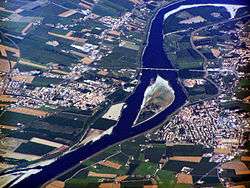
Sermide on the left | |
 Sermide Location of Sermide in Italy | |
| Coordinates: 45°0′N 11°18′E / 45.000°N 11.300°ECoordinates: 45°0′N 11°18′E / 45.000°N 11.300°E | |
| Country | Italy |
| Region | Lombardy |
| Province / Metropolitan city | Province of Mantua (MN) |
| Frazioni | S. Croce, Moglia, Malcantone, Porcara, Caposotto |
| Area | |
| • Total | 56.9 km2 (22.0 sq mi) |
| Elevation | 13 m (43 ft) |
| Population (Dec. 2004) | |
| • Total | 6,533 |
| • Density | 110/km2 (300/sq mi) |
| Demonym(s) | Sermidesi |
| Time zone | CET (UTC+1) |
| • Summer (DST) | CEST (UTC+2) |
| Postal code | 46028 |
| Dialing code | 0386 |

Sermide is a comune (municipality) in the Province of Mantua in the Italian region Lombardy, located about 180 kilometres (110 mi) southeast of Milan and about 45 kilometres (28 mi) southeast of Mantua. On 31 December 2004, it had a population of 6,533 and an area of 56.9 square kilometres (22.0 sq mi).[1]
The village of Sermide at the left of image on the right side of the Po river, contains the frazioni (subdivisions, mainly villages and hamlets): S. Croce, Moglia (also called "moia paes ad la gioia" (Moglia the village of joy), there is also a local way of saying: "Quand al ciel al s'oscura, quei ad la moia in gà minga paura", When the sky gets dark those from Moglia are not afraid), Malcantone, Porcara, and Caposotto.
Sermide borders the following municipalities: Bondeno, Calto, Carbonara di Po, Castelmassa, Castelnovo Bariano, Felonica, Magnacavallo, Mirandola, Poggio Rusco.
Website: http://www.comune.sermide.mn.it
Demographic evolution
