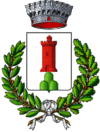
Serramazzoni
| Serramazzoni | ||
|---|---|---|
| Comune | ||
| Comune di Serramazzoni | ||
| ||
 Serramazzoni Location of Serramazzoni in Italy | ||
| Coordinates: 44°25′N 10°48′E / 44.417°N 10.800°E | ||
| Country | Italy | |
| Region | Emilia-Romagna | |
| Province / Metropolitan city | Modena (MO) | |
| Government | ||
| • Mayor | Roberto Rubbiani | |
| Area | ||
| • Total | 93.4 km2 (36.1 sq mi) | |
| Elevation | 791 m (2,595 ft) | |
| Population (31 July 2015)[1] | ||
| • Total | 8,253 | |
| • Density | 88/km2 (230/sq mi) | |
| Demonym(s) | Serramazzonesi | |
| Time zone | CET (UTC+1) | |
| • Summer (DST) | CEST (UTC+2) | |
| Postal code | 41028 | |
| Dialing code | 0536 | |
| Patron saint | Blessed Virgin of the Rosary | |
| Saint day | May 8 | |
| Website | Official website | |
Serramazzoni is a comune (municipality) in the Province of Modena in the Italian region Emilia-Romagna, located about 45 kilometres (28 mi) west of Bologna and about 30 kilometres (19 mi) southwest of Modena.
Serramazzoni borders the following municipalities: Fiorano Modenese, Maranello, Marano sul Panaro, Pavullo nel Frignano, Polinago, Prignano sulla Secchia, Sassuolo.
History
The first historical mention of Serramazzoni dates to 1327, when it was called Serra de Legorzano.
Main sights
- Falls of Rio delle Borre
- Via Vandelli
- Sasso delle Streghe
- Salsa della Cintora
- Falls of Bucamante
- National Museum of Antic Rose
- Romanesque Church of Santa Maria Assunta
Districts
Serramazzoni is divided into the districts: Faeto, Ligorzano, Monfestino, Montagnana, Pazzano, Pompeano, Rocca Santa Maria, Riccò, San Dalmazio, Selva, Stella, Valle, Varana.
People
- Luca Toni, football player
References
External links
This article is issued from Wikipedia - version of the 4/18/2016. The text is available under the Creative Commons Attribution/Share Alike but additional terms may apply for the media files.
