Sexto (Ponce)
| Barrio Sexto Cantera | |
|---|---|
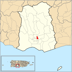 Location of barrio Sexto within the municipality of Ponce shown in red | |
| Country |
|
| Territory |
|
| Municipality |
|
| Area | |
| • Total | 0.27 sq mi (0.7 km2) |
| • Land | 0.26 sq mi (0.7 km2) |
| • Water | 0.01 sq mi (0.03 km2) |
| Population (2000) | |
| • Total | 4,745 |
| • Density | 18,250/sq mi (7,050/km2) |
| Source: 2000 Census | |
Sexto (Barrio Sexto) is one of the 31 barrios of the municipality of Ponce, Puerto Rico. Along with Primero, Segundo, Tercero, Cuarto, and Quinto, Sexto is one the municipality's six core urban barrios. Barrio Sexto used to be called Barrio Cantera.[1] It was organized in 1878.[2]
Location
Sexto is an urban barrio located in the southern section of the municipality, within the Ponce city limits, and north of the traditional center of the city, Plaza Las Delicias.
Boundaries
Barrio Sexto is bounded on the North by Cayey Street, on the South by Guadalupe Street, on the West by Atocha Street, and on the East by Rio Portugues.[3]
In terms of barrio-to-barrio boundaries, Sexto is bounded in the North by Portugués Urbano and Machuelo Abajo, in the South by Quinto, in the West by Segundo and Portugués Urbano, and in the East by Machuelo Abajo.

Features and demographics
Sexto has 0.1 square miles (260,000 m2) of land area and no water area. In 2000, the population of Sexto was 4,745. The population density in Sexto was 18,222 persons per square mile.[4]
The communities of La Cantera, Hoyo de Pepe, El Yeso, and Pueblito Nuevo are found here.
Notable landmarks
Barrio Sexto is home to the NRHP-listed old Spanish Military Hospital.
Notable people from Sexto
- Pete "El Conde" Rodríguez, singer, composer, orchestra director
Coordinates: 18°01′16″N 66°36′42″W / 18.0212402°N 66.6117170°W[5]
References
- ↑ Antepasados Esclavos. Retrieved 25 December 2013.
- ↑ Barrios de Ponce. Antepasados Esclavos.(From: Pedro Tomás de Córdoba. Memorias geográficas, históricas, económicas y estadísticas de la Isla de Puerto Rico.) Retrieved 28 November 2014.
- ↑ General Purpose Population Data, Census 2000. Unidad de Sistemas de Información Geográfica, Área de Tecnología de Información Gubernamental, Oficina de Gerencia y Presupuesto. Gobierno de Puerto Rico. Retrieved February 18, 2010.
- ↑ City Melt Retrieved, February 18, 2010.
- ↑ U.S. Geological Survey Geographic Names Information System: Sexto Barrio