List of Barrios of Ponce, Puerto Rico

This list of barrios of Ponce consists of the 31 barrios in the municipality of Ponce, Puerto Rico. With 31 barrios, Ponce is Puerto Rico's municipality with the largest number of barrios.[1][2][3][4]
With an expanding urban zone, Ponce's list of barrios consist of 13 located in the urban area of the city plus 18 outside the urban zone.[5][6][7] Of these 18, and as the urban area continues to expand, seven were considered suburban in 1999. These 7 suburban barrios were: Canas, Magueyes, Portugues, Machuelo Arriba, Sabanetas, Coto Laurel, and Cerrillos.[8] The remaining 11 are entirely rural barrios.[9] A 2000 report by the U.S. Census Bureau provides detailed demographics statistics for each of Ponce's barrios.[10]
From a demographics perspective, the 2000 Census showed that Montes Llanos is the least populated barrio in the municipality. Thanks to its larger area, barrio Canas was by far the most populated ward of the municipality.[11] At 68 persons per square mile, San Patricio was the least dense, while Cuarto was the most densely populated at 18,819 persons per square mile.
Geographically speaking, Ponce has nine barrios that border neighboring municipalities. These are Anón, Canas, Capitanejo, Coto Laurel, Guaraguao, Marueño, Quebrada Limón, Real, San Patricio. Canas and Capitanejo are also coastal barrios, and together with three other coastal barrios (Playa, Bucaná, and Vayas) make up the municipality's five coastal barrios.
There are also seven barrios within the city limits (Bucana, Canas Urbano, Machuelo Abajo, Magueyes Urbano, Playa, Portugués Urbano, and San Antón) that in addition to the original six city core barrios — named Primero, Segundo, Tercero, Cuarto, Quinto, and Sexto — make up the 13 urban barrios of the municipality. The historic zone of the city is within these original six core city barrios. These twelve barrios compose what is known as the urban zone of the municipality.
The remaining eight barrios (Magueyes, Tibes, Montes Llanos, Maragüez, Portugués, Machuelo Arriba, Cerrillos, Sabanetas) are located in the interior of the municipality. These last eight are outside the city limits and are neither coastal nor bordering barrios.[12]
Complete list of barrios
A summary of all the barrios of the municipality, their population, population density, and land and water areas as given by the U.S. Census Bureau is as follows:[13][14][15]
| No. | Barrio | Population (Census 2000) | Density (/sq mi) | Total Area (sq mi) | Land Area (sq mi) | Water Area (sq mi) |
|---|---|---|---|---|---|---|
| 1 | Anón | 1669 | 129.9 | 12.85 | 12.85 | 0.00 |
| 2 | Bucaná | 3963 | 2957.5 | 2.16 | 1.34 | 0.81 |
| 3 | Canas | 34065 | 2349.3 | 22.82 | 14.50 | 8.32 |
| 4 | Canas Urbano | 21482 | 9299.6 | 2.31 | 2.31 | 0.00 |
| 5 | Capitanejo | 1401 | 355.4 | 4.82 | 3.95 | 0.88 |
| 6 | Cerrillos | 4284 | 1377.5 | 3.31 | 3.11 | 0.20 |
| 7 | Coto Laurel | 5285 | 1492.9 | 3.60 | 3.54 | 0.06 |
| 8 | Cuarto | 3011 | 18818.8 | 0.17 | 0.16 | 0.00 |
| 9 | Guaraguao | 1017 | 247.4 | 4.11 | 4.11 | 0.00 |
| 10 | Machuelo Abajo | 13302 | 7515.3 | 1.86 | 1.77 | 0.90 |
| 11 | Machuelo Arriba | 13727 | 2124.9 | 6.61 | 6.46 | 0.15 |
| 12 | Magueyes | 6134 | 1345.2 | 4.56 | 4.56 | 0.00 |
| 13 | Magueyes Urbano | 1332 | 1074.2 | 1.24 | 1.24 | 0.00 |
| 14 | Maragüez | 754 | 142.0 | 6.42 | 5.31 | 1.11 |
| 15 | Marueño | 1474 | 350.1 | 4.21 | 4.21 | 0.00 |
| 16 | Montes Llanos | 462 | 214.9 | 2.15 | 2.15 | 0.00 |
| 17 | Playa | 16926 | 3864.4 | 14.98 | 4.38 | 10.60 |
| 18 | Portugués | 4882 | 1386.9 | 3.56 | 3.52 | 0.04 |
| 19 | Portugués Urbano | 5886 | 5163.2 | 1.14 | 1.14 | 0.00 |
| 20 | Primero | 3550 | 14200.0 | 0.25 | 0.25 | 0.00 |
| 21 | Quebrada Limón | 804 | 301.1 | 2.67 | 2.67 | 0.00 |
| 22 | Quinto | 724 | 6581.8 | 0.11 | 0.11 | 0.00 |
| 23 | Real | 3139 | 595.6 | 5.28 | 5.27 | 0.01 |
| 24 | Sabanetas | 6420 | 2351.6 | 2.79 | 2.73 | 0.06 |
| 25 | San Antón | 11271 | 10063.4 | 1.17 | 1.12 | 0.04 |
| 26 | San Patricio | 465 | 67.8 | 6.86 | 6.86 | 0.00 |
| 27 | Segundo | 11321 | 17416.9 | 0.65 | 0.65 | 0.00 |
| 28 | Sexto | 4745 | 18250.0 | 0.27 | 0.26 | 0.01 |
| 29 | Tercero | 773 | 9662.5 | 0.08 | 0.08 | 0.00 |
| 30 | Tibes | 866 | 123.5 | 7.01 | 7.01 | 0.00 |
| 31 | Vayas | 1338 | 187.9 | 10.47 | 7.12 | 3.35 |
| Ponce | 186475 | 1625.5 | 193.6 | 114.7 | 78.9 | |
Urban zone barrios
.jpg)
There are 13 barrios in the urban zone of the city of Ponce.[16] These are the original six urban barrios — named Primero, Segundo, Tercero, Cuarto, Quinto, and Sexto - plus seven others that the urban area has expanded to cover as well and which, with time, were incorporated into the city limits, namely, Bucaná, Canas Urbano, Machuelo Abajo, Magueyes Urbano, Portugués Urbano, and San Antón.[17][18] The historic zone of the city is within the original six urban zone barrios.
According to the 2000 Census, Cuarto - an urban barrio - was the most densely populated with 18,819 persons per square mile,[19]
| No. | Barrio | Population (Census 2000) | Density (/sq mi) | Total Area (sq mi) | Land Area (sq mi) | Water Area (sq mi) |
|---|---|---|---|---|---|---|
| 1 | Bucaná | 3963 | 2957.5 | 2.16 | 1.34 | 0.81 |
| 2 | Canas Urbano | 21482 | 9299.6 | 2.31 | 2.31 | 0.00 |
| 3 | Cuarto | 3011 | 18818.8 | 0.17 | 0.16 | 0.00 |
| 4 | Machuelo Abajo | 13302 | 7515.3 | 1.86 | 1.77 | 0.90 |
| 5 | Magueyes Urbano | 1332 | 1074.2 | 1.24 | 1.24 | 0.00 |
| 6 | Playa | 16926 | 3864.4 | 14.98 | 4.38 | 10.60 |
| 7 | Portugués Urbano | 5886 | 5163.2 | 1.14 | 1.14 | 0.00 |
| 8 | Primero | 3550 | 14200.0 | 0.25 | 0.25 | 0.00 |
| 9 | Quinto | 724 | 6581.8 | 0.11 | 0.11 | 0.00 |
| 10 | San Antón | 11271 | 10063.4 | 1.17 | 1.12 | 0.04 |
| 11 | Segundo | 11321 | 17416.9 | 0.65 | 0.65 | 0.00 |
| 12 | Sexto | 4745 | 18250.0 | 0.27 | 0.26 | 0.01 |
| 13 | Tercero | 773 | 9662.5 | 0.08 | 0.08 | 0.00 |
| Ponce | 186475 | 1625.5 | 193.6 | 114.7 | 78.9 | |
Original urban zone barrios
.jpg)
When barrios were first created around 1831,[20] the urban zone of the municipality of Ponce was divided into four barrios, centered at the intersection of Marina and Comercio streets (as it continues to be today). By 1878, barrio Quinto was added to the urban zone,[21] and by 1898 Cantera had been renamed as barrio Sexto to take its place among the urban barrios as well. (The port of la Playa, not the entire extension of barrio Playa, was also considered an urban zone in 1898.) These six original barrios that made up the urban zone of the municipality are detailed below.
| No. | Barrio | Population (Census 2000) | Density (/sq mi) | Total Area (sq mi) | Land Area (sq mi) | Water Area (sq mi) |
|---|---|---|---|---|---|---|
| 1 | Cuarto | 3011 | 18818.8 | 0.17 | 0.16 | 0.00 |
| 2 | Primero | 3550 | 14200.0 | 0.25 | 0.25 | 0.00 |
| 3 | Quinto | 724 | 6581.8 | 0.11 | 0.11 | 0.00 |
| 4 | Segundo | 11321 | 17416.9 | 0.65 | 0.65 | 0.00 |
| 5 | Sexto | 4745 | 18250.0 | 0.27 | 0.26 | 0.01 |
| 6 | Tercero | 773 | 9662.5 | 0.08 | 0.08 | 0.00 |
| Ponce | 186475 | 1625.5 | 193.6 | 114.7 | 78.9 | |
Rural barrios
.jpg)
The municipality has 18 rural barrios.[22] The 2000 Census showed that Montes Llanos, one of the 18 rural barrios, was the least populated barrio in the municipality.[23] At 68 persons per square mile, San Patricio - another rural barrio - was the least populated, while Cuarto was the most densely populated at 18,819 persons per square mile.[24]
| No. | Barrio | Population (Census 2000) | Density (/sq mi) | Total Area (sq mi) | Land Area (sq mi) | Water Area (sq mi) |
|---|---|---|---|---|---|---|
| 1 | Anón | 1669 | 129.9 | 12.85 | 12.85 | 0.00 |
| 2 | Canas | 34065 | 2349.3 | 22.82 | 14.50 | 8.32 |
| 3 | Capitanejo | 1401 | 355.4 | 4.82 | 3.95 | 0.88 |
| 4 | Cerrillos | 4284 | 1377.5 | 3.31 | 3.11 | 0.20 |
| 5 | Coto Laurel | 5285 | 1492.9 | 3.60 | 3.54 | 0.06 |
| 6 | Guaraguao | 1017 | 247.4 | 4.11 | 4.11 | 0.00 |
| 7 | Machuelo Arriba | 13727 | 2124.9 | 6.61 | 6.46 | 0.15 |
| 8 | Magueyes | 6134 | 1345.2 | 4.56 | 4.56 | 0.00 |
| 9 | Maragüez | 754 | 142.0 | 6.42 | 5.31 | 1.11 |
| 10 | Marueño | 1474 | 350.1 | 4.21 | 4.21 | 0.00 |
| 11 | Montes Llanos | 462 | 214.9 | 2.15 | 2.15 | 0.00 |
| 12 | Portugués | 4882 | 1386.9 | 3.56 | 3.52 | 0.04 |
| 13 | Quebrada Limón | 804 | 301.1 | 2.67 | 2.67 | 0.00 |
| 14 | Real | 3139 | 595.6 | 5.28 | 5.27 | 0.01 |
| 15 | Sabanetas | 6420 | 2351.6 | 2.79 | 2.73 | 0.06 |
| 16 | San Patricio | 465 | 67.8 | 6.86 | 6.86 | 0.00 |
| 17 | Tibes | 866 | 123.5 | 7.01 | 7.01 | 0.00 |
| 18 | Vayas | 1338 | 187.9 | 10.47 | 7.12 | 3.35 |
| Ponce | 186475 | 1625.5 | 193.6 | 114.7 | 78.9 | |
Suburban barrios
.jpg)
Of the 18 barrios outside the Ponce urban zone, seven were considered suburban in 1999. The suburban barrios were: Canas, Magueyes, Portugues, Machuelo Arriba, Sabanetas, Coto Laurel, and Cerrillos.[25] A 2000 report by the U.S. Census Bureau provides detailed demographics statistics for each of Ponce's barrios.[26] Thanks to its larger area, barrio Canas was by far the most populated ward of the municipality.[27]
| No. | Barrio | Population (Census 2000) | Density (/sq mi) | Total Area (sq mi) | Land Area (sq mi) | Water Area (sq mi) |
|---|---|---|---|---|---|---|
| 1 | Canas | 34065 | 2349.3 | 22.82 | 14.50 | 8.32 |
| 2 | Cerrillos | 4284 | 1377.5 | 3.31 | 3.11 | 0.20 |
| 3 | Coto Laurel | 5285 | 1492.9 | 3.60 | 3.54 | 0.06 |
| 4 | Machuelo Arriba | 13727 | 2124.9 | 6.61 | 6.46 | 0.15 |
| 5 | Magueyes | 6134 | 1345.2 | 4.56 | 4.56 | 0.00 |
| 6 | Portugués | 4882 | 1386.9 | 3.56 | 3.52 | 0.04 |
| 7 | Sabanetas | 6420 | 2351.6 | 2.79 | 2.73 | 0.06 |
| Ponce | 186475 | 1625.5 | 193.6 | 114.7 | 78.9 | |
Bordering barrios
%2C_Ponce%2C_PR_(DSC02305A).jpg)
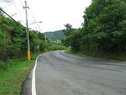
Ponce has nine barrios that border neighboring municipalities. These are Canas (borders Peñuelas), Quebrada Limón (borders Peñuelas), Marueño (borders Peñuelas), Guaraguao (borders Peñuelas and Adjuntas), San Patricio (borders Adjuntas, Utuado, and Jayuya), Anón (borders Jayuya and Juana Diaz), Real (borders Juana Diaz), Coto Laurel (borders Juana Diaz), and Capitanejo (borders Juana Diaz). Canas and Capitanejo are also coastal barrios, and together with three others (Playa, Bucaná, and Vayas) make up the municipality's five coastal barrios.
| No. | Barrio | Population (Census 2000) | Density (/sq mi) | Total Area (sq mi) | Land Area (sq mi) | Water Area (sq mi) |
|---|---|---|---|---|---|---|
| 1 | Anón | 1669 | 129.9 | 12.85 | 12.85 | 0.00 |
| 2 | Canas | 34065 | 2349.3 | 22.82 | 14.50 | 8.32 |
| 3 | Capitanejo | 1401 | 355.4 | 4.82 | 3.95 | 0.88 |
| 4 | Coto Laurel | 5285 | 1492.9 | 3.60 | 3.54 | 0.06 |
| 5 | Guaraguao | 1017 | 247.4 | 4.11 | 4.11 | 0.00 |
| 6 | Marueño | 1474 | 350.1 | 4.21 | 4.21 | 0.00 |
| 7 | Quebrada Limón | 804 | 301.1 | 2.67 | 2.67 | 0.00 |
| 8 | Real | 3139 | 595.6 | 5.28 | 5.27 | 0.01 |
| 9 | San Patricio | 465 | 67.8 | 6.86 | 6.86 | 0.00 |
| Ponce | 186475 | 1625.5 | 193.6 | 114.7 | 78.9 | |
Coastal barrios
%2C_Ponce%2C_PR_(DSC05629).jpg)
Ponce has five barrios that face the Caribbean Sea. These are: Bucaná, Canas, Capitanejo, Playa, and Vayas. These five make up the municipality's coastal barrios. Two of these—Canas and Capitanejo—are also bordering barrios.
| No. | Barrio | Population (Census 2000) | Density (/sq mi) | Total Area (sq mi) | Land Area (sq mi) | Water Area (sq mi) |
|---|---|---|---|---|---|---|
| 1 | Bucaná | 3963 | 2957.5 | 2.16 | 1.34 | 0.81 |
| 2 | Canas | 34065 | 2349.3 | 22.82 | 14.50 | 8.32 |
| 3 | Capitanejo | 1401 | 355.4 | 4.82 | 3.95 | 0.88 |
| 4 | Playa | 16926 | 3864.4 | 14.98 | 4.38 | 10.60 |
| 5 | Vayas | 1338 | 187.9 | 10.47 | 7.12 | 3.35 |
| Ponce | 186475 | 1625.5 | 193.6 | 114.7 | 78.9 | |
Interior barrios
The municipality has eight barrios -- Cerrillos, Machuelo Arriba, Magueyes, Maragüez, Montes Llanos, Portugués, Sabanetas, Tibes—that are located entirely in the interior of the municipality. '"Interior" here means that these are non urban zone barrios which border neither the Caribbean Sea nor adjacent municipalities.[28]
| No. | Barrio | Population (Census 2000) | Density (/sq mi) | Total Area (sq mi) | Land Area (sq mi) | Water Area (sq mi) |
|---|---|---|---|---|---|---|
| 1 | Cerrillos | 4284 | 1377.5 | 3.31 | 3.11 | 0.20 |
| 2 | Machuelo Arriba | 13727 | 2124.9 | 6.61 | 6.46 | 0.15 |
| 3 | Magueyes | 6134 | 1345.2 | 4.56 | 4.56 | 0.00 |
| 4 | Maragüez | 754 | 142.0 | 6.42 | 5.31 | 1.11 |
| 5 | Montes Llanos | 462 | 214.9 | 2.15 | 2.15 | 0.00 |
| 6 | Portugués | 4882 | 1386.9 | 3.56 | 3.52 | 0.04 |
| 7 | Sabanetas | 6420 | 2351.6 | 2.79 | 2.73 | 0.06 |
| 8 | Tibes | 866 | 123.5 | 7.01 | 7.01 | 0.00 |
| Ponce | 186475 | 1625.5 | 193.6 | 114.7 | 78.9 | |
References
- ↑ Historia de Nuestros Barrios: Portugués, Ponce. Rafael Torrech San Inocencio. El Sur a la Vista. elsuralavista.com. 14 February 2010. Accessed 12 February 2011.
- ↑ Ponce. Proyecto Salon Hogar. Map of Barrios of Ponce. (Map with fully urbanized barrios conglomerated and merged as "Zona Urbana". Barrio not labeled is named "Machuelo Abajo".) Retrieved November 30, 2009.
- ↑ "Ponce: General Information." Puerto Rico Encyclopedia. Retrieved November 30, 2009.
- ↑ Ponce Puerto Rico. AreciboWeb. (Map showing the 31 geo-numbered barrios of Ponce.) Retrieved November 30, 2009.
- ↑ Mapa de Localizacion Limite de Barrios de Ponce. Oficina de Ordenacion Territorial. Municipio Autonomo de Ponce. Ponce, Puerto Rico. Retrieved March 24, 2010.
- ↑ Ponce, Puerto Rico: Barrios AreciboWeb. Retrieved 22 November 2009.
- ↑ Un Acercamiento Sociohistorico y Linguistico a los Toponimos del Municipio de Ponce, Puerto Rico. Amparo Morales, María T. Vaquero de Ramírez. "Estudios de lingüística hispánica: homenaje a María Vaquero". Page 113. Retrieved 19 July 2011.
- ↑ Sunny A. Cabrera Salcedo. Hacia un Estudio Integral de la Toponimia del Municipio de Ponce, Puerto Rico. Ph. D. dissertation. May 1999. University of Massachusetts Amherst. Graduate School. Department of Spanish and Portuguese. Page 21.
- ↑ AREAS IN PUERTO RICO ELIGIBLE FOR RURAL HOUSING LOANS: BARRIOS, TOWNS AND VILLAGES. U.S. Department of Agriculture. Rural Development. Page 7. 2 June 2010. Retrieved 21 October 2012.
- ↑ U.S. Census Bureau. Accessed February 12, 2011.
- ↑ Lo Que No Sabias de Puerto Rico y Mucho Mas. By Boricua Online.com. Barrio Canas Most Populated. Retrieved December 7, 2009.
- ↑ Mapa de Localizacion Limite de Barrios de Ponce. Oficina de Ordenacion Territorial. Municipio Autonomo de Ponce. Ponce, Puerto Rico. Retrieved March 24, 2010.
- ↑ U.S. Census Bureau. Fact Finder. Ponce Municipio, Puerto Rico -- County Subdivision and Place. Retrieved March 6, 2010.
- ↑ Ponce... Pearl of the South. The Real Estate Book. List of Barrios of Ponce from U.S. Census Bureau. This map shows fully urbanized barrios conglomerated and merged as "Zona Urbana". The barrio missing a label is called "Machuelo Abajo" Retrieved December 7, 2009.
- ↑ Welcome to Puerto Rico.Org, Map of Ponce. By Welcome to Puerto Rico.org. Retrieved December 7, 2009.
- ↑ Mapa de Localizacion Limite de Barrios de Ponce. Oficina de Ordenacion Territorial. Municipio Autonomo de Ponce. Ponce, Puerto Rico. Retrieved March 24, 2010.
- ↑ Ponce, Puerto Rico: Barrios AreciboWeb. Retrieved 22 November 2009.
- ↑ Un Acercamiento Sociohistorico y Linguistico a los Toponimos del Municipio de Ponce, Puerto Rico. Amparo Morales, María T. Vaquero de Ramírez. "Estudios de lingüística hispánica: homenaje a María Vaquero". Page 113. Retrieved 19 July 2011.
- ↑ Lo Que No Sabias de Puerto Rico y Mucho Mas. By Boricua Online.com. Barrio Canas Most Populated. Retrieved December 7, 2009.
- ↑ Barrios de Ponce. Antepasados Esclavos.(From: Pedro Tomás de Córdoba. Memorias geográficas, históricas, económicas y estadísticas de la Isla de Puerto Rico.) Retrieved 19 June 2012.
- ↑ Barrios de Ponce. Antepasados Esclavos.(From: Ubeda y Delgado, Manuel. (1878). Isla de Puerto Rico: estudio histórico, geográfico y estadístico de la misma. Citado en Municipio de Ponce: memoria suplementaria al mapa de límites del municipio y sus barrios. (1953). Ponce: Junta de Planificación. Page 7.) Retrieved 19 June 2012.
- ↑ Mapa de Localizacion Limite de Barrios de Ponce. Oficina de Ordenacion Territorial. Municipio Autonomo de Ponce. Ponce, Puerto Rico. Retrieved March 24, 2010.
- ↑ Lo Que No Sabias de Puerto Rico y Mucho Mas. By Boricua Online.com. Barrio Canas Most Populated. Retrieved December 7, 2009.
- ↑ Lo Que No Sabias de Puerto Rico y Mucho Mas. By Boricua Online.com. Barrio Canas Most Populated. Retrieved December 7, 2009.
- ↑ Sunny A. Cabrera Salcedo. Hacia un Estudio Integral de la Toponimia del Municipio de Ponce, Puerto Rico. Ph. D. dissertation. May 1999. University of Massachusetts Amherst. Graduate School. Department of Spanish and Portuguese. Page 21.
- ↑ U.S. Census Bureau. Accessed February 12, 2011.
- ↑ Lo Que No Sabias de Puerto Rico y Mucho Mas. By Boricua Online.com. Barrio Canas Most Populated. Retrieved December 7, 2009.
- ↑ Mapa de Localizacion Limite de Barrios de Ponce. Oficina de Ordenacion Territorial. Municipio Autonomo de Ponce. Ponce, Puerto Rico. Retrieved March 24, 2010.