Shire of Mornington (Victoria)
| Shire of Mornington Victoria | |||||||||||||
|---|---|---|---|---|---|---|---|---|---|---|---|---|---|
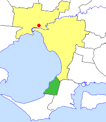 Location in Melbourne | |||||||||||||
| Population | 32,800 (1992)[1] | ||||||||||||
| • Density | 107.68/km2 (278.9/sq mi) | ||||||||||||
| Established | 1893 | ||||||||||||
| Area | 304.6 km2 (117.6 sq mi) | ||||||||||||
| Council seat | Mornington | ||||||||||||
| Region | Mornington Peninsula | ||||||||||||
| County | Mornington | ||||||||||||
|
| |||||||||||||
| |||||||||||||
The Shire of Mornington was a local government area about 50 kilometres (31 mi) south of Melbourne, the state capital of Victoria, Australia, encompassing the western extremity of the Mornington Peninsula. The shire covered an area of 90.65 square kilometres (35.0 sq mi) immediately to the south of Frankston, and existed from 1960 until 1994.
History
The Mount Eliza Road District (centred on Frankston) was created on 6 November 1860, and became a shire on 24 November 1871. On 31 May 1893, it was renamed the Shire of Frankston and Hastings, while its western riding was severed and named New Mornington, to avoid confusion with the previous entity. On 19 January 1894, it was renamed the Shire of Mornington.[2]
On 15 December 1994, the Shire of Mornington was abolished, and, along with the Shires of Shire of Flinders and Hastings and parts of the City of Frankston, was merged into the newly created Shire of Mornington Peninsula.[3] The Age reported in July 1994 that the result had been supported by Hastings and Mornington councils from the beginning, but opposed by Flinders, which wanted to merge with the southern coastal section of Hastings.[4]
Council formerly met at the Shire Hall, at Queen Street and Vancouver Street, Mornington. The facility is used today as a civic centre and library by the Shire of Mornington Peninsula.
Wards
The Shire of Mornington was divided into four ridings, each of which elected three councillors:
- Mornington North Riding
- Mornington South Riding
- Mount Eliza Riding
- Mount Martha Riding
Suburbs and localities
- Moorooduc (shared with the Shire of Hastings)
- Mornington
- Mount Eliza (shared with the City of Frankston)
- Mount Martha
Population
| Year | Population |
|---|---|
| 1954 | 5,793 |
| 1958 | 7,540* |
| 1961 | 7,819 |
| 1966 | 10,214 |
| 1971 | 14,289 |
| 1976 | 20,206 |
| 1981 | 23,512 |
| 1986 | 27,397 |
| 1991 | 29,958 |
* Estimate in the 1958 Victorian Year Book.
References
- ↑ Australian Bureau of Statistics, Victoria Office (1994). Victorian Year Book. p. 49. ISSN 0067-1223.
- ↑ Victorian Municipal Directory. Brunswick: Arnall & Jackson. 1992. pp. 769–770. Accessed at State Library of Victoria, La Trobe Reading Room.
- ↑ Australian Bureau of Statistics (1 August 1995). Victorian local government amalgamations 1994-1995: Changes to the Australian Standard Geographical Classification (PDF). Commonwealth of Australia. p. 10. ISBN 0-642-23117-6. Retrieved 2007-12-16.
- ↑ Neales, Sue (27 July 1994). "Crunch time for councils in south and south-east". The Age. p. 8.
Coordinates: 38°13′S 145°03′E / 38.217°S 145.050°E