Shojaabad, East Azerbaijan
| Shojaabad شجاع اباد | |
|---|---|
| village | |
|
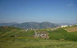
Village view in July 2013 | |
 Shojaabad | |
| Coordinates: 38°51′47″N 46°57′54″E / 38.86306°N 46.96500°ECoordinates: 38°51′47″N 46°57′54″E / 38.86306°N 46.96500°E | |
| Country |
|
| Province | East Azerbaijan |
| County | Kaleybar |
| Bakhsh | Central |
| Rural District | Misheh Pareh |
| Population (2006) | |
| • Total | 73 |
| Time zone | IRST (UTC+3:30) |
| • Summer (DST) | IRDT (UTC+4:30) |
Shojaabad (Persian: شجاعآباد, also Romanized as Shojā‘ābād)[1] is a village in Misheh Pareh Rural District, in the Central District of Kaleybar County, East Azerbaijan Province, Iran. At the 2006 census, its population was 73, in 21 families. [2]
Situation
Online edition of the Dehkhoda Dictionary, quoting Iranian Army files,[3] reports a population of 67 people in late 1940s.[4] At the 2006 census, its population was 73, in 21 families. [2] According to a more recent statistics (2012) the population is 80 people in 22 families.[5]
Due to the proximity to Babak Fort the village is already experiencing a rapid growth.
References
- ↑ Shojaabad can be found at GEOnet Names Server, at this link, by opening the Advanced Search box, entering "-3829422" in the "Unique Feature Id" form, and clicking on "Search Database".
- 1 2 "Census of the Islamic Republic of Iran, 1385 (2006)". Islamic Republic of Iran. Archived from the original (Excel) on 2011-11-11.
- ↑ فرهنگ جغرافیایی ایران، آبادیها، زیر نظر حسینعلی رزم آرا، تهران: سازمان جغرافیایی کشور، 1329، ج 4
- ↑ http://www.loghatnaameh.org/dehkhodaworddetail-be049bde41f948bb8b85eda865c0317d-fa.html
- ↑ http://www.ostan-as.gov.ir/uploads/2/CMS/user/file/702/%D8%A2%D8%A8%D8%A7%D8%AF%D9%8A.pdf
This article is issued from Wikipedia - version of the 2/18/2014. The text is available under the Creative Commons Attribution/Share Alike but additional terms may apply for the media files.