Shyroka Balka
For other uses, see Shyroka Balka (disambiguation).
| Shyroka Balka Широка Балка | |
|---|---|
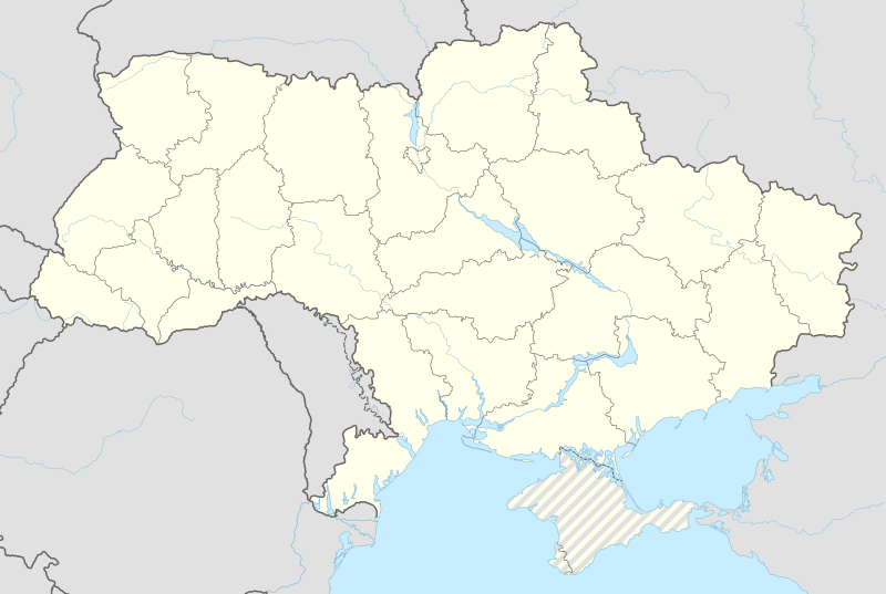 Shyroka Balka Location of Shyroka Balka within Ukraine | |
| Coordinates: UA 48°18′4″N 37°55′39″E / 48.30111°N 37.92750°ECoordinates: UA 48°18′4″N 37°55′39″E / 48.30111°N 37.92750°E | |
| Country | Ukraine |
| Province | Donetsk Oblast |
| Elevation | 134 m (440 ft) |
| Population (2001 census) | |
| • Total | 477 |
| Time zone | EET (UTC+2) |
| • Summer (DST) | EEST (UTC+3) |
| Postal code | 84619 |
| Area code | +380 6242 |
Shyroka Balka (Ukrainian: Широка Балка; Russian: Широкая Балка) is a settlement in Horlivka municipality of Donetsk Oblast of eastern Ukraine, at 43.5 km NNE from the centre of Donetsk city.
During the War in Donbass, in 2015, the settlement was taken under control of pro-Russian forces of the self-proclaimed Donetsk People's Republic.[1]
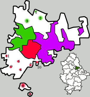
Administrative system of Horlivka:
| Districts of Horlivka: |
Populated places: 1 — Hladosove 2 — Holmivsky 3 — Zaitseve 4 — Mykhailivka 5 — Ozeryanivka 6 — Panteleymonivka 7 — Piatykhatky 8— Ryasne 9 — Stavky 10 — Fedorivka 11 — Shyroka Balka |
Demographics
Native language as of the Ukrainian Census of 2001:[2]
- Ukrainian 71.28%
- Russian 28.51%
- Belorussian 0.21%
References
External links
This article is issued from Wikipedia - version of the 11/7/2016. The text is available under the Creative Commons Attribution/Share Alike but additional terms may apply for the media files.