Silver City, Idaho
|
Silver City Historic District | |
|
Silver City in 1892 | |
 | |
| Location | Owyhee County, Idaho |
|---|---|
| Nearest city | Jordan Valley, Oregon |
| Coordinates | 43°01′01″N 116°43′59″W / 43.01694°N 116.73306°WCoordinates: 43°01′01″N 116°43′59″W / 43.01694°N 116.73306°W |
| Area | 10,240 acres (41.4 km2) |
| NRHP Reference # | 72000446[1] |
| Added to NRHP | May 19, 1972 |

Silver City is a ghost town in Owyhee County, Idaho, United States. At its height in the 1880s, it was a gold and silver mining town with a population of around 2,500 and approximately 75 businesses. Silver City served as county seat of Owyhee County from 1867 to 1934. Today, the town has about 70 standing buildings, all of which are privately owned. Many of the owners are third- or fourth-generation descendants of the original miners. There are a handful of small businesses, but no gas or service stations. The property is now owned by the Bureau of Land Management.[2]
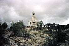
Silver City was founded in 1864 soon after silver was discovered at nearby War Eagle Mountain (elev. 8,065 ft (2,458 m)). The settlement grew quickly and was soon considered one of the major cities in Idaho Territory. The first daily newspaper and telegraph office in Idaho Territory were established in Silver City. The town was also among the first places in present-day Idaho to receive electric and telephone service.
The placer and quartz vein mines became depleted around the time Idaho became a state in 1890. Due in part to its extremely remote location, Silver City began a slow decline but was never completely abandoned. Small-scale mining continued off and on until World War II; the last mine to be operated all year round in Silver City was the "Potossi," managed by Ned Williams.
The Idaho Hotel in Silver City was restored and re-opened for tourists in 1972. It relies on the use of propane refrigerators and stoves in order to supply cold drinks and snacks or a complete meal to guests during the summer months. The rooms are fitted with indoor plumbing and furnished with antiques, making it a tourist destination.
In 1972, the townsite and its environs were listed on the National Register of Historic Places as a historic district, the Silver City Historic District, with a total area of 10,240 acres (41.4 km2).[1]
Geography
Silver City is located at an elevation of 6,179 feet (1,883 m) above sea level. It is located 25 miles (40 km) southwest of Murphy (elev. 2,820 feet (860 m)), via a dirt road.
| Historical population | |||
|---|---|---|---|
| Census | Pop. | %± | |
| 1870 | 960 | — | |
| 1880 | 593 | −38.2% | |
| 1890 | 583 | −1.7% | |
| 1900 | 976 | 67.4% | |
| 1910 | 650 | −33.4% | |
| 1920 | 630 | −3.1% | |
| 1930 | 183 | −71.0% | |
| 1940 | 165 | −9.8% | |
| 1950 | 110 | −33.3% | |
| source:[3] | |||
References
- 1 2 National Park Service (2009-03-13). "National Register Information System". National Register of Historic Places. National Park Service.
- ↑ Wells, Merle (1971). "Silver City Historic District" (NRHP Nomination). NPS Focus. National Park Service. Retrieved 3 November 2015.
- ↑ Moffatt, Riley. Population History of Western U.S. Cities & Towns, 1850-1990. Lanham: Scarecrow, 1996, 98.
External links
- Official website - Historic Silver City Idaho
- Boise State University - library - Catherine Minear Moore
- The Owyhee War - 1868
- Idaho State Historical Society - photos - digital collections - Owyhee mining district
- Western Mining History.com - photos - Silver City, Idaho
- Ghost Towns.com - photos - Silver City, Idaho
- Exploring Silver City - blog - photos - 2002-08
- West County Explorers Club.com - blog - Silver City, Idaho - 2010-10
- YouTube.com - video - Silver City at sunset - 2008-09
Municipalities and communities of Owyhee County, Idaho, United States | ||
|---|---|---|
| Cities | ||
| CDP | ||
| Unincorporated communities | ||
| Indian reservation | ||
| Ghost towns | ||