Sink (geography)

Mediterranean Sink during the Messinian Event
Red Sea when blocked by the Perim volcano
Africa: Afar Depression
USA: Carson Sink
USA: Humboldt Sink
USA: Quinn River Sink
USA: Salton Sink
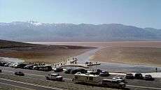
A geographic sink is a depression within an endorheic basin where water collects with no visible outlet. Instead of discharging, the collected water is lost due to evaporation and/or penetration (water sinking underground, e.g., to become groundwater in an aquifer). If the sink has karstic terrain, water will sink at a higher rate than the surface evaporation, and conversely if the lakebed or sink bed has a layer of soil that is largely impervious to water (hardpan), evaporation will predominate. Since dry lakes in sinks with hardpan have little penetration, they require more severe aridity/heat to eliminate collected water at a comparable rate as for a similar sink with appreciable penetration.
Depending on losses, precipitation, and inflow (e.g., a spring, a tributary, or flooding); the temporal result of a lake in a sink may be a persistent lake, an intermittent lake, a playa lake (temporarily covered with water), or an ephemeral lake.