Sint Maartensbrug
| Sint Maartensbrug | |
|---|---|
| Village | |
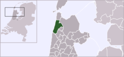 | |
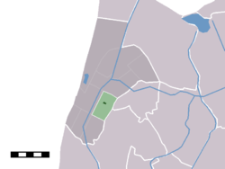 The village centre (darkgreen) and the statistical district (lightgreen) of Sint Maartensbrug in the former municipality of Zijpe. | |
| Coordinates: 52°47′N 4°44′E / 52.783°N 4.733°ECoordinates: 52°47′N 4°44′E / 52.783°N 4.733°E | |
| Country | Netherlands |
| Province | North Holland |
| Municipality | Schagen |
| Population | |
| • Total | 322 |
| Time zone | CET (UTC+1) |
| • Summer (DST) | CEST (UTC+2) |
Sint Maartensbrug is a village in the Dutch province of North Holland. It is a part of the municipality of Schagen, and lies about 14 km northwest of Heerhugowaard.
In 2001, the village of Sint Maartensbrug had 322 inhabitants. The built-up area of the village was 0.05 km², and contained 115 residences.[1] The wider statistical area of Sint Maartensbrug has a population of around 780.[2]
References
- ↑ Statistics Netherlands (CBS), Bevolkingskernen in Nederland 2001 . Statistics are for the continuous built-up area.
- ↑ Statistics Netherlands (CBS), Gemeente Op Maat 2004: Zijpe .
This article is issued from Wikipedia - version of the 3/15/2013. The text is available under the Creative Commons Attribution/Share Alike but additional terms may apply for the media files.