Skellefteå
| Skellefteå | ||
|---|---|---|
|
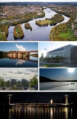
Skellefteå in images | ||
| ||
| Nickname(s): Schtaan, Guldstaden (Goldtown), Skellhell[1] | ||
 Skellefteå 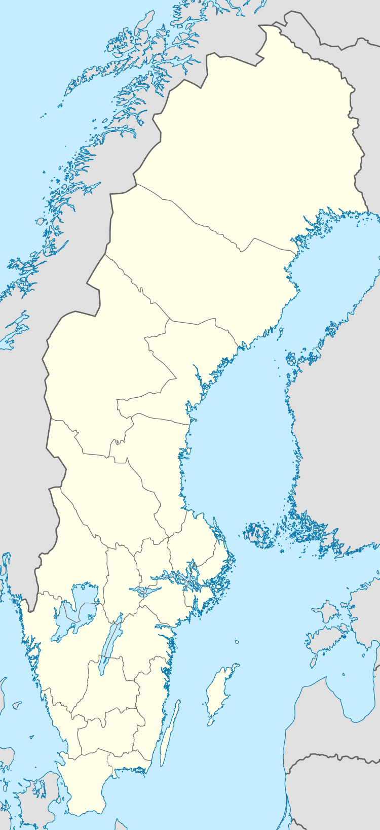 Skellefteå | ||
| Coordinates: 64°45′N 20°57′E / 64.750°N 20.950°ECoordinates: 64°45′N 20°57′E / 64.750°N 20.950°E | ||
| Country | Sweden | |
| Province | Västerbotten | |
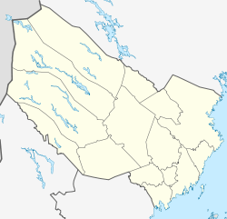
| County | Västerbotten County | |
| Municipality | Skellefteå Municipality | |
| Area[2] | ||
| • City | 21.74 km2 (8.39 sq mi) | |
| Population (31 December 2010)[2] | ||
| • City | 32,775 | |
| • Density | 1,507/km2 (3,900/sq mi) | |
| • Urban | 72 025 | |
| Time zone | CET (UTC+1) | |
| • Summer (DST) | CEST (UTC+2) | |
| Area code(s) | +46 0910 | |
Skellefteå is a city and the seat of Skellefteå Municipality in Västerbotten County, Sweden, with 32,775 inhabitants in 2010.[2] The municipality had approximately 72,000 inhabitants at the end of 2013 .[2] In the local accent the "å" is omitted and the city is pronounced locally as Skellefte.
The city is a historically industrial city with mining being a large industry, especially for gold – hence the nickname "Gold Town". Politically it is a Social Democratic stronghold. The city is a well-known ice hockey town, with its main team Skellefteå AIK playing in the Swedish top division, the SHL and being Swedish champions on multiple occasions.
The city was incorporated in 1845 and grew to its current population size mostly in the 1950s and 1960s, growing only slowly since. It is the second largest city in Västerbotten after Umeå and is located roughly halfway between it and Luleå. The river Skellefte älv passes through the city and it is located around 15 kilometres (9.3 mi) from the Bothnian Bay open sea. Skellefteå is served by Skellefteå Airport, locally known as Falmark, also around 15 kilometres (9.3 mi) from the city centre to the south.
History
The name Skellefteå is recorded to having been spelled as Skelepht in 1327. The origin of the name remains unknown.
From the 14th century on, attempts were made to Christianize Skellefteå. However, – for the most part – the entire large Northern Swedish territory of Norrland was not Christianized until several hundred years after the rest of Sweden, and many northern areas such as Skellefteå remained unexplored well past the Middle Ages.
Not before the very end of the 17th century did the indigenous Sami people of Northern Sweden begin turning into Christianity, much due to the efforts by the Northern Swedish superintendent Mathias Steuchius, who worked hard to accomplish this.
Eventually, the reason for the sudden awakened interest towards Skellefteälven and the surrounding areas were the great northern fishing grounds of salmon. The increased demand for fish was sparked by a stricter enforcement of the annual month-long fasting by the Catholic Church, whereby meat was substituted by fish.
The actual city of Skellefteå is one of the youngest cities of Norrland. It was founded in 1845 by the vicar Nils Nordlander.
Today
In the 20th century, Skellefteå evolved to an industrial and mining city and many wooden houses were demolished to give room for brick buildings. The largest private employer in Skellefteå is the mining company Boliden AB, with about 1'200 employees. The mining is primarily done for copper, but with the ore particles of gold, silver and platinum also follow. However, Skellefteå is still referred to as the "Goldtown". During the 1990s, the computer industry flourished, causing subsidiaries of Ericsson and Tieto Enator to become important employers.
If things go according to plan, Skellefteå will be the site of the hind legs of the world's largest moose – Stoorn –, a tourist attraction planned to be built, spanning from Skellefteå into Arvidsjaur in Norrbotten.
Industry
- Boliden AB, a big mining and smelting company
- Skellefteå Kraft
Sports
- Skellefteå AIK, an ice hockey team in the highest Swedish league, Swedish Hockey League, 1978, 2013 and 2014 Swedish Champions.
- Morön BK, football club playing in Division 2 Norrland
- Skellefteå FF, football club playing in Division 2 Norrland
- Sunnanå SK, women's football (soccer)
Notable natives
People
- Anders Andersson, ice hockey player
- Johan Alm, ice hockey player
- Viktor Arvidsson, ice hockey player
- Johan Backlund, ice hockey player
- Niclas Burström, ice hockey player
- Per Olov Enquist, writer
- Jimmie Ericsson, ice hockey player
- Jan Erixon, ice hockey player
- Tim Erixon, ice hockey player
- Toini Gustafsson-Rönnlund, skier
- Peter Haber, actor
- Andreas "Vintersorg" Hedlund, musician
- Jonathan Hedström, ice hockey player
- Thomas Idergard, political commentator
- Adam Larsson, ice hockey player
- Stieg Larsson, writer
- Stig Larsson, writer
- Oscar Lindberg, ice hockey player for the New York Rangers
- Mats Lindgren, ice hockey player
- Joakim Lindström, ice hockey player
- Hanna Marklund, football player
- Hardy Nilsson, ice hockey player and later coach
- Anna Nordlander, painter
- Joakim Nyström, tennis player
- David Rundblad, ice hockey player
- Victoria Silvstedt, supermodel
- Henning Sjöström, lawyer
- Margot Wallström, former first Vice President of the European Commission and current Special Representative on Sexual Violence in Conflict with the UN. Since 2014 Foreign Secretary of Sweden.
Artists
- Moon Safari (band), a symphonic rock band.
- The Wannadies, an alternative rock band formed in 1988.
- Vintersorg, a metal band.
- Amber Oak, a pop-rock band.
Climate
Skellefteå has subarctic climate that is borderline continental with mild summers and cold and snowy winters. The climate is somewhat moderated by the Bothnia Bay, although marine effects are limited, ensuring very mild summer temperatures for a coastal area so far north. The surrounding municipality has an all-time high of 33.9 °C (93.0 °F)[3] during the 2014 Swedish heat wave, which is very hot given the latitude and proximity to a major body of water. Although summer highs traditionally averaged just below 20 °C (68 °F) it has been warmer in recent decades.
| Climate data for Skellefteå, Sweden | |||||||||||||
|---|---|---|---|---|---|---|---|---|---|---|---|---|---|
| Month | Jan | Feb | Mar | Apr | May | Jun | Jul | Aug | Sep | Oct | Nov | Dec | Year |
| Average high °C (°F) | −5 (23) |
−5 (23) |
0 (32) |
6 (43) |
13 (55) |
18 (64) |
21 (70) |
19 (66) |
13 (55) |
6 (43) |
0 (32) |
−2 (28) |
7 (44.5) |
| Average low °C (°F) | −13 (9) |
−13 (9) |
−8 (18) |
−2 (28) |
3 (37) |
8 (46) |
11 (52) |
10 (50) |
6 (43) |
1 (34) |
−5 (23) |
−9 (16) |
−0.9 (30.4) |
| Average precipitation mm (inches) | 42 (1.65) |
33 (1.3) |
32 (1.26) |
32 (1.26) |
35 (1.38) |
40 (1.57) |
57 (2.24) |
71 (2.8) |
65 (2.56) |
55 (2.17) |
61 (2.4) |
48 (1.89) |
571 (22.48) |
| Average precipitation days | 18 | 14 | 13 | 11 | 11 | 11 | 12 | 14 | 15 | 15 | 17 | 17 | 168 |
| Source #1: [4] | |||||||||||||
| Source #2: [5] | |||||||||||||
See also
- Westrobothnian
- Sollefteå (similar name)
- Morö backe
References
- http://lokalhistoria.skelleftea.org
- Some material has been translated and incorporated from sv:Skellefteå
- ↑ "Skellhell inte så illa som du tror". March 2011. Retrieved 7 March 2014.
- 1 2 3 4 "Tätorternas landareal, folkmängd och invånare per km2 2005 och 2010" (in Swedish). Statistics Sweden. 14 December 2011. Archived from the original on 10 January 2012. Retrieved 10 January 2012.
- ↑ "Månadens väder Juli 2014" (in Swedish). SMHI. Retrieved 3 November 2015.
- ↑ (English) "Institute of Meteorology and Water Management". www.worldclimateguide.co.uk.
- ↑ "SMHI Climate Data 2002-2015 (based on temperature averages for Piteå and Bjuröklubb and SMHI temperature map 1961-1990)". SMHI. odate=April 2016
External links
![]() Media related to Skellefteå at Wikimedia Commons
Media related to Skellefteå at Wikimedia Commons
| Wikivoyage has a travel guide for Skellefteå. |
- Skellefteå – Official site
- Tourist in Skellefteå – Tourist information in Swedish, English and German languages
Municipalities and seats of Västerbotten County | ||
|---|---|---|
| Municipalities | ||
| Municipal seats | ||