Smithland Lock and Dam
| Smithland Lock and Dam | |
|---|---|
 | |
| Location | Kentucky/Illinois border |
| Coordinates | 37°09′59″N 88°25′42″W / 37.1664°N 88.4284°WCoordinates: 37°09′59″N 88°25′42″W / 37.1664°N 88.4284°W |
| Construction began | 1971 |
| Opening date | 1980 |
| Operator(s) |
|
| Dam and spillways | |
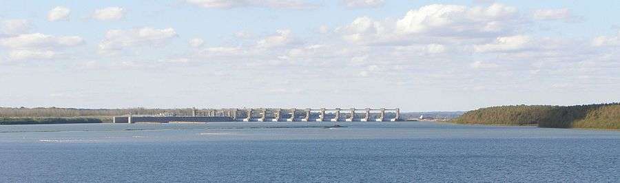
| Type of dam | Concrete fixed weir with 11 Tainter gates |
| Impounds | Ohio River |
| Length | 2,951 feet |
| Reservoir | |
| Normal elevation | 324 feet above sealevel |
Smithland Lock and Dam is the 18th Lock and dam on the Ohio River, 919 miles down stream of Pittsburgh and 63 miles upstream from the confluence of the Mississippi with the Ohio. There are 2 locks for commercial barge traffic that are 1,200 feet long by 110 feet wide.[1]
History
Smithland lock and dam was authorized in 1965 to replace lock and dam 50 and 51 on the Ohio river.
| Wikimedia Commons has media related to Category:Smithland Lock and Dam. |
See also
References
External links

- U.S. Army Corps of Engineers, Pittsburgh District
- U.S. Army Corps of Engineers, Huntington District
- U.S. Army Corps of Engineers, Louisville District
This article is issued from Wikipedia - version of the 10/24/2016. The text is available under the Creative Commons Attribution/Share Alike but additional terms may apply for the media files.