Sodam
| Sodam(MajorPanchayath) సోదం | |
|---|---|
| MAJOR PANCHAYATH | |
|
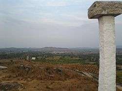
Aerial view of Sodam seen from Seethamma Gutta. | |
 Sodam(MajorPanchayath) Location in Andhra Pradesh, India | |
| Coordinates: 13°32′51″N 78°54′27″E / 13.54750°N 78.90750°ECoordinates: 13°32′51″N 78°54′27″E / 13.54750°N 78.90750°E | |
| Country | India |
| State | Andhra Pradesh |
| District | Chittoor |
| Mandal | Sodam |
| Government | |
| • Type | Panchayath |
| • Body | Sarpanch |
| AreaCombined are villages in panchayath | |
| • Total | 3.04 km2 (1.17 sq mi) |
| Population (2011) | |
| • Total | 6,995 |
| • Density | 2,300/km2 (6,000/sq mi) |
| Languages | |
| • Official | Telugu |
| Time zone | IST (UTC+5:30) |
| PIN | 517123 |
| Vehicle registration | AP03 |
Sodam is a mandal in punganur constituency of Chittoor district in the southern Indian state of Andhra Pradesh.State leaders like Peddireddy Ramchandra Reddy and Mithun Reddy hail from this place. Plr foods and sivasakthi dairy are located in this mandal. It is 180 km from bangalore and 190 km from chennai and resides 60 km from district headquarters. It is the mandal headquarters of Sodam mandal.[1] Main Crops grown here are Groundnut,sugarCane and paddy as well. Mango is very extensively grown. Jandrapeta suburb of sodam panchayath is separated just by a bridge and both of them look like twin towns. Sadum has educational facilities such as Government Junior College and Govt High School. Private Institutions include SriVinayaka Degree College, Sri vinayaka public school and sri vidyamandir school. Name of the village is said to be derived from the bridge constructed by British Govt which is still operational without any damage.
Peepal Groove School by satsung Foundation is an international school present 4.4 km from the town. Sodam has good commercial centre with shops such as JCMR stores, SriVijayaLakshmi Super Market and many others. Varanasi Ramaswami reddy is said to be the Zamindar of the village long back. VRR theatre is the theatre in sodam which is as good as many theatres in the constituency. Nearby Urban centres are piler 11 km. Hindus are the major religion followed by Muslims and Christians. Literacy rate is 68.41 slightly better when compared to other areas in the district. Somala, Piler, Kalikiri, Pulicherla are the surrounding mandals.
References
| Wikimedia Commons has media related to Sodam. |
- ↑ "Chittoor District Mandals" (PDF). Census of India. pp. 470, 514. Retrieved 25 June 2015.