South Dakota Highway 471
| ||||
|---|---|---|---|---|
|
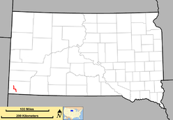
Route of SD 471 (in red) | ||||
| Route information | ||||
| Defined by SDCL §31-4-244 | ||||
| Maintained by SDDOT | ||||
| Length: | 15 mi (24 km) | |||
| Existed: | 1976 – present | |||
| Major junctions | ||||
| South end: |
| |||
| North end: |
| |||
| Location | ||||
| Counties: | Fall River | |||
| Highway system | ||||
| ||||

South Dakota Highway 471 (SD 471) is a state route that runs from U.S. Route 18 (US 18) in Edgemont, south and southeast to South Dakota Highway 71 southeast of Rumford. The route is about 15 miles (24 kilometers) in length.
South Dakota 471 was designated in 1976. It was previously a portion of South Dakota Highway 52, which had been used on this route from 1951 to 1975.
Route description
Highway 471 begins at a junction with Highway 71 in the Oglala National Grassland. The highway travels northwest through the community of Rumford before turning west and passing through Provo. Here, Highway 471 veers north and enters the city of Edgemont as 3rd Street before turning into 2nd Avenue. The designation continues west onto A Street, passing through Edgemont[1] before briefly turning north on 6th Avenue to terminate at US 18.[2]
Major intersections
The entire route is in Fall River County.
| Location | mi[3] | km | Destinations | Notes | |
|---|---|---|---|---|---|
| | 0.000 | 0.000 | Southern terminus | ||
| Edgemont | 21.639 | 34.825 | US 18P | ||
| 22.085 | 35.542 | Northern terminus | |||
| 1.000 mi = 1.609 km; 1.000 km = 0.621 mi | |||||
References
- ↑ Google (2011-12-14). "Highway 471" (Map). Google Maps. Google. Retrieved 2011-12-14.
- ↑ Edgemont City Map (PDF) (Map). South Dakota Department of Transportation.
- ↑ "Transportation Inventory Management". South Dakota Department of Transportation. Retrieved 2011-12-14.