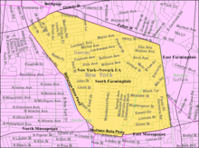
South Farmingdale, New York
| South Farmingdale, New York | |
|---|---|
| Hamlet and census-designated place | |
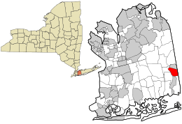 Location in Nassau County and the state of New York. | |
 Location within the state of New York | |
| Coordinates: 40°43′6″N 73°26′44″W / 40.71833°N 73.44556°WCoordinates: 40°43′6″N 73°26′44″W / 40.71833°N 73.44556°W | |
| Country | United States |
| State | New York |
| County | Nassau |
| Area | |
| • Total | 2.2 sq mi (5.7 km2) |
| • Land | 2.2 sq mi (5.7 km2) |
| • Water | 0.0 sq mi (0.0 km2) |
| Elevation | 59 ft (18 m) |
| Population (2010) | |
| • Total | 14,486 |
| • Density | 6,582/sq mi (2,541.4/km2) |
| Time zone | Eastern (EST) (UTC-5) |
| • Summer (DST) | EDT (UTC-4) |
| ZIP code | 11735 |
| Area code(s) | 516 |
| FIPS code | 36-69001 |
| GNIS feature ID | 0965744 |
South Farmingdale is a hamlet and census-designated place (CDP) in the Town of Oyster Bay in Nassau County, New York, United States. The population of the CDP was 14,486 at the 2010 census.[1] The area is often identified as part of Farmingdale,[2] and is served by the Farmingdale Post Office, Farmingdale School District, and Farmingdale Library.
Geography
South Farmingdale is located at 40°43′6″N 73°26′44″W / 40.71833°N 73.44556°W (40.718195, -73.445558).[3]
According to the United States Census Bureau, the CDP has a total area of 2.2 square miles (5.7 km²), all land.
For the 2000 Census, the CDP gained territory over the 1990 census.[4]
Demographics
2010 census
According to the 2010 census[5] the population was 90.1% White 83% Non-Hispanic White, 1.4% African American, 0.1% Native American, 4.5% Asian, 0.0% Pacific Islander, 2.2% from other races, and 1.7% from two or more races. Hispanics or Latinos of any race were 10% of the population.
2000 census
At the time of the 2000 census, there were 15,061 people 4,899 households, and 4,095 families residing in the CDP. The population density was 6,886.0 per square mile (2,655.3/km²). There were 4,950 housing units at an average density of 2,263.2/sq mi (872.7/km²). The racial makeup of the CDP was 93.01% White, 0.79% African American, 0.08% Native American, 3.18% Asian, 0.03% Pacific Islander, 1.85% from other races, and 1.07% from two or more races. Hispanic or Latino of any race were 5.90% of the population.[6]
There were 4,899 households of which 36.3% had children under the age of 18 living with them, 69.9% were married couples living together, 10.5% had a female householder with no husband present, and 16.4% were non-families. 13.5% of all households were made up of individuals and 7.2% had someone living alone who was 65 years of age or older. The average household size was 3.07 and the average family size was 3.37.
Age distribution was 25.1% under the age of 18, 6.2% from 18 to 24, 30.8% from 25 to 44, 21.7% from 45 to 64, and 16.2% who were 65 years of age or older. The median age was 38 years. For every 100 females there were 96.5 males. For every 100 females age 18 and over, there were 91.0 males.
The median household income was $71,168, and the median family income was $76,049. Males had a median income of $52,290 versus $36,475 for females. The per capita income for the CDP was $25,927. About 2.5% of families and 2.8% of the population were below the poverty line, including 4.4% of those under age 18 and 2.9% of those age 65 or over.
Public services
Farmingdale Postal Services
Residents of South Farmingdale have a ZIP code of 11735. They are served by the Farmingdale Post Office, located at 918 Main Street, Farmingdale, NY 11735-5426. While residents can and do typically use Farmingdale as their postal address, the post office also accepts mail that is addressed to South Farmingdale.[7]
Farmingdale Library
The Farmingdale Public Library is located at 16 Merritts Road, Farmingdale, NY 11735-3251.
Farmingdale School District
South Farmingdale is served by the Farmingdale School District. The district includes Farmingdale High School, Howitt Middle School, Northside Elementary School, Woodward Parkway School, Albany Avenue Elementary School in North Massepequa, and Saltzman East Memorial in Suffolk County.
Railroads
South Farmingdale is served by the Farmingdale (LIRR station) on the Ronkonkoma Branch of the Long Island Rail Road (LIRR). The station is located on Front Street, in Farmingdale. South Farmingdale is also served by the Massapequa Park (LIRR station) on the Babylon Branch. LIRR trains also run directly along the northeast boundary of the CDP using the Central Branch; however, the last station along this branch, the South Farmingdale Station, closed in 1974. It was along this stretch of the Central Branch that Mile-a-Minute Murphy set a record in 1899, pedalling a bicycle for one mile behind a train in less than one minute.
South Farmingdale Fire Department
The area is served by the South Farmingdale Fire Department. The main firehouse is located at 819 Main Street, Farmingdale, NY 11735-4140. A second station is at the corner of Merrits Rd and Beverly Road.[8]
South Farmingdale Water District
South Farmingdale has its own Water District, which has provided service to the area since 1931. It also serves North Massapequa, as well as parts of Bethpage and Seaford.
References
- ↑ "Profile of General Population and Housing Characteristics: 2010 for South Farmingdale, CDP, New York".
- ↑ Road signs erected by the county at the southeast corner of the CDP (along Main Street, about a mile from the Village of Farmingdale) welcome travelers to Farmingdale.
- ↑ "US Gazetteer files: 2010, 2000, and 1990". United States Census Bureau. 2011-02-12. Retrieved 2011-04-23.
- ↑ "New York: 2000 Population and Housing Unit Counts" (PDF). September 2003. p. III-10. Retrieved 2010-12-22.
- ↑ http://factfinder2.census.gov/faces/tableservices/jsf/pages/productview.xhtml?pid=DEC_10_DP_DPDP1
- ↑ "US 2000 Census data for CDP of South Farmingdale, NY".
- ↑ "ZIP Code Lookup". Enter 11735 in field for results.
- ↑ "South Farmingdale Fire Department".