Spießhorn
| Spießhorn | |
|---|---|
|
The Spießhorn seen from Seebuck. The right hand summit is part of the Kleiner Spießhorn | |
| Highest point | |
| Elevation | 1,348.9 m above sea level (NHN) (4,426 ft) |
| Coordinates | 47°49′50″N 8°02′29″E / 47.83069°N 8.04146°ECoordinates: 47°49′50″N 8°02′29″E / 47.83069°N 8.04146°E |
| Geography | |
 Spießhorn | |
| Parent range | Black Forest |
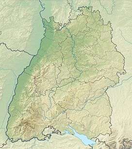
The Spießhorn is a mountain, 1,348.9 m above NHN[1] high, in the Black Forest just east of the Herzogenhorn. The summit is on the boundary between St. Blasien and Bernau im Schwarzwald. The Spießhorn is largely forested. At the summit is an observation pavilion. To the southwest is a subpeak, the Kleines Spießhorn.
References
External links
| Wikimedia Commons has media related to Spießhorn. |
This article is issued from Wikipedia - version of the 12/7/2015. The text is available under the Creative Commons Attribution/Share Alike but additional terms may apply for the media files.