Srednekansky District
| Srednekansky District Среднеканский район (Russian) | |
|---|---|
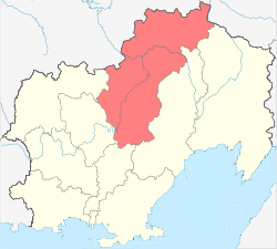 Location of Srednekansky District in Magadan Oblast | |
| Coordinates: 64°00′N 153°30′E / 64.000°N 153.500°ECoordinates: 64°00′N 153°30′E / 64.000°N 153.500°E | |
| Location | |
| Country | Russia |
| Federal subject | Magadan Oblast[1] |
| Administrative structure (as of July 2012) | |
| Administrative center | urban-type settlement of Seymchan[1] |
| Inhabited localities:[1] | |
| Urban-type settlements[2] | 1 |
| Rural localities | 4 |
| Municipal structure (as of July 2010) | |
| Municipally incorporated as | Srednekansky Municipal District[3] |
| Municipal divisions:[3] | |
| Urban settlements | 1 |
| Rural settlements | 3 |
| Statistics | |
| Area | 91,800 km2 (35,400 sq mi) |
| Population (2010 Census) | 3,228 inhabitants[4] |
| • Urban | 87.3% |
| • Rural | 12.7% |
| Density | 0.04/km2 (0.10/sq mi)[5] |
| Time zone | MAGT (UTC+11:00)[6] |
| Srednekansky District on WikiCommons | |
Srednekansky District (Russian: Среднека́нский райо́н) is an administrative[1] and municipal[3] district (raion), one of the eight in Magadan Oblast, Russia. It is located in the central and northern parts of the oblast and borders with the Sakha Republic in the north and northwest, Bilibinsky District of Chukotka Autonomous Okrug and Severo-Evensky District in the northeast, Omsukchansky District in the east, Khasynsky District in the south, Yagodninsky District in the southwest, and with Susumansky District in the west.[7] The area of the district is 91,800 square kilometers (35,400 sq mi). Its administrative center is the urban locality (an urban-type settlement) of Seymchan.[1] Population: 3,228 (2010 Census);[4] 5,461 (2002 Census);[8] 16,594 (1989 Census).[9] The population of Seymchan accounts for 87.3% of the district's total population.[4]
Economy
The main industries of the district are gold, silver, tin, cobalt, bismuth, tungsten, lead, zinc, and coal mining. In addition, under the protection of the mountain ranges, the area in the valley of the Kolyma River lends itself for agricultural production.
Transportation
The district is served by the Seymchan Airport in Seymchan.
References
Notes
- 1 2 3 4 5 Law #1292-OZ
- ↑ The count of urban-type settlements may include the work settlements, the resort settlements, the suburban (dacha) settlements, as well as urban-type settlements proper.
- 1 2 3 Law #511-OZ
- 1 2 3 Russian Federal State Statistics Service (2011). "Всероссийская перепись населения 2010 года. Том 1" [2010 All-Russian Population Census, vol. 1]. Всероссийская перепись населения 2010 года (2010 All-Russia Population Census) (in Russian). Federal State Statistics Service. Retrieved June 29, 2012.
- ↑ The value of density was calculated automatically by dividing the 2010 Census population by the area specified in the infobox. Please note that this value is only approximate as the area specified in the infobox does not necessarily correspond to the area of the entity proper or is reported for the same year as the population.
- ↑ Правительство Российской Федерации. Федеральный закон №107-ФЗ от 3 июня 2011 г. «Об исчислении времени», в ред. Федерального закона №271-ФЗ от 03 июля 2016 г. «О внесении изменений в Федеральный закон "Об исчислении времени"». Вступил в силу по истечении шестидесяти дней после дня официального опубликования (6 августа 2011 г.). Опубликован: "Российская газета", №120, 6 июня 2011 г. (Government of the Russian Federation. Federal Law #107-FZ of June 31, 2011 On Calculating Time, as amended by the Federal Law #271-FZ of July 03, 2016 On Amending Federal Law "On Calculating Time". Effective as of after sixty days following the day of the official publication.).
- ↑ Law #511-OZ. Excerpt available on the official website of the Magadan Oblast Duma: Srednekansky District—Cartographic Description of the District's Borders (Russian)
- ↑ Russian Federal State Statistics Service (May 21, 2004). "Численность населения России, субъектов Российской Федерации в составе федеральных округов, районов, городских поселений, сельских населённых пунктов – районных центров и сельских населённых пунктов с населением 3 тысячи и более человек" [Population of Russia, Its Federal Districts, Federal Subjects, Districts, Urban Localities, Rural Localities—Administrative Centers, and Rural Localities with Population of Over 3,000] (XLS). Всероссийская перепись населения 2002 года [All-Russia Population Census of 2002] (in Russian). Retrieved August 9, 2014.
- ↑ Demoscope Weekly (1989). "Всесоюзная перепись населения 1989 г. Численность наличного населения союзных и автономных республик, автономных областей и округов, краёв, областей, районов, городских поселений и сёл-райцентров" [All Union Population Census of 1989: Present Population of Union and Autonomous Republics, Autonomous Oblasts and Okrugs, Krais, Oblasts, Districts, Urban Settlements, and Villages Serving as District Administrative Centers]. Всесоюзная перепись населения 1989 года [All-Union Population Census of 1989] (in Russian). Институт демографии Национального исследовательского университета: Высшая школа экономики [Institute of Demography at the National Research University: Higher School of Economics]. Retrieved August 9, 2014.
Sources
- Магаданская областная Дума. Закон №1292-ОЗ от 9 июня 2010 г. «Об административно-территориальном устройстве Магаданской области», в ред. Закона №1756-ОЗ от 9 июня 2014 г. «О внесении изменений в Закон Магаданской области "Об административно-территориальном устройстве Магаданской области"». Вступил в силу через 10 дней после дня официального опубликования. Опубликован: Приложение к газете "Магаданская правда", №63(20183), 16 июня 2010 г. (Magadan Oblast Duma. Law #1292-OZ of June 9, 2010 On the Administrative-Territorial Structure of Magadan Oblast, as amended by the Law #1756-OZ of June 9, 2014 On Amending the Law of Magadan Oblast "On the Administrative-Territorial Structure of Magadan Oblast". Effective as of the day which is 10 days after the official publication date.).
- Магаданская областная Дума. Закон №511-ОЗ от 28 декабря 2004 г. «О границах и статусе муниципальных образований в Магаданской области», в ред. Закона №1544-ОЗ от 2 ноября 2012 г. «О внесении изменений в отдельные Законы Магаданской области». Вступил в силу с 31 декабря 2004 г., за исключением положений, для которых установлены иные сроки вступления в силу. Опубликован: "Магаданская правда", №146 (19370), 29 декабря 2004 г. (Magadan Oblast Duma. Law #511-OZ of December 28, 2004 On the Borders and Status of the Municipal Formations in Magadan Oblast, as amended by the Law #1544-OZ of November 2, 2012 On Amending Various Laws of Magadan Oblast. Effective as of December 31, 2004, with the exception of clauses for which different dates of taking effect have been set.).
| Cities and towns | |||
|---|---|---|---|
| Districts | |||