Srijemske Laze
| Srijemske Laze | |
|---|---|
| Village | |
 | |
| Nickname(s): Little Moscow[1] | |
 | |
 Srijemske Laze | |
| Coordinates: HR 45°13′15″N 18°57′19″E / 45.220934°N 18.955382°E | |
| Country |
|
| County |
|
| Municipality | Stari Jankovci |
| Population (2011[2]) | |
| • Total | 566 |
| Time zone | CET (UTC+1) |
| • Summer (DST) | CEST (UTC+2) |
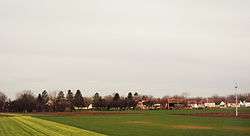
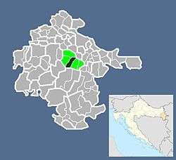
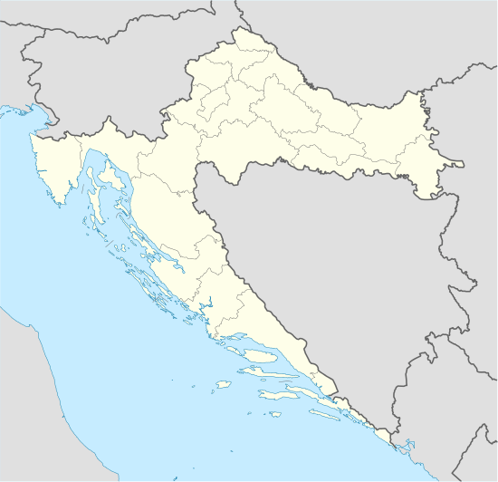
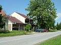
Srijemske Laze (Serbian Cyrillic: Сремске Лазе) is a village in Stari Jankovci municipality, Vukovar-Syrmia County, Croatia. According to 2011 census there is 566 residents.[2] The majority ethnic group in village are Serbs. Village is connected by the D46 highway.
Geography
Southern edge of administrative area of village bordering Bosut river. North of the river is oak forest and after forest there are large agricultural fields. Between village itself and the southern part of administrative area village lying Zagreb–Belgrade railway. Through the village passing D46 highway. At the eastern end, village is physically connected to the neighboring village Slakovci. The village is part of Pannonian sub-region of Syrmia. The area of village is completely flat, gently sloped from slightly higher north to lower south. Word Srijemske in village name comes from Eastern Herzegovinian, Shtokavian dialect of Serbo-Croatian language word for region of Syrmia.
History
Middle Ages
In the Middle Ages modern village area were populated by Catholic population.[3] Name of place that than existed was Laz.[3] Origin of old village name comes from Croat word laz, which means the low gentle hill that man can easily exceed walking.[3] Catholic village Laz which was just south of the present day village, was abandoned under the influence of Ottoman Empire in the 17th century.[3]
Resettlement
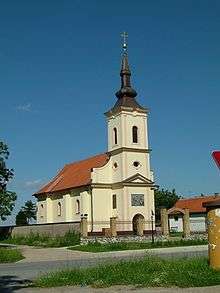
Since after the Ottoman Empire village remained deserted and empty, Austrian Empire in early 18th century inhabited village with Serbs mostly from eastern Bosnia (from Bijeljina and Zvornik) and southwestern Hungary.[3] In 1719 locals built a wooden church of All saint Arhistratiz's, which on 18 June 1752 was consecrated by episkopos Partenije.[3] In that period under the parish belonged also Orthodox families from neighboring village Jankovci until in new village wasn't built Orthodox church.[3]
Administrative Changes till the collapse of Austro-Hungaria
In 1701 village administratively became part of Military Frontier.[3] In 1716 village become part of Vukovar Seigniory in Kingdom of Slavonia.[3] In 1745 during the final delimitation between Vukovar Seigniory and Military Frontier village again become part of Military Frontier. In 1848 and 1849 village was part of short-lived self-proclaimed Serbian autonomous region Serbian Vojvodina. Village stay part of Military Frontier until 1881 and unification of Croatian and Slavonian Military Frontier into Kingdom of Croatia-Slavonia.[3] When in 1873 Military Frontier was demilitarized village become part of Mirkovci municipality and then village name got geographical prefix Srijemske so that it can be distinguished from other four villages in Kingdom of Croatia-Slavonia with that name.[3]
Kingdom of Yugoslavia
At the end of the First World War Srijemske Laze become part of short-lived unrecognized State of Slovenes, Croats and Serbs that joined the Kingdom of Serbia to form the Kingdom of Serbs, Croats and Slovenes that will later change its name into Kingdom of Yugoslavia. In that period wider region was shortly part of Drina Banovina with capital in Sarajevo, but than become part of Sava Banovina that letter become part of autonomous Banovina of Croatia. Narrower region was part of the Syrmia County till 1924 and then Syrmia Oblast.
World War II
During World War II village was part of Nazzi puppet Independent State of Croatia and Vuka county within it. In 1941 in village lived about 900 inhabitants, out of which during the World War II 300 took part in Yugoslav Partisans and 150 were killed. During the war village was permanent safe place for partisans that because of that call it Little Moscow.[1] At that time in village was created two days of remembrance and celebration of that period. These were Socialist Slava (22 August) and Day of the Dead (14 October).[1] Socialist Slava was created in memory of year 1943, when about 120 people went to partisans, and Day of the Dead commemorate the 56 villagers killed on 14 October 1944 when Ustaše launched a punitive expedition aimed at the destruction of partisan nests.[1]
War in Croatia and peaceful reintegration
During the war in Croatia Srijemske Laze was within self-proclaimed Serb political entity SAO Eastern Slavonia, Baranja and Western Syrmia. In the final stages of conflict United Nations Mission conducted peaceful reintegration of this region into Croatian jurisdiction. Population in Srijemske Laze decreased from 1991 till 2001 for 29.4%.[3]
Politics
In Srijemske Laze there are local committees of Independent Democratic Serb Party and New Serbian Party.[3]
Culture
Every year on the Orthodox Christmas Eve (January 6), residents in the churchyard have a bonfire for "Badnjak", the Serbian word for Christmas Eve. In this occasion locals take oak trees from the area and make a ritual fire.
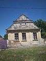
Education
Branch school of Elementary school Stari Jankovci is located in Srijemske Laze. Education at local school is implemented in Serbian language.[4]
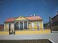
Gallery
See also
References
- 1 2 3 4 Milutin Bekić, Održavanje, uređivanje i korištenje spomenika revolucije u nastavnoj praksi male područne škole. U zborniku: skupina autora, Mala područna škola, Školske novine i Zavod za prosvjetno-pedagošku službu SRH, Zagreb, 1981., str 45. – 48.
- 1 2 http://www.dzs.hr/Hrv/censuses/census2011/htm/H11_Zup26_4146.html
- 1 2 3 4 5 6 7 8 9 10 11 12 13 "Općina Jankovci-Naselja Općine Jankovci:Srijemske Laze". Retrieved 2013-06-29.
- ↑ Popis osnovnih i srednjih škola s nastavom na jeziku i pismu nacionalnih manjina po modelu A, školska godina 2011./2012., Ministarstvo znanosti obrazovanja i sporta
Coordinates: 45°14′N 18°56′E / 45.233°N 18.933°E