Stampetta Bridge
| Stampetta Bridge Štampetov most | |
|---|---|
 | |
| Carries | Ljubljana–Sežana Railroad |
| Locale | Vrhnika, Slovenia |
| Characteristics | |
| Total length | 100.6 m (330 ft)[1] |
| History | |
| Construction end | 1856[1] |
The Stampetta Bridge (Slovene: Štampetov most, German: Stampetta-Viaduct[2][3]) is a railroad viaduct south of Vrhnika, Slovenia. It is named after the engineer that built it.[4][5]
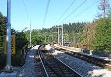
The Stampetta Bridge is originally a brick and stone structure that was built in 1856 as part of the Austrian Southern Railway.[1] During the Second World War, the bridge was badly damaged.[4] It was first damaged in 1941, but repaired by Italian forces.[1] Sabotage attacks were later carried out by Partisan forces in October 1943, June 1944, and September 1944 in order to disrupt German supply lines.[1] The bridge was repaired from 1945 to 1946.[1]
During the Yugoslav era, the Railway Workers Hiking Club (Planinsko društvo Železničar) of Ljubljana held an annual walk across the Stampetta Bridge.[6][7] Today the bridge also spans the A1 Freeway, where it is categorized as a 14.5 m (48 ft) tunnel.[8] During construction of the freeway, part of the bridge was altered;[4] an additional two arches were added to the original seven arches.[1]
References
- 1 2 3 4 5 6 7 Klanjšček, Zdravko. 1999. "Štampetov most." Enciklopedija Slovenije, vol. 13. Ljubljana: Mladinska knjiga, p. 135.
- ↑ von Stein, Lorenz. 1891. "Zeitschrift für Eisenbahnen und Dampfschiffahrt der österreichische-ungarischen Monarchie", vol. 4. Vienna: A. Hartleben, p. 810.
- ↑ Laibacher Zeitung. 1891. 110(235) (15 October): 1959.
- 1 2 3 Slovenian Ministry of Culture register of national heritage reference number ešd 9543
- ↑ Oblak, Nataša. 2003. "Veliki ljudje v malem kraju." Vrhniški razgledi 4: 25–75, p. 75. (Slovene)
- ↑ "Tudi letos se dobimo na Zaloški." 1986. Dogovori 13(5): 1. (Slovene)
- ↑ "Spominski pohod 40-letnice." Naša komuna 17(6): 8. (Slovene)
- ↑ Seznam predorov na avtocestah in hitrih cestah ter njihove dejanske dolžine. (List of Freeway and Expressway Tunnels and Their Actual Lengths). (Slovene)
External links
 Media related to Stampetta Bridge at Wikimedia Commons
- Stampetta Bridge at Geopedia
| Settlements | 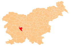 | |
|---|---|---|
| Landmarks |
| |
| Notable people |
| |
Coordinates: 45°56′26.74″N 14°16′37.45″E / 45.9407611°N 14.2770694°E