Jamnik, Vrhnika
| Jamnik | |
|---|---|
 Jamnik Location in Slovenia | |
| Coordinates: 45°58′49.09″N 14°14′27.53″E / 45.9803028°N 14.2409806°ECoordinates: 45°58′49.09″N 14°14′27.53″E / 45.9803028°N 14.2409806°E | |
| Country |
|
| Traditional region | Inner Carniola |
| Statistical region | Central Slovenia |
| Municipality | Vrhnika |
| Area | |
| • Total | 0.52 km2 (0.20 sq mi) |
| Elevation | 631 m (2,070 ft) |
| [1] | |
Jamnik (pronounced [ˈjaːmnik]) is a small settlement in the hills west of Vrhnika in the Inner Carniola region of Slovenia.[2]
History
Jamnik became a separate settlement in 2002, when its territory was administratively separated from Zaplana.[3]
References
External links
| Settlements | 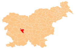 | |
|---|---|---|
| Landmarks |
| |
| Notable people |
| |
This article is issued from Wikipedia - version of the 11/5/2016. The text is available under the Creative Commons Attribution/Share Alike but additional terms may apply for the media files.