Stange
| Stange kommune | |||
|---|---|---|---|
| Municipality | |||
 | |||
| |||
 Stange within Hedmark | |||
| Coordinates: 60°38′58″N 11°21′59″E / 60.64944°N 11.36639°ECoordinates: 60°38′58″N 11°21′59″E / 60.64944°N 11.36639°E | |||
| Country | Norway | ||
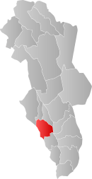
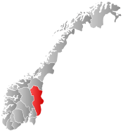
| County | Hedmark | ||
| District | Hedmarken | ||
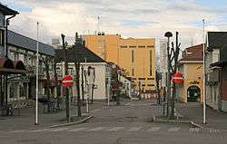
| Administrative centre | Stangebyen | ||
| Government | |||
| • Mayor (2007) | Nils A. Røhne (Ap) | ||
| Area | |||
| • Total | 724 km2 (280 sq mi) | ||
| • Land | 641 km2 (247 sq mi) | ||
| Area rank | 151 in Norway | ||
| Population (2004) | |||
| • Total | 18,288 | ||
| • Rank | 53 in Norway | ||
| • Density | 29/km2 (80/sq mi) | ||
| • Change (10 years) | 1.8 % | ||
| Demonym(s) | Stangesokning[1] | ||
| Time zone | CET (UTC+1) | ||
| • Summer (DST) | CEST (UTC+2) | ||
| ISO 3166 code | NO-0417 | ||
| Official language form | Bokmål | ||
| Website |
www | ||
|
| |||

![]() Stange is a municipality in Hedmark county, Norway. It is part of the traditional region of Hedmarken. The administrative centre of the municipality is the village of Stangebyen.
Stange is a municipality in Hedmark county, Norway. It is part of the traditional region of Hedmarken. The administrative centre of the municipality is the village of Stangebyen.


General information
Name
The municipality (originally the parish) is named after the old Stange farm (Old Norse: Stangir), since the first church was built there. The name is the plural form of stǫng which means "bar, pole, rod". (The farm is lying on a long hill, and this is probably the background for the name.)
Coat-of-arms
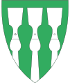
The coat-of-arms is from modern times. They were granted on 20 June 1986. The arms show a silver-colored medieval plough called an ard on a green background. It symbolizes this historic importance of agriculture in the area; originally the growing of grains and then later growing potatoes. The arms were designed by Arne Løvstad.[2][3]
History
Archeological finds indicate agricultural settlements in the area well before the Viking Age. Since the shortest route from the south to Hamar went through the area, there have also been trade and hospitality there since time immemorial. Stange has its own historical association that publishes articles, short research topics, as well as authoritative works on the area's history.
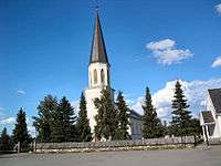
Stange church is located here and it is one of the oldest medieval churches in Norway. It is mentioned in 1225 in Håkon Håkonsen's saga.
The municipality of Stange was established on 1 January 1838 (see formannskapsdistrikt). The neighboring municipality of Romedal was merged with Stange on 1 January 1964.
Geography
The municipality is situated on the east side of the lake Mjøsa. It borders the municipalities of Hamar on the north; Løten, Våler, and Åsnes to the east; Nord-Odal to the south; and Eidsvoll to the west.
Stange consists of several areas that were previously distinct, including Vallset, Romedal, Espa, Åsbygda, Tangen, and Stange itself. The municipality can be roughly divided into two areas: the northern area, with rich and fertile agricultural land; and a southern area with craggy, forested area (the Stange Commons). As a result, the northern section is dominated by large, prosperous farms; the southern part by small, marginal farms.
Sister cities
The following cities are twinned with Stange:[4]
-
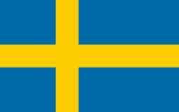 - Botkyrka, Stockholm County, Sweden
 -
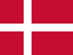 - Brøndby, Region Hovedstaden, Denmark
 -
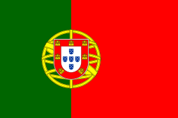 - Montalegre, Região Norte, Portugal
References
- ↑ "Navn på steder og personer: Innbyggjarnamn" (in Norwegian). Språkrådet. Retrieved 2015-12-01.
- ↑ Norske Kommunevåpen (1990). "Nye kommunevåbener i Norden". Retrieved 2008-12-29.
- ↑ "Beskrivelse av Stanges kommunevåpen" (in Norwegian). Stange kommune. Retrieved 2008-12-29.
- ↑ "Vennskapskommuner" (in Norwegian). Stange kommune. Retrieved 2008-12-29.
External links
| Wikimedia Commons has media related to Stange. |
| Look up Stange in Wiktionary, the free dictionary. |
- Municipal fact sheet from Statistics Norway
- Municipal website (Norwegian)