Ohio State Route 357
| ||||
|---|---|---|---|---|
|
A red line indicating the path of SR 357 | ||||
| Route information | ||||
| Maintained by ODOT | ||||
| Length: | 2.35 mi[1] (3.79 km) | |||
| Existed: | 1934[2][3] – present | |||
| Major junctions | ||||
| South end: | West Shore Boulevard near Put-in-Bay | |||
| North end: | Dead end near Lake Erie | |||
| Location | ||||
| Counties: | Ottawa | |||
| Highway system | ||||
| ||||


State Route 357 (SR 357) is a 2.353-mile-long (3.787 km) north–south state highway in the northern portion of U.S. state of Ohio. Existing entirely on South Bass Island in Lake Erie, the highway begins at its southern terminus of West Shore Boulevard, about 0.75 miles (1.21 km) west of Put-in-Bay. SR 357 then travels northeast to its northern terminus at a dead end at Lake Erie, approximately 2 miles (3.2 km) east of Put-in-Bay.
SR 357 is one of two Ohio state routes on Lake Erie islands. Though this two-lane route travels predominantly east–west, it once extended to the mainland of Ohio via the Catawba Island ferry, which is why it carries a north–south routing.
Route description
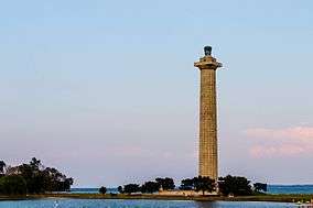
The entirety of SR 357 exists within the confines of South Bass Island in Lake Erie. It is located within Put-in-Bay Township in Ottawa County. In 2012, between 490 and 590 vehicles travel on the road on average each day.[4] SR 357 begins at West Shore Boulevard, and travels southwestward. The route passes by Oak Point State Park, and becomes part of Bayview Avenue.[5] SR 357 then intersects County Route 163, which leads to the Put-in-Bay Airport, and the Put-in-Bay–Catawba Island ferry. The route later leaves Put-in-Bay, near Perry's Victory and International Peace Memorial.[6] SR 357 turns northeast to Columbus Avenue, and later ends at a dead end near the lake, next to a driveway.[1][7]
History
The SR 357 designation was created in 1934. At the time, the highway was routed along the entirety of its present alignment on South Bass Island.[2][3] However, in 1946, when SR 53 was extended northerly from Port Clinton to end at its present northern terminus in Catawba Island, SR 357 was simultaneously extended south onto the mainland via the ferry that connects Put-in-Bay with Catawba Island, then south along SR 53 to a new southern terminus at SR 2 east of Port Clinton.[8][9] By 1969, all of the 1946 extension of SR 357 was eliminated, with the Put-in-Bay–Catawba Island ferry becoming a connector between the southern end of SR 357 and the northern endpoint of SR 53, and the mainland portion of SR 357 becoming just SR 53.[10][11] By 1973, the Put-in-Bay–Catawba Island ferry docked on the south side of South Bass Island, ending the direct access to ferry docks and the rest of the state highway system from SR 357.[12]
Major intersections
The entire route is in Ottawa County.
| Location | mi[1] | km | Destinations | Notes | |
|---|---|---|---|---|---|
| Portage Township | Southern terminus from 1946–1969 | ||||
| Catawba Island Township | Former concurrency terminus | ||||
| Lake Erie | Put-in-Bay–Catawba Island ferry | ||||
| Put-in-Bay Township | 0.00 | 0.00 | TR 270 (West Shore Boulevard) | Southern terminus | |
| Put-in-Bay | 1.018 | 1.638 | |||
| Put-in-Bay Township | 2.353 | 3.787 | Lake Erie | Northern terminus at a dead end | |
1.000 mi = 1.609 km; 1.000 km = 0.621 mi
| |||||
See also
References
- 1 2 3 Ohio Department of Transportation. "Technical Services DESTAPE" (PDF). Retrieved 2013-12-21.
- 1 2 Map of Ohio Showing State Highway System (MrSID) (Map). Cartography by ODOH. Ohio Department of Highways. 1933. § H3. Retrieved 2011-07-31.
- 1 2 Map of Ohio Showing State Highway System (MrSID) (Map). Cartography by ODOH. Ohio Department of Highways. 1934. § H3. Retrieved 2011-07-31.
- ↑ "Technical Services Traffic Counts" (PDF). Ohio Department of Transportation. 2012. Retrieved 2013-12-21.
- ↑ "Oak Point State Park". Ohio Department of Natural Resources. Retrieved 2013-12-11.
- ↑ "Perry's Victory & International Peace Memorial". National Park Service. Retrieved 2013-12-10.
- ↑ Google (2013-12-08). "Ohio State Route 357" (Map). Google Maps. Google. Retrieved 2013-12-08.
- ↑ Ohio Highway Map (MrSID) (Map). Cartography by ODOH. Ohio Department of Highways. 1945. § H3. Retrieved 2011-07-31.
- ↑ Ohio Highway Map (MrSID) (Map). Cartography by ODOH. Ohio Department of Highways. 1946. § H3-4. Retrieved 2011-07-31.
- ↑ Official Ohio Highway Map (MrSID) (Map). Cartography by ODOH. Ohio Department of Highways. 1969. § H3. Retrieved 2011-07-31.
- ↑ Official Ohio Highway Map (MrSID) (Map). Cartography by ODOH. Ohio Department of Highways. 1971. § H3. Retrieved 2011-07-31.
- ↑ Official Ohio Highway Map (MrSID) (Map). Cartography by ODOT. Ohio Department of Transportation. 1973. § H3. Retrieved 2013-08-28.