Staufenberg, Lower Saxony
| Staufenberg | ||
|---|---|---|
| ||
 Staufenberg | ||
Location of Staufenberg within Göttingen district 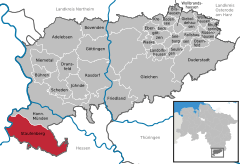
 | ||
| Coordinates: 51°21′00″N 09°35′59″E / 51.35000°N 9.59972°ECoordinates: 51°21′00″N 09°35′59″E / 51.35000°N 9.59972°E | ||
| Country | Germany | |
| State | Lower Saxony | |
| District | Göttingen | |
| Government | ||
| • Mayor | Volker Zimmermann | |
| Area | ||
| • Total | 77.55 km2 (29.94 sq mi) | |
| Population (2015-12-31)[1] | ||
| • Total | 7,800 | |
| • Density | 100/km2 (260/sq mi) | |
| Time zone | CET/CEST (UTC+1/+2) | |
| Postal codes | 34355 | |
| Dialling codes | 05543 | |
| Vehicle registration | GÖ | |
| Website | www.staufenberg-nds.de | |

Staufenberg is the southernmost municipality of the district of Göttingen, and of Lower Saxony, Germany. It is situated east of the river Fulda, approx. 6 km south of Hannoversch Münden, and 12 km northeast of Kassel. Its seat is in the village Landwehrhagen.
Points of interest
References
This article is issued from Wikipedia - version of the 6/21/2015. The text is available under the Creative Commons Attribution/Share Alike but additional terms may apply for the media files.