Stone Head, Indiana
| Stone Head | |
|---|---|
| Unincorporated community | |
|
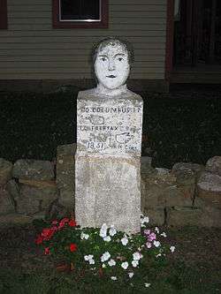
The namesake stone head | |
 Brown County's location in Indiana | |
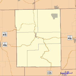
 Stone Head Location in Brown County | |
| Coordinates: 39°07′48″N 86°09′32″W / 39.13000°N 86.15889°WCoordinates: 39°07′48″N 86°09′32″W / 39.13000°N 86.15889°W | |
| Country | United States |
| State | Indiana |
| County | Brown |
| Township | Van Buren |
| Elevation[1] | 581 ft (177 m) |
| ZIP code | 47201 |
| FIPS code | 18-73448[2] |
| GNIS feature ID | 444206 |
Stone Head is an unincorporated community in Van Buren Township, Brown County, Indiana.
History
Stone Head was named after the historic 1851 mile marker sculpture in the shape of a head.[3] Stone Head contained a post office from 1890 until 1891.[4]
Kissing the stone head is said to bring good luck.[5]
The Thomas A. Hendricks House and Stone Head Road Marker was listed on the National Register of Historic Places in 1984.[6]
Geography
Stone Head is located at 39°07′48″N 86°09′32″W / 39.13000°N 86.15889°W.
References
- ↑ "US Board on Geographic Names". United States Geological Survey. 2007-10-25. Retrieved 2008-01-31.
- ↑ "American FactFinder". United States Census Bureau. Retrieved 2008-01-31.
- ↑ Wissing, Douglas (2001). Indiana. Globe Pequot Press. p. 60. ISBN 978-1-56044-906-5.
- ↑ "Brown County". Jim Forte Postal History. Retrieved 28 August 2014.
- ↑ Wolfsie, Dick (10 November 2009). Indiana Curiosities, 3rd: Quirky characters, roadside oddities & other offbeat stuff. Rowman & Littlefield. p. 197. ISBN 978-0-7627-6161-6.
- ↑ National Park Service (2010-07-09). "National Register Information System". National Register of Historic Places. National Park Service.
This article is issued from Wikipedia - version of the 10/26/2016. The text is available under the Creative Commons Attribution/Share Alike but additional terms may apply for the media files.
