Summerlin Parkway
| Summerlin Parkway | |
|---|---|
| Route information | |
| Maintained by the City of Las Vegas | |
| Length: | 6 mi[1] (10 km) |
| Existed: | 1989 – present |
| Major junctions | |
| West end: |
|
| East end: |
|
| Highway system | |
| |
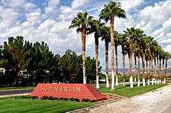
Summerlin Parkway is a freeway in the western portion of the City of Las Vegas, Nevada, connecting U.S. Route 95 (US 95) to Clark County Route 215 (CC 215). Summerlin Parkway serves the master planned community of Summerlin.
Route description
Summerlin Parkway begins at its junction with the Las Vegas Beltway (CC 215). The road quickly becomes a divided highway with two lanes in each direction as it heads east from the intersection. At Anasazi Drive, Summerlin Parkway becomes a full freeway and maintains this status as it heads eastward through Summerlin and Las Vegas. The freeway terminates at the interchange with Rainbow Boulevard (SR 595) and US 95, locally known as the "Rainbow Curve" interchange.
History
Summerlin Parkway was initially constructed by the developers of Summerlin through the Summerlin Homeowners Association. The first construction along the parkway consisted of rebuilding the US 95 interchange and constructing the divided highway west to Town Center Drive. Later projects funded by the Regional Transportation Commission of Southern Nevada brought freeway interchanges to Buffalo Drive in 1992 and Rampart Boulevard in 1994.[2]
By 2000, Summerlin Parkway was built up to expressway standards to a western end at Anasazi Drive, and by 2004 the expressway terminated at the Las Vegas Beltway.[3] A half-interchange was added at Durango Drive by 2005, and the Anasazi Drive intersection was converted to an interchange by 2006.[2] Also in 2005, the Nevada Department of Transportation had reconstructed the US 95/Rainbow Boulevard interchange as part of its US 95 widening project (including a new direct connection from eastbound Summerlin Parkway to US 95 north which was not constructed in 1989).[3]
In 2016, the City of Las Vegas installed a median cable barrier system in the median of Summerlin Parkway. The $2 million project was designed to reduce impacts from drivers losing control of vehicles into the landscaped median and prevent crossover collisions.[4]
Exit list
The entire route is in Las Vegas, Clark County. All exits are unnumbered.
| mi | km | Destinations | Notes | ||
|---|---|---|---|---|---|
| At-grade intersection; CC 215 exit 28; western end of Summerlin Parkway | |||||
| Anasazi Drive | |||||
| Town Center Drive | |||||
| Rampart Boulevard | |||||
| Durango Drive | Westbound exit and eastbound entrance | ||||
| Buffalo Drive | Not accessible from westbound HOV lane | ||||
| Rainbow Boulevard (SR 595) | Eastbound exit only | ||||
| Eastbound exit and westbound entrance; US 95 exit 81; eastern end of Summerlin Parkway | |||||
| 1.000 mi = 1.609 km; 1.000 km = 0.621 mi | |||||
Future
The City of Las Vegas and the Regional Transportation Commission of Southern Nevada are currently proposing to improve Summerlin Parkway. Some of the proposed improvements include adding one additional lane, adding a new managed lane in each direction, adding auxiliary lanes and aesthetics improvements along the entire parkway. No timetable for these improvements has been established.[5]
An HOV flyover has been constructed in order to facilitate HOV movements between Summerlin Parkway and US 95 heading to and from downtown. The direct connection ramps opened in July 2012, even though Summerlin Parkway does not yet have HOV lanes.
See also
-
 Nevada portal
 -
 U.S. Roads portal
References
- ↑ "Summerlin Parkway project study area". Archived from the original on January 12, 2008.
- 1 2 "Summerlin Parkway project history". Archived from the original on March 13, 2011.
- 1 2 "Summerlin Parkway". AARoads. 2005-10-16. Retrieved 2013-01-30.
- ↑ Marroquin, Art (November 6, 2016). "New cable barriers spring into action on Summerlin Parkway median". Las Vegas Review-Journal. Retrieved November 12, 2016.
- ↑ "Summerlin Parkway project overview". Archived from the original on March 14, 2011.
External links
- "Summerlin Parkway project information site". Archived from the original on January 28, 2011.
- Summerlin Parkway at AARoads.com