Tonopah, Nevada
| Tonopah, Nevada | |
|---|---|
| CDP | |
|
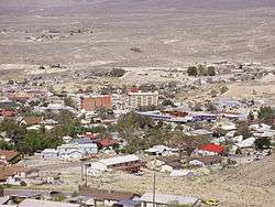
View of central Tonopah from the south | |
| Nickname(s): Queen of the Silver Camps[1] | |
| Motto: Visit Today & Mine Away | |
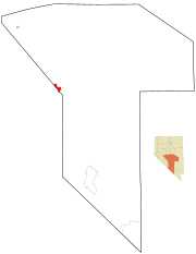 Tonopah, Nevada, is located in the Tonopah Basin near the Nye County border. | |
 Tonopah, Nevada Location in the United States | |
| Coordinates: 38°4′2″N 117°13′48″W / 38.06722°N 117.23000°WCoordinates: 38°4′2″N 117°13′48″W / 38.06722°N 117.23000°W[2] | |
| Country | United States |
| State | Nevada |
| Government | |
| • Senate | Mike McGinness (R) |
| • Assembly | James Oscarson (R) |
| • U.S. Congress | Mark Amodei (R) |
| Area | |
| • Total | 16.2 sq mi (42.0 km2) |
| • Land | 16.2 sq mi (42.0 km2) |
| • Water | 0.0 sq mi (0.0 km2) |
| Elevation | 6,047 ft (1,843 m) |
| Population (2010) | |
| • Total | 2,478 |
| • Density | 162.1/sq mi (62.6/km2) |
| Time zone | Pacific (PST) (UTC-8) |
| • Summer (DST) | PDT (UTC-7) |
| ZIP code | 89049 |
| Area code(s) | 775 |
| FIPS code | 32-73600 |
| GNIS feature ID | 0845985 |
| Website | http://www.tonopahnevada.com/ |
Nevada Historical Marker | |
| Reference no. | 15 |
Tonopah is a census-designated place (CDP) in and the county seat of Nye County, Nevada, United States.[3] It is located at the junction of U.S. Routes 6 and 95, approximately midway between Las Vegas and Reno. In the 2010 census, the population was 2,478. The CDP has a total area of 16.2 square miles (42 km2), all land.
History
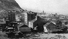
The European-American community began circa 1900 with the discovery of gold and silver-rich ore by prospector Jim Butler. The legendary tale of discovery says that he went looking for a burro that had wandered off during the night and sought shelter near a rock outcropping. When Butler discovered the animal the next morning, he picked up a rock to throw at it in frustration, noticing that the rock was unusually heavy. He had stumbled upon the second-richest silver strike in Nevada history.
Men of wealth and power entered the region to consolidate the mines and reinvest their profits into the infrastructure of the town of Tonopah. George Wingfield, a 24-year-old poker player when he arrived in Tonopah, played poker and dealt faro in the town saloons. Once he had a small bankroll, he talked Jack Carey, owner of the Tonopah Club, into taking him in as a partner and to file for a gaming license. In 1903, miners rioted against Chinese workers in Tonopah. This resulted in China enforcing a boycott in China of U.S. goods.
By 1904, after investing his winnings in the Boston-Tonopah Mining Company, Wingfield was worth $2 million. When old friend George S. Nixon, a banker, arrived in town, Wingfield invested in his Nye County Bank. They grub-staked miners with friend Nick Abelman, and bought existing mines. By the time the partners moved to Goldfield, Nevada and made their Goldfield Consolidated Mining Company a public corporation in 1906, Nixon and Wingfield were worth more than $30 million.[4]
Wingfield believed that the end of the gold and silver mining production was coming and took his bankroll to Reno, where he invested heavily in real estate and casinos. Real estate and gaming became big business throughout Central Nevada. By 1910, gold production was falling and by 1920, the town of Tonopah had less than half the population it had fifteen years earlier.
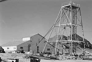
Small mining ventures continued to provide income for local miners and the small town struggled on. Located about halfway between Reno and Las Vegas, it has supported travelers as a stopover and rest spot on a lonely highway. Today the Tonopah Station has slots and the Banc Club also offers some gaming.
Also in Nye County is the Yomba Band of the Yomba Indian Reservation, a federally recognized band of Western Shoshone people. The Western Shoshone dominated most of Nevada at the time of European-American settlement in the 1860s.
Since the late 20th century, Tonopah has relied on the nearby military Tonopah Test Range as its main source of employment. The military has used the range and surrounding areas as a nuclear bomb test site, a bombing range, and as a base of operations for the development of the F-117 Nighthawk.
In the fall of 2011, a California-based solar energy company, SolarReserve, started construction on $980 million advanced solar energy project just outside town called the Crescent Dunes Solar Energy Project. The project incorporates SolarReserve's advanced solar energy storage technology and will put Tonopah at the worldwide center of technology for this class of solar energy storage. The project construction activities, which peaks at 800 workers on site, was scheduled to be completed in 2014.
Etymology and pronunciation
Founder, Jim Butler named the settlement, from what is thought to be a Shoshone language word, pronounced "TOE-nuh-pah."[5] Although the town previously had a variety of names, including Butler City, Jim Butler's name has survived. According to local history, the name is said to mean "hidden spring".[6]
Linguistically the name derives from either Shoshone to-nuv (greasewood), or Northern Paiute to-nav (greasewood), and pa, meaning water in both dialects.[7]
Climate
Tonopah has an arid, cold desert climate with cool winters and hot summers. Due to Tonopah’s aridity and high altitude, daily temperature ranges are quite large. Nights are cool, even in summer.
There are an average of 50.3 afternoons with highs at or above 90 °F or 32.2 °C, 157.8 mornings with lows of 32 °F (0 °C) or lower, 7.6 afternoons where the high does not top freezing and 1.7 mornings with lows below 0 °F or −17.8 °C. The record high temperature in Tonopah was 104 °F (40 °C) on July 18, 1960, and the record low −15 °F (−26.1 °C) on January 24, 1937 and January 23, 1962.
There are an average of 38 days with measurable precipitation. The wettest calendar year was 1946 with 10.27 in (261 mm) and the driest 1927 with 1.92 in (49 mm). The most precipitation in one month was 2.87 inches (72.9 mm) in November 1946. The most precipitation in 24 hours was 1.62 inches (41.1 mm) on August 17, 1977. Average annual snowfall is 16.8 inches or 0.43 metres, though even in winter the median snow depth is zero and the maximum recorded only 13 inches or 0.33 metres on February 11, 1968. The most snowfall in one year was 79.3 inches (2.01 m) from July 1946 to June 1947, including 37.0 inches or 0.94 metres in November 1946.[8]
| Climate data for Tonopah Airport, Nevada (1981–2010 normals) | |||||||||||||
|---|---|---|---|---|---|---|---|---|---|---|---|---|---|
| Month | Jan | Feb | Mar | Apr | May | Jun | Jul | Aug | Sep | Oct | Nov | Dec | Year |
| Record high °F (°C) | 67 (19) |
75 (24) |
79 (26) |
88 (31) |
96 (36) |
103 (39) |
104 (40) |
103 (39) |
96 (36) |
90 (32) |
91 (33) |
70 (21) |
104 (40) |
| Average high °F (°C) | 44.8 (7.1) |
49.2 (9.6) |
56.8 (13.8) |
64.4 (18) |
74.4 (23.6) |
84.8 (29.3) |
91.9 (33.3) |
89.7 (32.1) |
80.8 (27.1) |
68.1 (20.1) |
53.8 (12.1) |
44.3 (6.8) |
66.9 (19.4) |
| Average low °F (°C) | 20.3 (−6.5) |
24.3 (−4.3) |
29.0 (−1.7) |
34.6 (1.4) |
43.2 (6.2) |
51.5 (10.8) |
57.5 (14.2) |
55.4 (13) |
48.1 (8.9) |
37.5 (3.1) |
26.5 (−3.1) |
19.4 (−7) |
37.3 (2.9) |
| Record low °F (°C) | −15 (−26) |
−9 (−23) |
4 (−16) |
9 (−13) |
19 (−7) |
27 (−3) |
40 (4) |
37 (3) |
24 (−4) |
13 (−11) |
4 (−16) |
−13 (−25) |
−15 (−26) |
| Average precipitation inches (mm) | 0.49 (12.4) |
0.48 (12.2) |
0.57 (14.5) |
0.40 (10.2) |
0.53 (13.5) |
0.28 (7.1) |
0.47 (11.9) |
0.51 (13) |
0.33 (8.4) |
0.34 (8.6) |
0.44 (11.2) |
0.30 (7.6) |
5.14 (130.6) |
| Average snowfall inches (cm) | 4.4 (11.2) |
2.7 (6.9) |
3.0 (7.6) |
1.4 (3.6) |
.5 (1.3) |
0 (0) |
0 (0) |
0 (0) |
0 (0) |
.2 (0.5) |
2.2 (5.6) |
2.4 (6.1) |
16.8 (42.8) |
| Average precipitation days (≥ 0.01 in) | 4.1 | 4.4 | 4.3 | 3.4 | 3.4 | 2.3 | 3.1 | 2.9 | 2.7 | 2.2 | 2.5 | 3.3 | 38.6 |
| Average snowy days (≥ 0.1 in) | 2.6 | 2.4 | 1.9 | 1.2 | .4 | 0 | 0 | 0 | .1 | .3 | 1.3 | 2.1 | 12.3 |
| Source: NOAA (extremes 1954–present),[9] WRCC[10] | |||||||||||||
Demographics
As of the census[11] of 2000, there were 2,627 people, 1,109 households, and 672 families residing in the CDP. The population density was 162.1 people per square mile (2.59/km²). There were 1,561 housing units at an average density of 96.3 per square mile (37.2/km²). The racial makeup of the CDP was 91.24% White, 1.41% Native American, 0.76% African American, 0.42% Asian, 0.30% Pacific Islander, 2.82% from other races, and 3.05% from two or more races. Hispanic or Latino of any race were 6.17% of the population.
There were 1,109 households out of which 32.2% had children under the age of 18 living with them, 48.9% were married couples living together, 7.5% had a female householder with no husband present, and 39.4% were non-families. 34.2% of all households were made up of individuals and 10.1% had someone living alone who was 65 years of age or older. The average household size was 2.33 and the average family size was 3.03.
In the CDP the population was spread out with 27.1% under the age of 18, 6.2% from 18 to 24, 29.3% from 25 to 44, 27.3% from 45 to 64, and 10.1% who were 65 years of age or older. The median age was 39 years. For every 100 females there were 108.3 males. For every 100 women age 18 and over, there were 105.9 men.
The median income for a household in the CDP was $37,401, and the median income for a family was $47,917. Males had a median income of $40,018 versus $22,056 for females. The per capita income for the CDP was $18,256. About 5.7% of families and 11.2% of the population were below the poverty line, including 7.3% of those under age 18 and 19.1% of those age 65 or over.
Transportation
During the silver bonanza of the first decade of the 20th century, the need in the precious-metal fields for freight service led to construction of a network of local railroad lines across the Nevada desert to Tonopah. Examples include the Las Vegas and Tonopah Railroad, the Tonopah and Goldfield Railroad, and the Tonopah and Tidewater Railroad. Coal was hauled to the silver mines to power mine operations and also the stamp mills built in and around Tonopah to break apart the hard-rock ore for milling and refining.
As the railroad lines were reduced with the decline of mining and restructuring of railroads in the late 20th century, 18-wheelers became the dominant method of moving freight. Tonopah took on a new identity as an extreme freight destination. The chorus of the song "Willin'" by Lowell George of Little Feat on the albums Little Feat, Sailin' Shoes, and Waiting for Columbus refers to either Tonopah, Arizona, or Tonopah, Nevada:
And I've been from Tucson to Tucumcari, Tehachapi to Tonopah.
I've driven every kind of rig that's ever been made;
driven the backroads so I wouldn't get weighed.
In the early 21st century, Tonopah is served by two U.S. Highways, Routes 6 and 95. There is no rail service. General aviation facilities are located at nearby Tonopah Airport. The nearest airport with scheduled passenger service is Mammoth Yosemite Airport, about 100 miles away. The nearest major airports are McCarran International Airport in Las Vegas, and Reno–Tahoe International Airport in Reno, each more than 200 miles away.
Notable people
- Hugh Bradner, physicist, and inventor of the neoprene wetsuit, which helped to revolutionize scuba diving.[12]
- T. Brian Callister, MD, physician and nationally known health care policy expert; practiced in Tonopah between 1991 and 1995.
- Thomas Joseph Connolly. Roman Catholic bishop of Baker
- Barbara Graham, the notorious Butcher of Burbank, California. One of four women to be executed in California.
- William Robert Johnson, Roman Catholic bishop of Orange
- Andriza Mircovich, only prisoner to be executed by shooting in Nevada.
- Tasker Oddie, 12th Governor of Nevada and a United States Senator; resident of Tonopah.[13]
- Stalking Cat, Body Modification Icon
- Claire Fahy, pioneering aviator, died here on 19 December 1930, after the airplane she was piloting crashed when the engine stalled on takeoff at 50 feet.
Places of interest
- Mizpah Hotel, with construction begun in 1905, shortly after the town of Tonopah was founded, and finished in late 1908, after several delays.[14] The Mizpah Hotel was once the tallest building in the state.
- Clown Motel is located next to a graveyard.
In popular culture
_in_Tonopah%2C_Nevada.jpg)
- Tonopah was the subject of an episode of Rhett & Link: Commercial Kings.[15] Rhett and Link developed a slogan for the town "Visit Tonopah, We're Different".[16]
- The television show Ghost Adventures has filmed multiple episodes in Tonopah, which is known for its haunted buildings, most notably the Mizpah Hotel. .
- The Clown Motel was featured on the Longmont Potion Castle Volume 9 track "Clown Motel".
References
- ↑ "Town of Tonopah Nevada - Queen of the Silver Camps". tonopahnevada.com. Retrieved 28 September 2015.
- ↑ "Tonopah". Geographic Names Information System. United States Geological Survey. Retrieved 2016-08-10.
- ↑ "Find a County". National Association of Counties. Archived from the original on 2011-05-31. Retrieved 2011-06-07.
- ↑ Moe, Al W. (2008). "The Roots of Reno". p. 20.
- ↑ Varney, P (1990). "Appendix C: pronunciation guide". Southern California's best ghost towns: a practical guide. Norman, Oklahoma: University of Oklahoma Press. p. 121. ISBN 0-8061-2608-6.
- ↑ "Town of Tonopah Nevada - Queen of the Silver Camps". tonopahnevada.com. Retrieved 28 September 2015.
- ↑ Carlson, Helen S. (1974). Nevada Place Names: A Geographical Dictionary. Reno, Nevada: University of Nevada Press. pp. 233, 234. ISBN 0-87417-094-X.
- ↑ http://www.wrcc.dri.edu/cgi-bin/cliMAIN.pl?nv8160; http://www.wrcc.dri.edu/cgi-bin/cliMAIN.pl?nv8170
- ↑ "NowData - NOAA Online Weather Data". National Oceanic and Atmospheric Administration. Retrieved 2013-07-19.
- ↑ "Seasonal Temperature and Precipitation Information". Western Regional Climate Center. Retrieved March 24, 2013.
- ↑ "American FactFinder". United States Census Bureau. Archived from the original on 2013-09-11. Retrieved 2008-01-31.
- ↑ Taylor, Michael (2008-05-11). "Hugh Bradner, UC's inventor of wetsuit, dies". San Francisco Chronicle. Retrieved 2013-09-01.
- ↑ "Nevada Governor Tasker Lowndes Oddie". National Governors Association. Retrieved October 4, 2012.
- ↑ "Notes from Tonopah, Nevada". Engineering and Mining Journal. New York: Hill Publishing Company. 86 (18): 871. 1908. Retrieved 1 October 2013.
- ↑ Henry Brean. "Ad puts quirky Tonopah on map". Las Vegas Review-Journal. Retrieved 28 September 2015.
- ↑ "Archived copy". Archived from the original on 2013-03-29. Retrieved 2013-01-22.
Further reading
- McCracken, Robert D., A History of Tonopah, Nevada, (1992), ISBN 1-878138-52-9
External links
| Wikimedia Commons has media related to Tonopah, Nevada. |
- June 2009 Photos of Tonopah and Goldfield, Nevada
- Official town website Retrieved 22 October 2009
- Tonopah photos and information at WesternMiningHistory.com Retrieved 22 October 2009
- Official State of Nevada Tourism site
- Photos of Mizpah mine at Historic American Engineering Record
- Official website of the Central Nevada Museum — located in Tonopah.