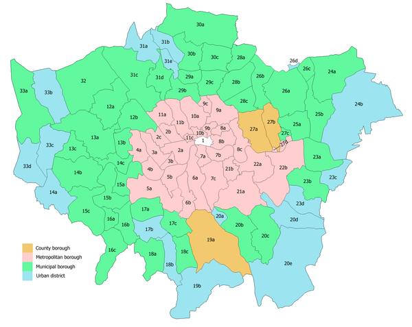
Municipal Borough of Surbiton
| Surbiton | |
|---|---|
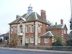 Surbiton Town Hall | |
| Area | |
| • 1894 | 3,046 acres (12.3 km2) |
| • 1965 | 4,710 acres (19.1 km2) |
| Population | |
| • 1901 | 15,017 |
| • 1961 | 62,977 |
| History | |
| • Created | 1855 |
| • Abolished | 1965 |
| • Succeeded by | Royal Borough of Kingston upon Thames |
| Status |
Improvement Commissioners District(1855 - 1894) Urban district (1894 - 1936) Municipal borough (after 1936) |
| • Motto |
Consilio Et Animis (By Wisdom and Courage) |
Surbiton was a local government district in northeast Surrey, United Kingdom from 1855 to 1965.
Creation
Until 1855 Surbiton was administered as part of the parish of Kingston upon Thames. In that year a body of improvement commissioners was formed by a local act of parliament to govern the area.[1]
Changes
The Local Government Act 1894 reconstituted the Improvement Commissioners District as an urban district, and Surbiton Urban District Council was formed to replace the commissioners.
The parishes of Hook and Tolworth were added from the short-lived Kingston Rural District in 1895 and Chessington was added in 1933, transferred from Epsom Rural District. In 1936 the town was granted a charter of incorporation to become a municipal borough.
Abolition
Surbiton formed part of the review area of the Royal Commission on Local Government in Greater London. The transfer to Greater London was supported by Surbiton Borough Council and opposed by Surrey County Council.[2] In 1965 it was abolished and its former area transferred to Greater London to be merged into an expanded Royal Borough of Kingston upon Thames.
The former town hall in Ewell Road still survives, with the winged lion from the crest of the borough's arms in the façade. The building is now used as a Sessions House, and is Grade II listed.[3]
Coat of arms
The borough's coat of arms was: Azure an elm tree proper in front of a sun ascendant or. The supporters were two stags proper, and the crest was a winged lion couchant above a bridge proper. The arms survives in a stained glass window of Surbiton's parish church of Saint Mark.[4]
References
- ↑ Kelly's Directory of Kent, Surrey & Sussex, 1891, p.1497 (Historical Directories), accessed February 5, 2008
- ↑ HC Deb 18 May 1962 vol 659 cc156-7W
- ↑ Historic England. "Sessions House (1358440)". National Heritage List for England. Retrieved 20 July 2016.
- ↑ "Stained glass - Coat of arms for Borough of Surbiton". Flickr. Retrieved 28 January 2015.
Local government districts abolished or transferred by the London Government Act 1963 | ||
|---|---|---|
| London | ||
| Essex | ||
| Hertfordshire | ||
| Middlesex, CC | ||
| Kent | ||
| Surrey | ||
| Transfers | Middlesex to Hertfordshire: Potters Bar
| |
Coordinates: 51°22′30″N 0°17′49″W / 51.375°N 0.297°W