Tacotalpa (municipality)
| Tacotalpa | |
|---|---|
| Municipality | |
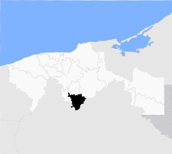 Location of the municipality in Tabasco. | |
| Country |
|
| State | Tabasco |
| Capital | Tacotalpa |
| Time zone | Central Standard Time (UTC-6) |
| • Summer (DST) | Central Daylight Time (UTC-5) |
Tacotalpa is a municipality in Tabasco in south-eastern Mexico.[1]
Climate
| Climate data for Tacotalpa | |||||||||||||
|---|---|---|---|---|---|---|---|---|---|---|---|---|---|
| Month | Jan | Feb | Mar | Apr | May | Jun | Jul | Aug | Sep | Oct | Nov | Dec | Year |
| Average high °C (°F) | 26.7 (80.1) |
28.1 (82.6) |
30.6 (87.1) |
33 (91.4) |
34.3 (93.7) |
33.4 (92.1) |
32.7 (90.9) |
32.7 (90.9) |
31.8 (89.2) |
30.2 (86.4) |
28.6 (83.5) |
27.4 (81.3) |
30.8 (87.4) |
| Average low °C (°F) | 17.4 (63.3) |
17.9 (64.2) |
19.5 (67.1) |
21.4 (70.5) |
22.5 (72.5) |
22.5 (72.5) |
21.9 (71.4) |
21.8 (71.2) |
21.9 (71.4) |
20.9 (69.6) |
19.4 (66.9) |
18.1 (64.6) |
20.4 (68.7) |
| Average precipitation mm (inches) | 201 (7.9) |
145 (5.7) |
100 (4) |
99 (3.9) |
145 (5.7) |
315 (12.4) |
284 (11.2) |
360 (14) |
485 (19.1) |
419 (16.5) |
246 (9.7) |
218 (8.6) |
3,018 (118.8) |
| Source: Weatherbase [2] | |||||||||||||
References
- ↑ "-". Enciclopedia de los Municipios de México. Instituto Nacional para el Federalismo y el Desarrollo Municipal. Retrieved January 4, 2010.
- ↑ "Weatherbase: Historical Weather for Tacotalpa, Tabasco". Weatherbase. 2011. Retrieved on November 24, 2011.
Villahermosa (capital) | ||
| Municipalities and (municipal seats) |
|  |
Coordinates: 17°36′N 92°49′W / 17.600°N 92.817°W
This article is issued from Wikipedia - version of the 9/19/2016. The text is available under the Creative Commons Attribution/Share Alike but additional terms may apply for the media files.