Taksar, Gandaki
| Taksar, Gandaki टक्सार | |
|---|---|
| Village development committee | |
 | |
 Taksar, Gandaki Location in Nepal | |
| Coordinates: 28°07′N 83°58′E / 28.12°N 83.97°ECoordinates: 28°07′N 83°58′E / 28.12°N 83.97°E | |
| Country |
|
| Zone | Gandaki Zone |
| District | Syangja District |
| Population (2011) | |
| • Total | 2,061 |
| Time zone | Nepal Time (UTC+5:45) |
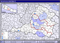
Taksar is a village development committee in Syangja District in the Gandaki Zone of central Nepal. At the time of the 2011 Nepal census it had a population of 2,061 people living in 529 individual households.[1] It is very beautiful landscape. There is the variety of ethnic groups. It is only one VDC in Syangja district which borders with two districts Kaski and Tanahun. There is the road connection with Kaski and Tanahun.
References
- ↑ "National Population Census 2011 (Ward Level)" (PDF). Central Bureau of Statistics. Retrieved April 2014. Check date values in:
|access-date=(help)
External links
This article is issued from Wikipedia - version of the 7/18/2015. The text is available under the Creative Commons Attribution/Share Alike but additional terms may apply for the media files.