Talas District, Kyrgyzstan
| Talas | |
|---|---|
| Raion | |
 | |
| Country | Kyrgyzstan |
| Province | Talas Province |
| Population (2009)[1] | |
| • Total | 57,412 |
| Time zone | GMT +5 (UTC+5) |
Talas is a raion (district) of Talas Province in north-western Kyrgyzstan. The capital lies at Manas
Demographics
In total, Talas District include 27 settlements in 13 rural communities (aiyl okmotus). Each rural community can consist of one or several villages. Its population, according to the Population and Housing Census of 2009, was 57,412. All of them live in rural areas.
| Historical populations in Talas District | ||
|---|---|---|
| Year | Pop. | ±% |
| 1970 | 36,643 | — |
| 1979 | 42,891 | +17.1% |
| 1989 | 48,703 | +13.6% |
| 1999 | 50,045 | +2.8% |
| 2009 | 57,412 | +14.7% |
| Note: enumerated de facto population; Source:[1] | ||
Ethnic composition
According to the 2009 Census, the ethnic composition of the Talas District (de jure population) was:[1]
| Ethnic group | Population | Proportion of Talas District population |
|---|---|---|
| Kyrgyzs | 58,867 | 99.3% |
| Russians | 170 | 0.3% |
| other groups | 249 | 0.4% |
Rural communities and villages
The rural communities and settlements in the Talas District are:[2]
- Aral aiyl okmotu (center - village Aral)
- Jergetal aiyl okmotu (center - village Kyzyl-Tuu, and also villages Chyiyrchyk and Kek-Kashat)
- Dolon aiyl okmotu (center - village Tash-Aryk, and also villages Ak-Jar and Orto-Aryk)
- Kok-Oy aiyl okmotu (center - village Kok-Oy)
- Bekmoldo aiyl okmotu (center - village Sasyk-Bulak, and also villages Kara-Oy, Kenesh and Chong-Tokoy)
- Aydaraliev aiyl okmotu (center - village Kepyure-Bazar)
- Nurjan aiyl okmotu (center - village Jon-Aryk, and also village Kek-Tokoy)
- Berdike Baatyr aiyl okmotu (center - village Kum-Aryk, and also villages Kozuchak and Arashan)
- Osmokulov aiyl okmotu (center - village Taldy-Bulak, and also village Ak-Korgon)
- Omuraliev aiyl okmotu (center - village Manas, and also village Chat-Bazar)
- Kuugandy aiyl okmotu (center - village Uch-Emchek)
- Kara-Suu aiyl okmotu (center - village Kara-Suu)
- Kalba aiyl okmotu (center - village Kalba, and also villages Atay Ogonbaev and Balbal)
References
- 1 2 3 Population and Housing Census 2009. Book 3 (in tables). Provinces of Kyrgyzstan: Talas Province (Перепись населения и жилищного фонда Кыргызской Республики 2009. Книга 3 (в таблицах). Регионы Кыргызстана: Таласская область), Bishkek: National Committee on Statistics, 2010
- ↑ List of rural communities of Kyrgyzstan
Capital: Bishkek (also four raions: Lenin, Oktyabr, Pervomay, Sverdlov) | ||
| Batken Region | 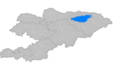 | |
| Chuy Region | ||
| Issyk Kul Region | ||
| Jalal-Abad Region | ||
| Naryn Region | ||
| Osh Region | ||
| Talas Region | ||
Coordinates: 42°31′N 72°14′E / 42.517°N 72.233°E
This article is issued from Wikipedia - version of the 5/16/2015. The text is available under the Creative Commons Attribution/Share Alike but additional terms may apply for the media files.