Tennessee State Route 91
| |
|---|---|
| Route information | |
| Length: | 53.5 mi (86.1 km) |
| Major junctions | |
| South end: |
|
|
| |
| North end: |
|
| Location | |
| Counties: | Washington, Carter, Johnson |
| Highway system | |

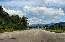
State Route 91 (SR-91) is a state highway in the northeastern portion of the U.S. state of Tennessee, in the area known as the Tri-Cities region. The route connects Johnson City with Damascus, Virginia via Elizabethton, Hunter, and Mountain City.
Route description
SR-91 begins at an intersection with US-11E/SR-34 in Johnson City. The first section of the road follows two one-way streets, namely Market Street (westbound traffic) and Main Street (eastbound traffic). It has an interchange with I-26/US-19W/US-23 before continuing along East Main Street and Elizabethton Highway as it leaves the city.[1]
In Elizabethton, it meets US-321/SR-67/SR-362, and runs concurrent with US-321 along West Elk Avenue and Broad Street through the city's downtown area. Along the way, it passes Sycamore Shoals State Historic Area. Farther into the city, the highway crosses the Doe River before reaching its US-19E/US-321/SR-67/SR-37 intersection. It then turns northward to run concurrent with these highways, crossing the Watauga River via the Gilbert Peters Bridge before splitting off again and continuing northeastward along Stony Creek Road.[1]
In northeastern Elizabethton, SR 91 passes Elizabethton Municipal Airport and the Elizabethton campus of Northeast State Community College. Beyond the community of Hunter, the highway enters the Cherokee National Forest as it continues northeastward through a broad valley between Holston Mountain to the north and the Iron Mountains to the south. Northeast of the Buladeen area, the highway ascends to over 3,500 feet (1,100 m) through a series of switchback curves as it passes over a cross ridge between Holston Mountain and the Irons, where it enters Johnson County. It then descends into the secluded Shady Valley.[1]
In Shady Valley, the route intersects US-421/SR-34/SR-133. US-421 continues northwestward to Bristol, while SR-133 continues northeastward toward Damascus, Virginia. SR-91 turns southeastward to run concurrent with US-421 and SR-34. The highway crosses the Iron Mountains at Sandy Gap, climbing to over 3,800 feet (1,200 m) before descending again to the outskirts of Mountain City.[1]
Near downtown Mountain City, SR-91 splits off from US-421/SR-34 to once again follow a northeastward trek. It continues through a series of gradual ascents and descents across rugged terrain before reaching Laurel Bloomery in the northeastern part of the county. SR-91 meets its northern terminus at the Virginia state line, near Damascus, where the roadway continues as Virginia State Route 91 into Washington County, Virginia, and the Jefferson National Forest.[1]
Major intersections
| County | Location | mi | km | Destinations | Notes |
|---|---|---|---|---|---|
| Washington | Johnson City | 0.00 | 0.00 | Southern terminus | |
| Southern terminus of SR-400 | |||||
| I-26 exit 23 | |||||
| Carter | Elizabethton | Southern end of US-321 / SR 67 concurrency; Northern terminus of SR-362 | |||
| Northern terminus of SR-400 | |||||
| Northern end of US-321/SR-67 concurrency, Southern end of US-19E/SR-37 concurrency | |||||
| | Northern end of US-19E/SR-37 concurrency; interchange | ||||
| Johnson | Shady Valley | southern end of US-421/SR-34 concurrency; Southern terminus of SR-133 | |||
| Mountain City | Southern end of concurrency | ||||
| | Virginia state line | ||||
1.000 mi = 1.609 km; 1.000 km = 0.621 mi
| |||||
See also
-
 Tennessee portal
 -
 U.S. Roads portal
 - List of state routes in Tennessee
References
External links
-
 Media related to Tennessee State Route 91 at Wikimedia Commons