Tesker
| Tesker | |
|---|---|
| Commune and village | |
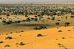 | |
 Tesker Location in Niger | |
| Coordinates: 14°35′05″N 9°13′00″E / 14.58472°N 9.21667°E | |
| Country |
|
| Region | Zinder |
| Department | Gouré |
| Population (2010) | |
| • Total | 33,544 |
| Time zone | WAT (UTC+1) |
Tesker or Tasker is a village and rural commune in Niger.[1] As of 2010, it had a population of 33,544 people. It is the birthplace of musician Mamane Barka (b. 1958).[2] The sparsely populated commune extends over a wide area and spans two major regions: the Sahel region in the south and the Sahara desert in the north. In the northeast, it rises up to a height of 710 metres (2,330 ft) at the Termit Massif. It is bordered by Fachi and Tabelot in the north, N'Gourti to the east, Alakoss, Kellé and N'Guelbély to the south and Tenhya to the west. The municipality is divided into 36 administrative villages, one traditional village, three hamlets, 29 camps and 144 watering places.
History
During the elections in the early 1990s, the vote from Tesker had to be cancelled as only 1,203 out of 8,785 voters were able to cast votes as a result of serious logistical problems.[3] New elections had to be organised for Tesker and the PNDS eventually won the election.[4] The rural community of Tesker emerged as an administrative unit in 2002 as part of a nationwide administrative reform. In November 2004, the government's High Commission for the Restoration of Peace hosted a reconciliation forum in the town.[5]
Demographics
There were 24,703 inhabitants in Tesker, according to the 2001 census, and 33,544 inhabitants in 2010. Arabs live in the north of the rural community,[6] and members of the Tuareg and Fulani subgroups such as the Kanimatane, Bororo'en, Dabanko'en, Uda'en, Tuntumanko'en and Wodaabe are residents as well. A 2004 government investigation looked at abuse against civilians by security forces,[7] while a 2005 reconciliation agreement was secured by the Government's High Commission for the Restoration of Peace after fighting ensued between Tuareg and Toubou communities in 2002 and 2003.[8]
Economy and infrastructure
The main town of Tesker has a military installation and a large cattle market. The main occupation is pastoral farming.[9]
References
- ↑ Loi n° 2002-014 du 11 JUIN 2002 portant création des communes et fixant le nom de leurs chefs-lieux. Includes list of 213 communes rurales and seats, 52 Communes urbaines and seats
- ↑ "Introducing Mamane Barka". Retrieved 2010-02-16.
- ↑ Olukoshi, Adebayo O.; Laakso, Liisa; Afrikainstitutet, Nordiska (1996). Challenges to the nation-state in Africa. Nordiska Afrikainstitutet, in cooperation with the Institute of Development Studies, University of Helsinki. p. 63. ISBN 978-91-7106-381-6. Retrieved 27 January 2013.
- ↑ Codesria Bulletin. Council for the Development of Economic and Social Research in Africa. 1992. p. 9. Retrieved 27 January 2013.
- ↑ Country reports on human rights practices: report submitted to the Committee on Foreign Affairs, U.S. House of Representatives and Committee on Foreign Relations, U.S. Senate by the Department of State in accordance with sections 116(d) and 502B(b) of the Foreign Assistance Act of 1961, as amended. United States. Congress. House. Committee on International Relations. 2005. p. 402. Retrieved 27 January 2013.
- ↑ Idrissa, Abdourahmane; Decalo, Samuel (1 June 2012). Historical Dictionary of Niger. Scarecrow Press. p. 96. ISBN 978-0-8108-6094-0. Retrieved 27 January 2013.
- ↑ Country Reports on Human Rights Practices for 2004. 1. United States. Dept. of State. 2008. p. 443. Retrieved 28 January 2013.
- ↑ African Commission on Human and Peoples' Rights; International Work Group for Indigenous Affairs (28 February 2010). Report of the African Commission's Working Group on Indigenous Populations/Communities: Mission to the Republic of Niger, 14-24 February 2006. IWGIA. pp. 51–. ISBN 978-87-91563-48-5. Retrieved 28 January 2013.
- ↑ Irons, William; Dyson-Hudson, Neville (1972). Perspectives on Nomadism. Brill Archive. pp. 106–. ISBN 978-90-04-03513-3. Retrieved 28 January 2013.
Coordinates: 14°35′05″N 9°13′00″E / 14.58472°N 9.21667°E