Gaya, Niger

Location of Gaya in Niger
Gaya is a city in the Dosso Region of Niger.[1] The city is situated 254 km southeast of the capital, Niamey, is located on the banks of the Niger River,[2] and is near the borders with Benin and Nigeria. Gaya has a population of 28,385 (2001 census). The wettest area in Niger, Gaya averages 800 mm in rainfall a year.
There is a bridge connecting Gaya to the town of Malanville in Benin.[3]
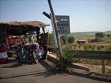
The road border entering Niger from Benin at Gaya.
Namesake
There is another town in Niger of the same name.
See also
References
- ↑ "Dosso". maplibrary.org. Retrieved 5 February 2007.
- ↑ Bullington, J. R (2003). "Letter From Niger". AmericanDiplomacy.com. American Diplomacy Publishers. Retrieved 5 February 2007.
- ↑ https://maps.google.com/maps?q=Gaya,%20Niger
External links
Coordinates: 11°53′16″N 03°26′48″E / 11.88778°N 3.44667°E
This article is issued from Wikipedia - version of the 7/9/2016. The text is available under the Creative Commons Attribution/Share Alike but additional terms may apply for the media files.