Texas Park Road 4
| ||||
|---|---|---|---|---|
| Route information | ||||
| Maintained by TxDOT | ||||
| Length: | 15.500 mi[1] (24.945 km) | |||
| Existed: | 1942[1] – present | |||
| Major junctions | ||||
| West end: |
| |||
| East end: |
| |||
| Location | ||||
| Counties: | Burnet | |||
| Highway system | ||||
| ||||
|
Park Road 4 Historic District | ||||
|
Park Road 4 as it descends into Hoover's Valley. | ||||
 | ||||
| Location |
Burnet County, Texas | |||
| Coordinates | 30°42′3″N 98°22′51″W / 30.70083°N 98.38083°W | |||
| Built | 1934-1942 | |||
| Architect | Multiple | |||
| NRHP Reference # | 10001221 | |||
| Added to NRHP | February 7, 2011[2] | |||


Park Road 4 (PR 4) is a 15.5-mile (24.9 km) park road near Burnet, Texas that travels through and provides access to Longhorn Caverns State Park and Inks Lake State Park. The highway connects State Highway 29 (SH 29) to U.S. Route 281 (US 281). The highway was constructed between 1934 and 1942 by the Civilian Conservation Corps (CCC), Works Progress Administration (WPA) and Texas State Highway Department (TSHD).
Route description
PR 4 begins at SH 29 near Buchanan Dam. The road then continues eastward through Inks Lake State Park. The road makes an ascent of 400 feet (120 m) from Hoover's Valley and then goes through Longhorn Caverns State Park before ending at US 281 south of Burnet.
History
The CCC constructed the first several miles in the mid-1930s to provide visitor access from US 281 to the newly renovated Longhorn Cavern State Park. Works Progress Administration workers extended the road west of the park headquarters in the early 1940s. The road connected with Ranch to Market Road 2342 (RM 2342) and was finally completed concurrently with the construction of Inks Lake State Park about 1942.
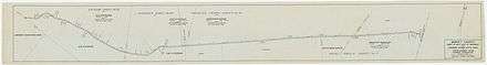
Between 1934 and 1942 the CCC and the TSHD built the eastern entrance portals, masonry bridges, retaining walls, two parking overlooks, culverts and guard walls. Large live oak and other trees were preserved by the CCC during road work, as indicated by historic plans and sketches. The CCC designed and installed additional plantings of native species at three locations along the roadway; the entrance portals, Longhorn Cavern, and Parking Overlook B.
All of PR 4 and Longhorn Cavern State Park were listed on the National Register of Historic Places on February 7, 2011, as the Park Road 4 Historic District.
Major intersections
The entire highway is in Burnet County.
| Location | mi[3] | km | Destinations | Notes | |
|---|---|---|---|---|---|
| | 0.0 | 0.0 | Western terminus | ||
| | 7.2 | 11.6 | |||
| | 15.5 | 24.9 | Eastern terminus | ||
| 1.000 mi = 1.609 km; 1.000 km = 0.621 mi | |||||
See also
 U.S. Roads portal
 National Register of Historic Places portal
 Texas portal
References
- 1 2 Transportation Planning and Programming Division (n.d.). "Park Road No. 4". Highway Designation Files. Texas Department of Transportation. Retrieved December 13, 2009.
- ↑ National Park Service (April 15, 2008). "National Register Information System". National Register of Historic Places. National Park Service.
- ↑ Statewide Planning Map (Map). Cartography by Transportation Planning and Programming Division. Texas Department of Transportation. 2012. Retrieved November 12, 2012.
External links
 Media related to Park Road 4 Historic District at Wikimedia Commons
 Geographic data related to Texas Park Road 4 at OpenStreetMap