Texas Park Road 72
| ||||
|---|---|---|---|---|
| Route information | ||||
| Maintained by TxDOT | ||||
| Length: | 4.346 mi[1] (6.994 km) | |||
| Existed: | 1978[1] – present | |||
| Major junctions | ||||
| West end: |
| |||
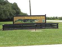
| East end: | Brazos Bend State Park | |||
| Location | ||||
| Counties: | Fort Bend | |||
| Highway system | ||||
| ||||

Park Road 72 (PR 72) is a park road in Fort Bend County, Texas that begins at Farm to Market Road 762 (FM 762) and goes east into Brazos Bend State Park.
Route description
PR 72 starts at FM 762 at the entrance of Brazos Bend State Park and goes east, entering the park. After 0.6 miles (1.0 km) the road comes to the ranger station where the park user fee is collected. Going southeast for 0.2 miles (0.3 km), the road passes the 40 Acre Lake parking lot. For 0.5 miles (0.8 km) PR 72 loops around the south end of a point of timber before it steadies on a straight easterly heading for 1.3 miles (2.1 km) through the woods. The road then angles to the northeast for 0.6 miles (1.0 km), passing a parking lot on the left. Near Creekfield Lake, a park drive branches off going north to some campgrounds. At this point, PR 72 veers sharply to the west for 0.7 miles (1.1 km) before ending in a 0.3 miles (0.5 km) long turnaround loop.[2]
History
PR 72 was originally designated on August 21, 1978 in Hale Ranch State Park in Fort Bend County. The road began at the park entrance on FM 762 and ran eastward about 4.4 miles (7.1 km).[1]
The park's original name of Hale Ranch came from a hunting preserve belonging to Herman Hale, Joe Wesendoff and the Pilant Club of Houston. Hale Ranch is now part of Brazos Bend State Park. The park is located where Big Creek empties into the Brazos River.[3]
Major intersections
The entire highway is in Fort Bend County.
| Location | mi | km | Destinations | Notes | |
|---|---|---|---|---|---|
| Long Point | 0.000 | 0.000 | Western terminus | ||
| Brazos Bend State Park | 4.346 | 6.994 | Turnaround loop | Eastern terminus | |
| 1.000 mi = 1.609 km; 1.000 km = 0.621 mi | |||||
See also
 U.S. Roads portal
 Texas portal
References
- 1 2 3 Transportation Planning and Programming Division (n.d.). "Park Road No. 72". Highway Designation Files. Texas Department of Transportation. Retrieved January 15, 2013.
- ↑ Google (January 15, 2013). "Overview Map of Park Road 72" (Map). Google Maps. Google. Retrieved January 15, 2013.
- ↑ Sawyer, R. K. (2012). A Hundred Years of Texas Waterfowl Hunting: The Decoys, Guides, Clubs, and Places, 1870s to 1970s. College Station, TX: Texas A&M University Press. p. 349. ISBN 1-60344-763-6. Retrieved January 15, 2013.
External links
![]() Geographic data related to Texas Park Road 72 at OpenStreetMap
Geographic data related to Texas Park Road 72 at OpenStreetMap