Texas State Highway 203
| |||||||
|---|---|---|---|---|---|---|---|
 | |||||||
| Route information | |||||||
| Maintained by TxDOT | |||||||
| Length: | 39.837 mi[1] (64.111 km) | ||||||
| Existed: | 1939[1] – present | ||||||
| Major junctions | |||||||
| West end: |
| ||||||
|
| |||||||
| East end: |
| ||||||
| Highway system | |||||||
| |||||||

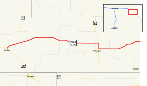
State Highway 203 is a nearly 40-mile (64 km) state highway in the U.S. state of Texas. It runs through the Texas panhandle from Hedley to the Oklahoma state line.
History
SH 203 was added to the state highway system by 1919, as part of SH 13; the former alignment of SH 13 via Wheeler became SH 33 and is now SH 152.[2][3][4] By 1926, SH 13 had taken the alignment that became US 66, while the route through Wellington became State Highway 52.[5] By 1935, the part of SH 52 east of Wellington remained, but the highway west of Wellington was renumbered SH 203, along with a proposed[6] route from Wellington to the state line near Dodson. In late 1945, the state renumbered the route via Dodson as part of Farm to Market Road 338 and rerouted SH 203 to absorb the rest of SH 52.[1][7][8] There have been no changes to the routing of SH 203 since 1945.
Route description
SH 203 heads northeastward from Hedley. It meets the beginning of SH 273 after leaving that town. SH 203 then turns more easterly and passes through Quail. North of Wellington, it overlaps US 83. It then ends at the Oklahoma state line, where it becomes SH 9.
Junction list
| County | Location | mi[9] | km | Destinations | Notes |
|---|---|---|---|---|---|
| Donley | Hedley | 0.0 | 0.0 | Western terminus | |
| 0.1 | 0.16 | Southern terminus of FM 1932 | |||
| | 2.0 | 3.2 | Southern terminus of SH 273 | ||
| | 6.6 | 10.6 | Southern terminus of FM 2944 | ||
| Collingsworth | Quail | 16.1 | 25.9 | ||
| | 21.4 | 34.4 | Southern terminus of FM 2344 | ||
| | 26.4 | 42.5 | Northern terminus of FM 1035 | ||
| | 27.4 | 44.1 | Western terminus of US 83 concurrency | ||
| Wellington | 29.3 | 47.2 | Eastern terminus of FM 3197, Western terminus of US 83 concurrency | ||
| | 30.3 | 48.8 | Northern terminus of FM 398 | ||
| | 32.3 | 52.0 | Southern terminus of FM 2734 | ||
| | 39.8 | 64.1 | Oklahoma state line; eastern terminus | ||
1.000 mi = 1.609 km; 1.000 km = 0.621 mi
| |||||
References
- 1 2 3 Transportation Planning and Programming Division (n.d.). "State Highway No. 203". Highway Designation Files. Texas Department of Transportation. Retrieved 2008-03-15.
- ↑ Commerce Journal, Highway Commission Adopts 25 Highways, July 6, 1917
- ↑ State Highway Department, Map Showing Proposed System of State Highways as Adopted June 1917
- ↑ Texas State Highway Department, Highway Map: State of Texas, October 1, 1919
- ↑ Rand McNally Auto Road Atlas, 1926, Texas
- ↑ Texas State Highway Department, , 1935
- ↑ Transportation Planning and Programming Division (n.d.). "State Highway No. 52". Highway Designation Files. Texas Department of Transportation. Retrieved 2008-03-15.
- ↑ Transportation Planning and Programming Division (n.d.). "Farm to Market Road No. 338". Highway Designation Files. Texas Department of Transportation. Retrieved 2008-03-15.
- ↑ Google (June 8, 2009). "driving directions for SH 203" (Map). Google Maps. Google. Retrieved June 8, 2009.