Texas State Highway 65
| ||||
|---|---|---|---|---|
 | ||||
| Route information | ||||
| Maintained by TxDOT | ||||
| Length: | 15.495 mi[1] (24.937 km) | |||
| Existed: | 1961 – present | |||
| Major junctions | ||||
| West end: |
| |||
| East end: |
| |||
| Location | ||||
| Counties: | Chambers | |||
| Highway system | ||||
| ||||

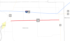
State Highway 65 or SH 65 is a Texas state route that runs for 15.495 miles (24.937 km) within Chambers County, from near Anahuac to Stowell. This route was designated in 1961, replacing a portion of SH 73 identified as SH 73-T.
History
Previous route
SH 65 was originally designated by 1926 along a route from Mt. Pleasant to Gladewater. By 1935, this route was reassigned to U.S. Highway 271.
Junction list
The entire route is in Chambers County.
| Location | mi | km | Destinations | Notes | |
|---|---|---|---|---|---|
| | Western terminus | ||||
| | |||||
| | |||||
| | |||||
| Stowell | Eastern terminus | ||||
| 1.000 mi = 1.609 km; 1.000 km = 0.621 mi | |||||
References
- ↑ Transportation Planning and Programming Division (n.d.). "State Highway No. 65". Highway Designation Files. Texas Department of Transportation.
This article is issued from Wikipedia - version of the 7/31/2016. The text is available under the Creative Commons Attribution/Share Alike but additional terms may apply for the media files.