Thuringian Forest Nature Park
| Thuringian Forest Nature Park | |
|---|---|
| Naturpark Thüringer Wald | |
|
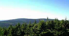
View from Grosser Finsterberg to Beerberg and Schneekopf (The three highest mountains of Thuringia) | |
 Location of the Thuringian Forest Nature Park | |
| Location | Thuringia, Germany |
| Coordinates | 50°31′N 10°59′E / 50.51°N 10.99°ECoordinates: 50°31′N 10°59′E / 50.51°N 10.99°E[1] |
| Area | 2,082 km2 (804 sq mi) |
| Established | 1990 |
| http://www.naturpark-thueringer-wald.eu/ | |
The Thuringian Forest Nature Park (German: Naturpark Thüringer Wald) is one of the two nature parks in the state of Thuringia, Germany.
The 1990 founded park has a size of 2,082 km2 (804 sq mi). It extends around the Rennsteig and comprises almost the entire Thuringian Forest and the Thuringian Highlands with Eisenach in northwest and Sonneberg in the south. It includes further the 170 km2 (66 sq mi) biosphere reservation Vessertal-Thüringen Forest, and a number of dams like Tambach-Dietharz Dam, Schmalwasser Dam, Ohra Dam, Lütsche Dam and the Leibis-Lichte Dam.
The highest mountains in the park are the Großer Beerberg (982 m above sea level (NN)) and the Schneekopf (978 m above sea level (NN)).
See also
References
- ↑ "Thüringer Wald Nature Park". protectedplanet.net.
External links
|  | |
This article is issued from Wikipedia - version of the 11/19/2016. The text is available under the Creative Commons Attribution/Share Alike but additional terms may apply for the media files.