Timiskaming, Quebec
| Timiskaming First Nation | |
|---|---|
| First Nations reserve | |
 | |
 Timiskaming | |
| Coordinates: 47°38′N 79°28′W / 47.633°N 79.467°WCoordinates: 47°38′N 79°28′W / 47.633°N 79.467°W | |
| Country |
|
| Province |
|
| Region | Abitibi-Témiscamingue |
| Regional county | None |
| Formed | 1854 |
| Government[1][2] | |
| • Chief | 4 councilors |
| • Federal riding | Abitibi—Témiscamingue |
| • Prov. riding | Rouyn-Noranda–Témiscamingue |
| Area[1][3] | |
| • Total | 18.20 km2 (7.03 sq mi) |
| • Land | 18.19 km2 (7.02 sq mi) |
| Population (2011)[3] | |
| • Total | 540 |
| • Density | 29.7/km2 (77/sq mi) |
| Time zone | EST (UTC-5) |
| • Summer (DST) | EDT (UTC-4) |
| Postal Code | J0Z 3B0 |
| Area code(s) | 819 |
| Website | www.timiskamingfirstnation.ca |
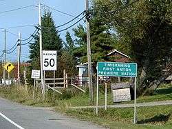
Timiskaming (former official designation Timiskaming 19) is a First Nations reserve in the Abitibi-Témiscamingue region of Quebec, Canada, just north of the head of Lake Timiskaming. It belongs to the Timiskaming First Nation, an Algonquin band.[2] It is geographically within the Témiscamingue Regional County Municipality but administratively not part of it.
History
In 1853, following the proposed distribution by Commissioner of Crown Lands John Rolph, the Governor General in Council assigned the Nipissing, Algonquin, and Ottawa Indians of the Timiscaming region a reserve of 38,400 acres (15,500 ha), located along the Ottawa River, and originally known as Temiscamingue Reserve. But piece-by-piece, the reserve was reduced in size when the Indians ceded lots back to the government in 1897, 1898, every year from 1905 to 1917, 1939, 1953, and 1955. But many of these surrenders are now being disputed.[4]
On October 23, 1999, the Quebec government officially recognized a name change from Timiscaming to Timiskaming.[5] On July 30, 2002, the Department of Indian Affairs recognized that the reserve's name was changed to Timiskaming.[4]
Demographics
Population
As of September 2012, the registered population of the Timiskaming First Nation is 1,898 members, of whom 630 live on the Timiskaming reserve, 7 live on another reserve or crown land, and 1,261 live off reserve.[2]
| Canada census – Timiskaming, Quebec community profile | |||
|---|---|---|---|
| 2011 | 2006 | 2001 | |
| Population: | 540 (6.9% from 2006) | 505 (-5.4% from 2001) | 549 (+14.9% from 1996) |
| Land area: | 18.19 km2 (7.02 sq mi) | 18.19 km2 (7.02 sq mi) | 18.82 km2 (7.27 sq mi) |
| Population density: | 29.7/km2 (77/sq mi) | 27.8/km2 (72/sq mi) | 29.2/km2 (76/sq mi) |
| Median age: | 28.8 (M: 28.8, F: 28.0) | 33.5 (M: 33.0, F: 34.1) | 44.8 (M: 43.5, F: 46.4) |
| Total private dwellings: | 191 | 193 | 167 |
| Median household income: | $.N/A | $33,792 | $35,157 |
| Notes: 2011 data for this area has been suppressed for data quality or confidentiality reasons. Population in 1996: 478[6] (+24.5% from 1991) - Population in 1991: 361[6] – References: 2011[3] 2006[7] 2001[8] | |||
Language
Mother tongue:[3]
- English as first language: 87.5%
- French as first language: 8.7%
- English and French as first language: 1.9%
- Other as first language: 1.9%
Economy
The reserve's economy is tied to the adjacent town of Notre-Dame-du-Nord and mostly based on logging, farming, construction, and tourism. There are about 15 enterprises on the reserve.[2] The Timiskaming First Nation administration employs about 70 persons.
Education
There is only one school on the reserve: Kiwetin School, providing pre-Kindergarten to secondary grade 2. It had an enrolment of 65 students in 2008-2009.[2]
References
- 1 2 "Timiskaming First Nation". Répertoire des municipalités (in French). Ministère des Affaires Municipales, Régions et Occupation du territoire. Retrieved 2011-01-04.
- 1 2 3 4 5 "Timiskaming First Nation". First Nations profiles. Aboriginal Affairs and Northern Development Canada. Retrieved 2012-10-26.
- 1 2 3 4 "Timiskaming, Quebec (Code 2485806) census profile". 2011 Census of Population. Statistics Canada. Retrieved 2012-10-26.
- 1 2 Natural Resources Canada - Legal Surveys Division, Historical Review - Timiskaming land title history
- ↑ http://www.stat.gouv.qc.ca/publications/referenc/pdf/mod99.pdf
- 1 2 "Electronic Area Profiles". Canada 1996 Census. Statistics Canada. Retrieved 2013-05-11.
- ↑ "2006 Community Profiles". Canada 2006 Census. Statistics Canada. March 30, 2011. Retrieved 2012-10-26.
- ↑ "2001 Community Profiles". Canada 2001 Census. Statistics Canada. February 17, 2012. Retrieved 2014-01-29.
 |
Nédélec | | ||
| Notre-Dame-du-Nord | |
Notre-Dame-du-Nord | ||
| ||||
| | ||||
| Notre-Dame-du-Nord |
| Regional county municipalities and equivalent territories | |
|---|---|
| Municipalities | |