Duparquet, Quebec
| Duparquet | |
|---|---|
| City | |
|
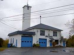
Town Hall of Duparquet | |
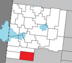 Location within Abitibi-Ouest RCM. | |
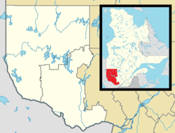 Duparquet Location in western Quebec. | |
| Coordinates: 48°30′N 79°14′W / 48.500°N 79.233°WCoordinates: 48°30′N 79°14′W / 48.500°N 79.233°W[1] | |
| Country |
|
| Province |
|
| Region | Abitibi-Témiscamingue |
| RCM | Abitibi-Ouest |
| Constituted | April 13, 1933 |
| Government[2] | |
| • Mayor | Gilbert Rivard |
| • Federal riding | Abitibi—Témiscamingue |
| • Prov. riding | Abitibi-Ouest |
| Area[2][3] | |
| • Total | 154.90 km2 (59.81 sq mi) |
| • Land | 123.63 km2 (47.73 sq mi) |
| Population (2011)[3] | |
| • Total | 657 |
| • Density | 5.3/km2 (14/sq mi) |
| • Pop 2006-2011 |
|
| • Dwellings | 359 |
| Time zone | EST (UTC−5) |
| • Summer (DST) | EDT (UTC−4) |
| Postal code(s) | J0Z 1W0 |
| Area code(s) | 819 |
| Highways |
|
| Website |
www |
Duparquet is a ville in northwestern Quebec, Canada in the MRC d'Abitibi-Ouest. It covers 157.4 km² and had a population of 657 as of the Canada 2011 Census.
History
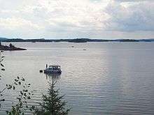
In 1912, a rich gold vein was discovered near Lake Duparquet by a prospector named Beattie. He set up the Beattie Gold Mine company that began operation in 1933. That same year, the new community forming at the mine was incorporated as Ville de Duparquet, named after the geographic township in which it is located. The township was named in 1916 in honour of Jean-Annet Chabreuil Du Parquet, a grenadier captain of the La Sarre Regiment, that was part of General Montcalm's army.[1]
After producing 1 million ounces of gold and killing at least 27 miners, including 4 in a landslide on 9 July 1946, the mine closed in 1956. But the owners of the mining rights are currently considering reopening it as an open-pit mine.[4]
Demographics
Population trend:[5]
- Population in 2011: 657 (2006 to 2011 population change: 2.8%)
- Population in 2006: 639
- Population in 2001: 675
- Population in 1996: 738
- Population in 1991: 680
Private dwellings occupied by usual residents: 312 (total dwellings: 359)
Mother tongue:[6]
- English as first language: 4.7%
- French as first language: 93.0%
- English and French as first language: 0%
- Other as first language: 2.3%
Residents of note
- birthplace of Chicago Black Hawks player Moose Vasko of the 1960s.
- Johanne Morasse (born March 12, 1957), a Quebec politician and teacher
Municipal council
- Mayor: Gilbert Rivard
- Councillors: Monique Lévesque Baril, Alain Letarte, Jean-Pierre Julien, Isabelle Proulx, Sylvie Lafortune, Solange Gamache
- General Director: Lise Boucher
References
- 1 2 "Duparquet (Ville)" (in French). Commission de toponymie du Québec. Retrieved 2011-01-04.
- 1 2 "Duparquet". Répertoire des municipalités (in French). Ministère des Affaires municipales, des Régions et de l'Occupation du territoire. Retrieved 2011-01-04.
- 1 2 "Duparquet census profile". 2011 Census data. Statistics Canada. Retrieved 2011-01-04.
- ↑ Patrick Rodrigue (18 September 2009). "Une mine à ciel ouvert à Duparquet?" (in French). canoe.ca. Retrieved 2010-01-04.
- ↑ Statistics Canada: 1996, 2001, 2006, 2011 census
- ↑ "Duparquet community profile". 2006 Census data. Statistics Canada. Retrieved 2011-01-04.
 |
Rapide-Danseur | | ||
| Lac-Duparquet | |
Rouyn-Noranda | ||
| ||||
| | ||||
| Rouyn-Noranda |
| Towns | |
|---|---|
| Municipalities | |
| Townships | |
| Parishes | |
| Unorganized territories | |
| |