Toe Jam Hill
| Toe Jam Hill | |
|---|---|
 Toe Jam Hill | |
| Highest point | |
| Elevation | 425 ft (130 m) NAVD 88[1] |
| Prominence | 425 ft (130 m) [1] |
| Coordinates | 47°35′03″N 122°30′08″W / 47.58417°N 122.50222°WCoordinates: 47°35′03″N 122°30′08″W / 47.58417°N 122.50222°W |
| Geography | |
| Location | Kitsap County, Washington, U.S. |
| Topo map | USGS Bremerton East |
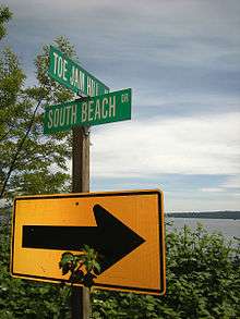
Toe Jam Hill, 425 feet tall, is the high point on Bainbridge Island, Washington and one of the highest points in Kitsap County, Washington.[1][2][3]
Its name has several explanations, including that it was named for a local settler with the name Torjam (the explanation given by the local historical society),[4] that it was named for stumbling drunkards, or that existing explanations are "all conjecture".[5][6]
The hill is a "villainous" milestone for bicycle riders on the Chilly Hilly season opener sponsored by Seattle's Cascade Bicycle Club,[7] and on the Bainbridge Island Half Marathon, formerly called Toe Jam Hill Half Marathon.[8]
The Bainbridge Island high point's location is reported variously at highpointing websites. Lists of John gives Gazzam Lake Hill based on USGS topographic maps, which used stereoscopic aerial surveys.[9] Peakbagger.com gives Toe Jam Hill at 15 feet higher or more, based on newer high-resolution LIDAR maps.[1]
LIDAR surveys in the 1990s also identified a geologic fault, now named the Toe Jam Hill Fault, north of the hill. It may intersect and may be secondary to the Seattle Fault.[10][11] It was the first fault discovered by laser imagery.[12]
A city park, Nutes Pond Park (also spelled Nute's Pond), was created on Toe Jam Hill in 2011.[13][14]
References
- 1 2 3 4 Greg Slayden (2004), Toe Jam Hill, peakbagger.com
- ↑ Bainbridge Island 20-foot contour topographical map (PDF), North Kitsap Trails Association, 2012, retrieved 2014-10-30 – Note: Toe Jam Hill summit is above 420 foot contour (420–440 ft.)
- ↑ Bainbridge Island 5-foot contour DWG file derived from 1996 Lidar collection, Kitsap County Department of Community Development - GIS Division, retrieved 2014-10-30 – Note: Toe Jam Hill summit is above 425 foot contour (425–430 ft.)
- ↑ Questions and answers to the Bainbridge Island History Quiz on the banners in the Bainbridge ferry terminal ramp, Bainbridge Island Historical Museum, retrieved 2014-10-30
- ↑ Rachel Pritchett (December 22, 2006), "Place names on Bainbridge Island", Puget Sound Blogs, Kitsap Sun
- ↑ "... And Now, the Kitsap Names Quiz", Kitsap Sun, January 1, 2007
- ↑ Florangela Davila (July 7, 2005), "Cycle-friendly Bainbridge inn is first stop on weekend of ups, downs and sweet scenery", The Seattle Times
- ↑ "Kitsap briefs: Bainbridge half marathon cancelled", Kitsap Sun, March 2, 2012
- ↑ John Kirk, "Kitsap County WA peaks list", Lists of John Lists of Peaks, Colorado
- ↑ Finding faults, Puget Sound Lidar Consortium, August 18, 2003
- ↑ Yeates, Robert S. (2004), Living with Earthquakes in the Pacific Northwest (PDF) (Second ed.), Oregon State University Press, pp. 119–120, ISBN 0-87071-024-9
- ↑ Nelson, A. R.; Johnson, S. Y.; Kelsey, H. M.; Wells, R. E.; Sherrod, B. L.; Pezzopane, S. K.; Bradley, L.; Koehler, R. D.; Bucknam, R. C. (November 2003), "Late Holocene earthquakes on the Toe Jam Hill fault, Seattle fault zone, Bainbridge Island, Washington", Geological Society of America Bulletin, 115 (11): 1368–1403, Bibcode:2003GSAB..115.1388N, doi:10.1130/B25262.1 – via United States Geological Survey publication warehouse (abstract) Cite uses deprecated parameter
|coauthors=(help) - ↑ Nutes Pond Park, Bainbridge Island Parks and Facilities, retrieved 2014-10-28
- ↑ Paul Brians (May 2, 2014), "Bainbridge's Secret Nute's Pond Park Unveiled", Inside Bainbridge (online),
Thirty-one acres of woods and wetland at the top of Toe Jam Hill ...