Bainbridge Island, Washington
| Bainbridge Island, Washington | |
|---|---|
| City | |
|
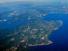
Washington State Ferries ferry landing on Bainbridge Island | |
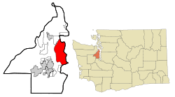 Location of Bainbridge Island, Washington | |
| Coordinates: 47°39′19″N 122°32′6″W / 47.65528°N 122.53500°WCoordinates: 47°39′19″N 122°32′6″W / 47.65528°N 122.53500°W | |
| Country | United States |
| State | Washington |
| County | Kitsap |
| Area[1] | |
| • Total | 65.02 sq mi (168.40 km2) |
| • Land | 27.61 sq mi (71.51 km2) |
| • Water | 37.41 sq mi (96.89 km2) |
| Population (2010)[2] | |
| • Total | 23,025 |
| • Estimate (2015)[3] | 23,840 |
| • Density | 833.9/sq mi (322.0/km2) |
| Time zone | Pacific (PST) (UTC-8) |
| • Summer (DST) | PDT (UTC-7) |
| ZIP code | 98110 |
| Area code(s) | 206 |
| FIPS code | 53-03736 |
| GNIS feature ID | 1512809[4] |
| Website | City of Bainbridge-Island |

Bainbridge Island is a city in Kitsap County, Washington, United States, and is coextensive with the eponymous island in Puget Sound. The population was 23,025 at the 2010 census, making Bainbridge Island the second largest city in Kitsap County.
In July 2005, CNN/Money and Money magazine named Bainbridge Island the second-best place to live in the United States.[5]
In August 2013, Bainbridge Island was recognized by Google with an eCity Award.[6] This award recognizes the strongest online business community in each state.[7]
The local newspapers are the weekly Bainbridge Island Review and the Bainbridge Islander.
History
In 1792, English explorer Captain George Vancouver spent several days with his ship HMS Discovery anchored off Restoration Point at the southern end of Bainbridge Island while boat parties surveyed other parts of Puget Sound. Vancouver spent a day exploring Rich Passage, Port Orchard, and Sinclair Inlet. He failed to find Agate Passage and so his maps show Bainbridge Island as a peninsula. Vancouver named Restoration Point on May 29, the anniversary of the English Restoration, in honor of King Charles II.[8]
In 1841, US Navy Lieutenant Charles Wilkes visited the island while surveying the Northwest. Lt. Wilkes named the island after Commodore William Bainbridge, commander of the frigate USS Constitution in the War of 1812. Bainbridge Island was originally a center for the logging and shipbuilding industries. The island was known for huge and accessible cedars, which were especially in demand for ships' masts. The original county seat of Kitsap County was at Port Madison on the north end of the island.
_evacuation_--_Group_of_young_evacuees_wave_from_special_train_as_it_leaves_Seattle_with_Island_evacuees%2C_March_30%2C_1942.jpg)
The first generation of Japanese immigrants, the Issei, came in 1883. During World War II, Japanese-American residents of Bainbridge Island were the first to be sent to internment camps, an event commemorated by the Bainbridge Island Japanese American Exclusion Memorial, which opened in 2011.[9] They were held by the US government through the duration of the war for fear of espionage. Many Filipinos who assisted the Japanese farmers were left to operate the strawberry fields, which they did successfully. Filipino farmers went north to locate First Nations families to work in the fields. Many romances arose from the berry fields and the birth of the Indo-Pinos emerged.
The city of Bainbridge Island has occupied the entire island since February 28, 1991, when the former City of Winslow (around 1.5 square miles (3.9 km2) of land on Eagle Harbor, incorporated August 9, 1947) annexed the rest of the island. Since the 1960s, Bainbridge Island has become an increasingly affluent bedroom community of Seattle, a 35-minute ride away on the Washington State Ferries.
Geography

Bainbridge Island was formed during the last ice age—13,000 to 15,000 years ago—when the 3,000-foot-thick (910 m) Vashon Glacier scraped out the Puget Sound and Hood Canal basins.
Bainbridge Island is located within the cool Puget Sound Basin, east of the Kitsap Peninsula, directly east of the Manette Peninsula and west of the City of Seattle. The island is approximately five miles (8 km) wide and ten miles (16 km) long, encompassing nearly 17,778 acres (71.95 km2), and is one of the larger islands in Puget Sound.[10]
Bainbridge Island shorelines border the main body of Puget Sound, a large protected embayment, Port Orchard Bay, and two high-current tidal passages, Rich Passage and Agate Pass. The island is characterized by an irregular coastline of approximately 53 miles (85 km), with numerous bays and inlets and a significant diversity of other coastal land forms, including spits, bluffs, dunes, lagoons, cuspate forelands, tombolos, tide flats, streams and tidal deltas, islands, and rocky outcrops. The high point is 425-foot (130 m) Toe Jam Hill.[11]
On the Kitsap Peninsula, Bremerton and Poulsbo lie across the Port Orchard channel to the west, and the city of Port Orchard lies across Rich Passage to the south.
The island is quite hilly and is known for its popular Chilly Hilly bicycle ride every February. This ride has been the unofficial start to the bicycling season in the Pacific Northwest since 1975.
Bainbridge Island is connected to the Kitsap Peninsula by the Agate Pass Bridge, carrying SR 305 over Agate Passage. The only other public way off the island is by the Seattle–Bainbridge ferry, the Washington State Ferries service from the dock at Winslow in Eagle Harbor to Colman Dock (Pier 52) in Seattle.
According to the United States Census Bureau, the city has a total area of 65.02 square miles (168.40 km2), of which, 27.61 square miles (71.51 km2) is land and 37.41 square miles (96.89 km2) is water.[1]
Demographics
| Historical population | |||
|---|---|---|---|
| Census | Pop. | %± | |
| 1950 | 637 | — | |
| 1960 | 919 | 44.3% | |
| 1970 | 1,461 | 59.0% | |
| 1980 | 2,196 | 50.3% | |
| 1990 | 3,081 | 40.3% | |
| 2000 | 20,308 | 559.1% | |
| 2010 | 23,025 | 13.4% | |
| Est. 2015 | 23,840 | [12] | 3.5% |
| US Decennial Census[13] 2015 estimate[3] | |||
According to a 2007 estimate, the median income for a household in the city was $88,243, and the median income for a family was $108,605. Males had a median income of $65,853 versus $42,051 for females. The per capita income for the city was $37,482. About 3.0% of families and 4.4% of the population were below the poverty line, including 3.8% of those under age 18 and 3.3% of those age 65 or over.
The socioeconomic profile varies significantly between the rural parts of the Island and Winslow-its urban center. In contrast to the Bainbridge Island as a whole, Winslow is home to households with a wide range of incomes. In 2010, the census block group in which Winslow is located had a median household income of $42,000, less than half of the Island's median household income and one-third of several of the Island's wealthiest block groups, and also $10,000 less than national and statewide averages. [2] More than half of Winslow households live in rental units, compared to 20% of households across the Island.
2010 census
As of the census[2] of 2010, there were 23,025 people, 9,470 households, and 6,611 families residing in the city. The population density was 833.9 inhabitants per square mile (322.0/km2). There were 10,584 housing units at an average density of 383.3 per square mile (148.0/km2). The racial makeup of the city was 91.0% White, 0.4% African American, 0.5% Native American, 3.2% Asian, 0.2% Pacific Islander, 0.7% from other races, and 3.9% from two or more races. Hispanic or Latino of any race were 3.9% of the population.
There were 9,470 households of which 31.9% had children under the age of 18 living with them, 60.2% were married couples living together, 7.1% had a female householder with no husband present, 2.6% had a male householder with no wife present, and 30.2% were non-families. 25.1% of all households were made up of individuals and 10.6% had someone living alone who was 65 years of age or older. The average household size was 2.41 and the average family size was 2.88.
The median age in the city was 47.7 years. 23.7% of residents were under the age of 18; 4.1% were between the ages of 18 and 24; 17.5% were from 25 to 44; 38% were from 45 to 64; and 16.4% were 65 years of age or older. The gender makeup of the city was 48.3% male and 51.7% female.
2000 census
As of the census of 2000, there were 20,308 people, 7,979 households, and 5,784 families residing in the city. The population density was 735.6 inhabitants per square mile (284.0/km2). There were 8,517 housing units at an average density of 308.5 per square mile (119.1/km2). The racial makeup of the city was 92.88% White, 0.28% African American, 0.62% Native American, 2.40% Asian, 0.11% Pacific Islander, 0.75% from other races, and 2.96% from two or more races. Hispanics or Latinos, of any race, were 2.17% of the population.
There were 7,979 households out of which 36.8% had children under the age of 18 living with them, 63.1% were married couples living together, 7.1% had a female householder with no husband present, and 27.5% were non-families. 22.6% of all households were made up of individuals and 9.1% had someone living alone who was 65 years of age or older. The average household size was 2.52 and the average family size was 2.98.
In the city the population was spread out with 26.7% under the age of 18, 3.6% from 18 to 24, 23.8% from 25 to 44, 33.1% from 45 to 64, and 12.8% who were 65 years of age or older. The median age was 43 years. For every 100 females there were 94.5 males. For every 100 females age 18 and over, there were 90.0 males.
Economy
Bainbridge Island has four centers of commerce on the island. Winslow is the downtown core and contains the majority of shopping and dining. Lynwood Center on the south end of the island has several restaurants and a small hotel. Fletcher Bay which is centrally located has a small grocery store and one restaurant. Finally Rolling Bay on the east side of the island is a small commercial center with Bay Hay and Feed, the Bud Hawk Post Office and several commercial shops.
Sports and recreation
The community has been especially concerned with preserving green space and keeping a tight control over development, both residential and commercial. The Bainbridge Island Land Trust, city and park district are instrumental in maintaining island open space.
Sports programs are successful. In 2001, Bainbridge Island Little League were represented in South Williamsport, Pennsylvania at the Little League World Series. The island's high school lacrosse team is known for numerous state titles, the most recent coming on May 19, 2007 over rival Mercer Island.[14] The island's high school sailing team has been the reigning Northwest Interscholastic Sailing Association[15] district double handed team racing champions for the past five seasons and is ranked 12th in the nation.[16] In 2009 the Bainbridge High School Fastpitch team won the Washington 3A State Title. The team also played in the championship game in 2010.
Points of interest
- Space Craft (A non profit arts event presenter)
- Bainbridge Island Museum of Art
- Bloedel Reserve
- Fay Bainbridge Park
- Battlepoint Park
- Fort Ward
- Fort Ward Park
- Frog Rock
- Gazzam Lake
- The Grand Forest
- Joel Pritchard Park
- IslandWood, a non-profit outdoor learning school providing environmental education[17]
- Point White Dock
- City Hall
- Wing Point Country Club
- Meadowmear Golf Course
- West Sound Wildlife Shelter, a non-profit wildlife hospital and rehabilitation center.
- Bainbridge Performing Arts
- Strawberry Hill Park
Government and politics
Bainbridge Island is a stronghold for the Democratic Party. Jay Inslee, the 23rd Governor of Washington is a local resident, and represented it in Congress from 1999 to 2012.
Bainbridge Island is located in Washington State's 23rd District and as of September 2014 is represented by Senator Christine Rolfes (Democrat), Representative Sherry Appleton (Democrat) and Representative Drew Hansen (Democrat). In the U.S. Congress Bainbridge is part of Washington's 6th congressional district and is represented by Democrat Derek Kilmer.[18]
In the 2004 Presidential election, Democrat John Kerry received 72.87% of the vote to Republican George W. Bush's 25.58%. In 2008, Barack Obama defeated John McCain by a margin of 77.79% to 20.79%.
In the 2009 election, Bainbridge Island passed Referendum 71, the "Everything but Marriage" gay rights bill, with 79.40% of the vote . It received 53.15% statewide. Bainbridge Island was one of the few municipalities in the state where the measure outperformed Obama.
In the 2008 Democratic primary (which in Washington state was not used for delegate appointment), Barack Obama defeated Hillary Clinton by a margin of 67.8% to 29.7%. This was Obama's second-best performance in an incorporated municipality in the state, behind Yarrow Point. In the earlier caucus, Obama received 79.3% of delegates, Clinton received 19.8%, and 0.1% were uncommitted .
Notable people
- Laura Allen – actress
- Bruce Barcott – author
- Jane F. Barry – author, Linksbridge principal
- Kiel Reijnen - Professional cyclist, Trek-Segafredo
- Tori Black – adult film star, Penthouse Cover Model
- Marshall Latham Bond – landlord, employer of Jack London for part of Klondike Gold Rush
- John Henry Browne – defense attorney[19]
- Frank Buxton – actor, television writer, author and television director
- Dove Cameron – actress, Disney's "Liv and Maddie"
- Chad Channing – musician, former drummer with Nirvana
- Leeann Chin – founder of the Leeann Chin restaurant chain[20]
- Mark Crispin – inventor
- Maureen Elsberry — paranormal researcher on Uncovering Aliens on the Science Channel[21][22]
- Jonathan Evison – author
- Bill Frisell musician
- Meg Greenfield – editor, The Washington Post editorial page [23][24]
- David Guterson – author [25][26]
- Kristin Hannah – author
- Brendan Hill - musician, drummer with Blues Traveler
- Jay Inslee – governor of Washington
- Russell Johnson – actor, best known as "The Professor" on Gilligan's Island [27][28]
- Chris Kattan – comedian, actor
- David Korten – economist, author and political activist
- Damien Lawson – musician, singer with Awaken the Empire
- Garrett Madison – mountain climber[29]
- Dinah Manoff – actress
- Jon Brower Minnoch – heaviest man recorded in history
- Elizabeth Mitchell - actress
- Jack Olsen – author [30]
- John Perkins – author
- Gifford Pinchot III – author, entrepreneur
- Ben Shepherd – Musician, bassist with Soundgarden [31]
- Emily Silver- Olympic swimmer [32]
- Ed Viesturs – mountain climber[33][34]
- Marcel Vigneron – runner-up of Top Chef, Marcel's Quantum Kitchen
- Susan Wiggs – author
- Garin Wolf – television writer, playwright
- Andrew Wood – musician
Sister cities
Bainbridge has the following sister cities:
See also
References
- 1 2 "US Gazetteer files 2010". United States Census Bureau. Archived from the original on 2012-01-24. Retrieved 2012-12-19.
- 1 2 "American FactFinder". United States Census Bureau. Retrieved 2012-12-19.
- 1 2 "Population Estimates". United States Census Bureau. Retrieved June 19, 2016.
- ↑ "Bainbridge Island". Geographic Names Information System. United States Geological Survey.
- ↑ "Money Best Places to Live 2005". Archived from the original on 2006-09-02. Retrieved 2012-06-13.
- ↑ Google eCity Awards Retrieved 12-16-13
- ↑ "Google Congratulates America's eCities: Google eCity Awards recognize the strongest online business community in each state". Ipsos.com. August 2013. Archived from the original on 2014-07-01. Retrieved 2013-08-23.
- ↑ Roberts, John E. (2005). A Discovery Journal: George Vancouver's First Survey Season - 1792. Trafford Publishing. pp. 57–60, 67. ISBN 978-1-4120-7097-3.
- ↑ Seelye, Katherine Q. (August 5, 2011), "A Wall to Remember an Era's First Exiles", The New York Times
- ↑ "US Gazetteer files: 2010, 2000, and 1990". United States Census Bureau. 2011-02-12. Retrieved 2011-04-23.
- ↑ Greg Slayden (2004), Toe Jam Hill, peakbagger.com
- ↑ "Annual Estimates of the Resident Population for Incorporated Places: April 1, 2010 to July 1, 2015". Retrieved July 2, 2016.
- ↑ United States Census Bureau. "Census of Population and Housing". Archived from the original on May 11, 2015. Retrieved September 26, 2013.
- ↑ "D1 final: Bainbridge Island Wins The Islands Battle". Walax.com March-19. Archived from the original on 21 June 2007. Retrieved 2007-05-21.
- ↑ "Northwest Interscholastic Sailing Association". Archived from the original on 2 January 2009. Retrieved 2008-12-17.
- ↑ "Interscholastic Sailing Association(ISSA)". Archived from the original on 2007-08-26.
- ↑ IslandWood homepage/
- ↑ DelBene leading Koster for Congress in 1st Dist. | HeraldNet.com - Local news Archived October 23, 2014, at the Wayback Machine.
- ↑ William Yardley, "For Lawyer in Afghan Killings, the Latest in a Series of Challenging Defenses," New York Times (March 25, 2012).
- ↑ "Leeann Chin, 77". Kitsap Sun. 2010-03-17. Archived from the original on 2012-02-24. Retrieved 2010-03-22.
- ↑ http://maureenelsberry.com/entering-unknown-not-paranormal-kind/
- ↑ http://www.bainbridgereview.com/community/284213401.html
- ↑ PBS
- ↑ NWsource
- ↑ "Biography of David Guterson". GradeSaver. Retrieved 2006-12-19.
- ↑ "David Guterson". Meet the Writers. Barnes & Noble.com. Archived from the original on 6 December 2006. Retrieved 2006-12-19.
- ↑ "Research Day: Urban Legend Purge". Defective Yeti. Retrieved 2006-12-19.
- ↑ "The Professor's Place". Retrieved 2006-12-19.
- ↑ "Everest News". Retrieved 30 March 2012.
- ↑ Holt, Gordy (2002-07-19). "Jack Olsen, Crime Writer". Seattle Post-Intelligencer. Retrieved 2007-01-01.
- ↑ "The Real Thing". SPIN. July 1996. Retrieved 2006-12-19.
- ↑ Swimming at About.com
- ↑ Sarah Tuff. "I'm a Runner: Ed Viesturs". Runner's World. Archived from the original on 2007-09-27. Retrieved 2006-12-19.
- ↑ "ESC". GradeSaver. Archived from the original on 5 December 2006. Retrieved 2006-12-19.
- ↑ "Sister Islands-Islas Hermanas Bainbridge-Ometepe". Archived from the original on 10 June 2006. Retrieved 2006-06-06.
External links
| Wikivoyage has a travel guide for Bainbridge Island. |
| Wikimedia Commons has media related to Bainbridge Island, Washington. |
- City of Bainbridge Island
- Bainbridge Island Chamber of Commerce
- Bainbridge Island Historical Society
Municipalities and communities of Kitsap County, Washington, United States | ||
|---|---|---|
| Cities |  | |
| CDPs | ||
| Other unincorporated communities | ||
| Indian reservation | ||