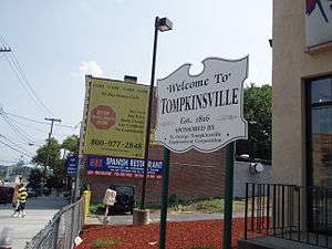
Tompkinsville, Staten Island
Tompkinsville is a neighborhood in northeastern Staten Island in New York City in the United States. Though the neighborhood sits on the island's eastern shore, along the waterfront facing Upper New York Bay — between St. George on the north and Stapleton on the south — it is reckoned as being part of the North Shore by the island's residents.
History

Tompkinsville, located in the Town of Castleton, was the site where early European explorers replenished their fresh water supplies and was known in colonial times as the "Watering Place". In 1815, a settlement was established by Daniel D. Tompkins in the neighborhood next to the existing quarantine station. He was elected Vice President the following year. In 1817 Tompkins built a dock at the foot of present-day Victory Boulevard and began offering steam ferry service to Manhattan.[1]
In the early 1900s, the telephone exchange that served Staten Island's eastern North Shore was named after the neighborhood; the name of this exchange was changed to "Saint George" in the mid-1920s, and to "Saint George 7" when New York Telephone upgraded telephone service throughout New York City in December 1930. Converted for All-Number Calling, "727" still exists on the island today. It is the sole surviving number of the designations of the 1920s.
Tompkinsville was the site of a Naval Frontier Base of the US Navy for many years. During World War II, it was designated Tompkinsville, SI, New York.
The 2014 death of Eric Garner, which happened in Tompkinsville, received wide media coverage.
Culture
The neighborhood hosts a number of live music and art venues, including Everything Goes Book Café, Deep Tanks Studio, Coyle Cavern, Ink Chyx Tattoo & Art Gallery, and the Staten Island LGBT Community Center, all of which take part in the north shore's monthly Second Saturday art walk.[2] As with much of the north shore, the area is decidedly more urban than is typical of Staten Island, evinced in the architecture (predominantly tall brick buildings) and numerous retail stores and eateries. Unlike many other North Shore communities (and like Port Richmond), the neighborhood has no public housing projects. Its housing stock is dominated by single-family homes built in the first few decades of the 20th century.
Demographics
The neighborhood is mixed commercial and residential. Like many areas of the northeastern part of the island, it suffered a decline following the construction of the Verrazano-Narrows Bridge in 1964, which shifted the commercial activity of the island towards its interior. Recent plans have called for the redevelopment of the harbor front area. The population is racially diverse, primarily made up of African-Americans, Hispanics, and Whites, with recent arrivals including immigrants from such countries as Albania. There is also a Sri Lankan community. The Little Sri Lanka in Tompkinsville is one of the largest Sri Lankan communities outside of the country of Sri Lanka itself.[3][4] The neighborhood also has a growing Mexican community.
Transportation
The neighborhood's Staten Island Railway station is one stop south of the terminus at St. George. Unlike at the majority of the Staten Island Railway's stations, a MetroCard must be used to enter or exit at Tompkinsville. Formerly, the exit was free, but faregates were installed at the station in the late 2000s to deter fare avoiders who would exit at the station to avoid paying the fare at St. George.
References
- ↑ "TOMPKINSVILLE, Staten Island". forgotten-ny.com. Retrieved 17 February 2015.
- ↑ "Second Saturday Staten Island". secondsaturdaystatenisland.com. Retrieved 17 February 2015.
- ↑ Harrison Peck. "NYC The Official Guide - Must-See Little Sri Lanka: 7 Great Things to See and Do". © 2006–2011 NYC & Company, Inc. All rights reserved. Retrieved 2011-11-27.
- ↑ Amy Zavatto (August 5, 2010). "Frommer's - New York City: Exploring Staten Island's Little Sri Lanka". 2000-2011 by John Wiley & Sons, Inc. All rights reserved. Retrieved 2011-11-27.
External links
Coordinates: 40°38′02″N 74°05′09″W / 40.63389°N 74.08583°W