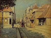
Torvegade

Torvegade (lit. "Market Street") is the central thorughfare of Christianshavn in Copenhagen, Denmark, connecting the city centre to Amager-side Copenhagen by way of the Knippelsbro bridge. It crosses Christianshavn Canal at Christianshavns Torv, the central square of the neighbourhood.
History
Torvegade was the central main street of Johan Sems's original town plan. Amager Gate was built in 1624 at the eastern end of the street, although the bridge which connected it to Amager across the Stadsgraven moat was not completed until 1628.[1] The Amager farmers passed through the street on the way to town with their produce. Amager Gate was demolished when it was decided to decommission Copenhagen's fortifications in the 1850s.

In the 1920s, the City decided to build a new Knippelsbro Bridge to widen Torvegade. Until then, the portion between Knippelsbro and the canal had been known as Lille Torvegade ("Little Market Street") while the portion between the canal and Christianshavn Rampart was known as Store Torvegade ("Great Market Street"). The houses along its north side (uneven numbers) were all expropriated and demolished. The expanded Torvegade was ready in 1926.[2]
Buildings
The Acciseboden ("TheOctroi House) at Christianshavn Rampart was originally a residence for the guard at Amager Gate. It was located just inside the gate but moved 12 metres in connection with the expansion of Torvegade in 1926. It was from 1857 to 1916 used by the soldiers who patrolled Christianshavn Rampart. The Acciseboden is thus misleading since it was never directly involved in the collection of octroi.[3] No. 22, 24, 27 and 30 all date from the 18th century and are listed. The Rhode House, on the corner of Strandgade, is from 1640.[4]
 Acciseboden
 The Rhode House on the corner of Strandgade
.jpg) 30 Torvegade
30 Torvegade
See also
References
- ↑ "Befæstningsleksikon 1600-1870" (in Danish). Selskabet for Københavns Historie. Retrieved 2013-03-11.
- ↑ "Torvegade" (in Danish). indenforvoldene.dk. Retrieved 2010-01-04.
- ↑ "Torvegade 75" (PDF) (in Danish). Christianshavns Lokalhistoriske Arkiv. Retrieved 2013-03-13.
- ↑ "Strandgade 14-14a". indenforvoldene.dk. Retrieved 2013-03-11.
External links
| Wikimedia Commons has media related to Torvegade. |
- Torvegade on indenforvoldene.dk
Coordinates: 55°40′20″N 12°35′29″E / 55.6723°N 12.5915°E